

08.08.17 - As sea levels rise, coastal communities continue to grow faster than non-coastal zones. How we plan these communities needs to change, says Fadi Masoud
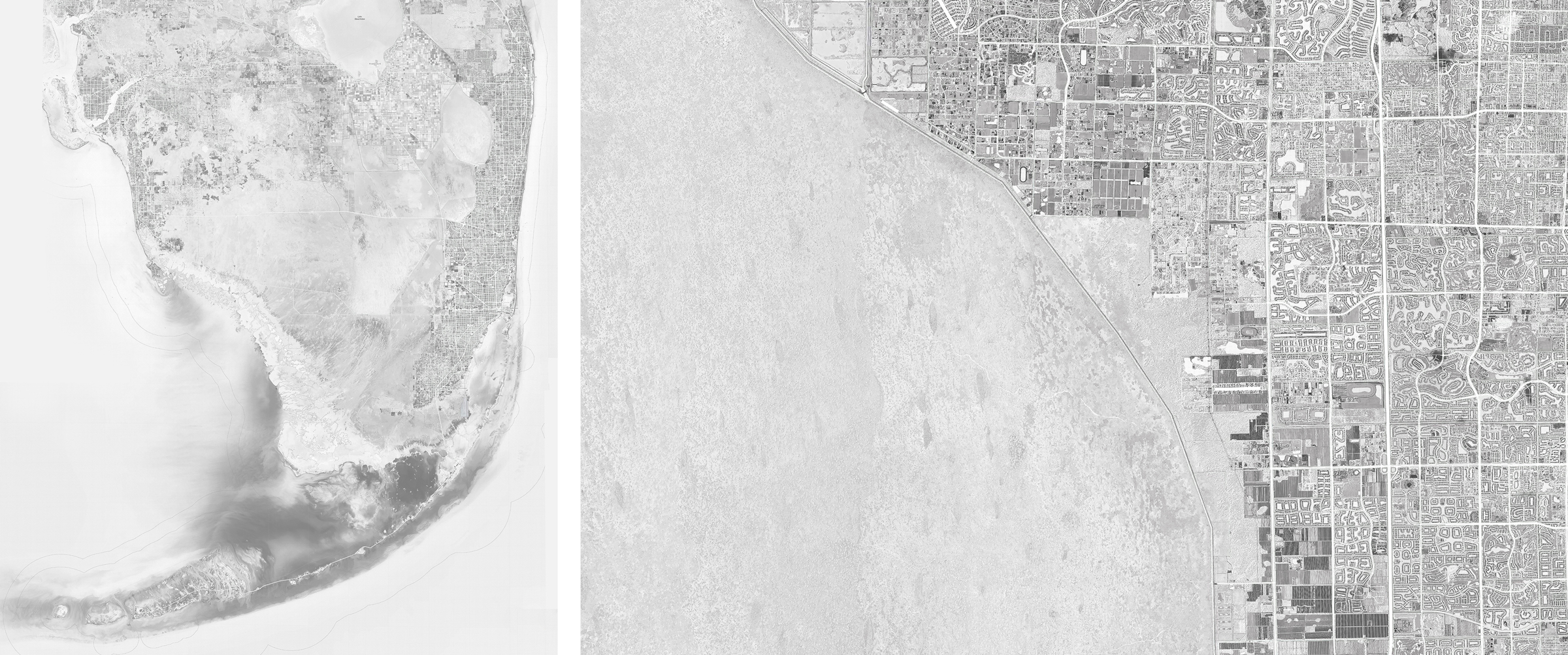
In recent years, Broward County located in Southeast Florida hasn’t been able to rely on historical data when preparing their prevention measures against flooding; the weather patterns and sea levels have consistently deviated from expected standards. According to Associate Processor Fadi Masoud,"Nowhere in North America are the patterns of precarious coastal development more visible than in South Florida...Thirty-five miles of levees and 2,000 hydraulic pumping stations drain a metropolitan area of 6,137 square miles (15,890 km2), resulting in the ‘world’s largest wet subdivision’ with $152 billion worth of property projected to be below sea level by 2050." As sea levels rise, millions of Americans could be forced to leave their homes.
So how does a city or region plan in the face of such precariousness? Masoud explored an alternative approach to land-use planning in the article "Coding Flux: Redesigning the Migranting Coast," recently published in Scenario Journal. "The pressures of accelerating coastal change demand a new responsive and flexible zoning paradigm that introduces time, process, and potential into land use regulation," writes Masoud.
Working under a collaborative project between MIT's Urban Risk Lab and the University of Toronto's Daniels Faculty, Masoud — with a team that includes Lecturer Ultan Byrne, Mayank Ojha, Aditiya Barve, and Kelly Leilani Main — has been researching and developing a new method of planning for future weather events for Broward County. They call it “flux code zoning” because of its ability to represent a range of projected future conditions.
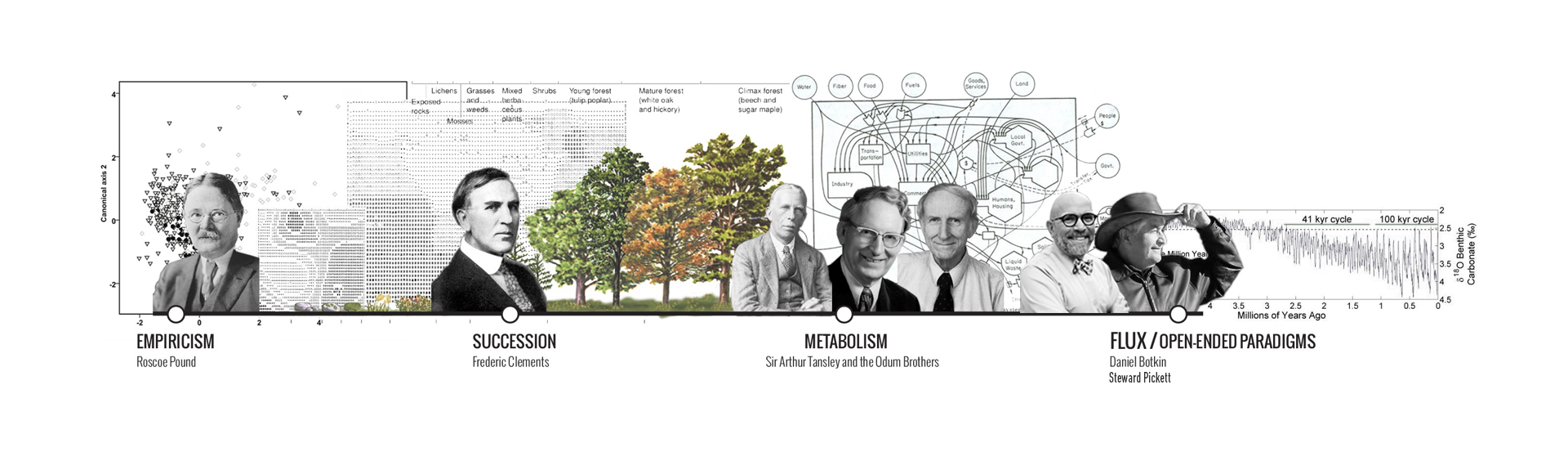
Four ecological paradigms have had a direct impact on public policy in North America. Image by Fadi Masoud.
“Normative or traditional zoning has historically relied on two conditions: on the regulation of land and the regulation of use,” writes Masoud. “We posit a third condition, a layer of the zoning envelope that introduces time, process, and scenario-driven flexibility into land use regulation.”
Visit Scenario Journal to read the full article.
Photo, top: South Florida’s urban fabric surrounded by water on three sides. Image by Fadi Masoud.