

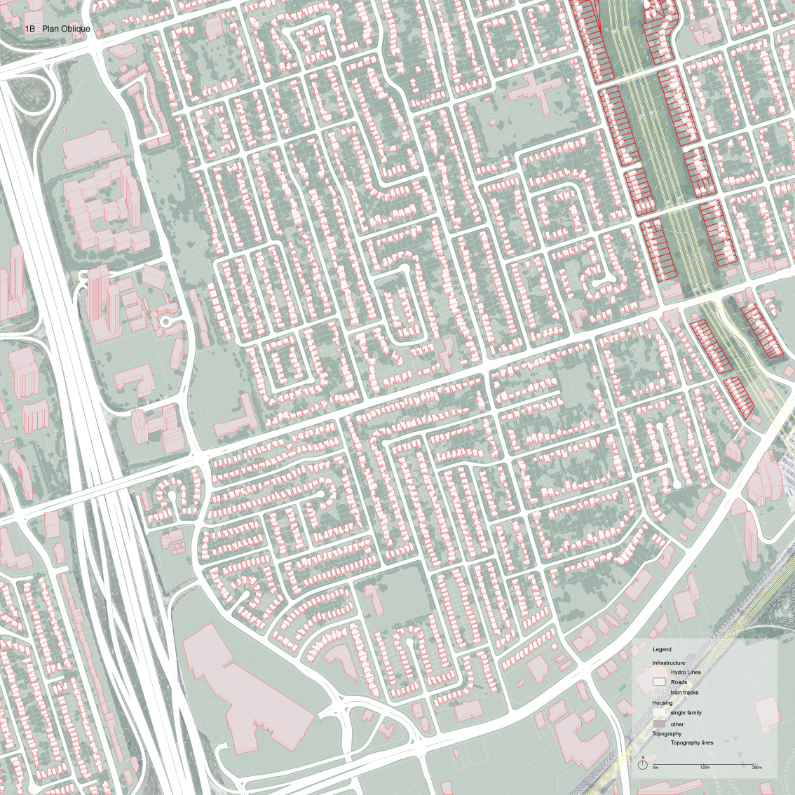
ARC200: Drawing and Representation 2
Students in Drawing and Representation 2 are assigned a neighbourhood somewhere in Toronto, which they study and draw in a series of design exercises. For their final project, they produce a neighbourhood-scale proposal for a design intervention.
Elif Diler
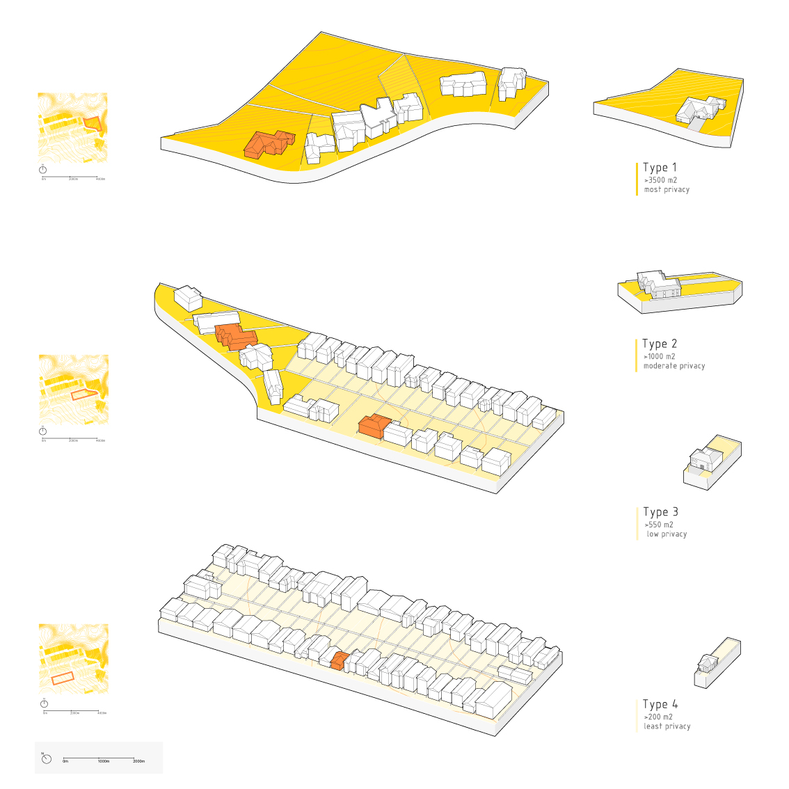
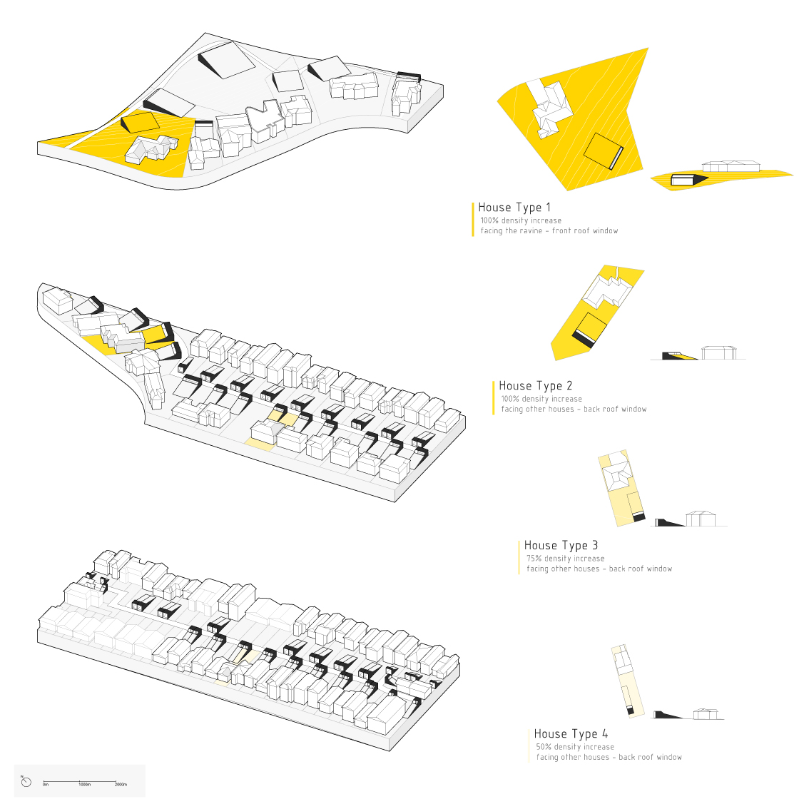
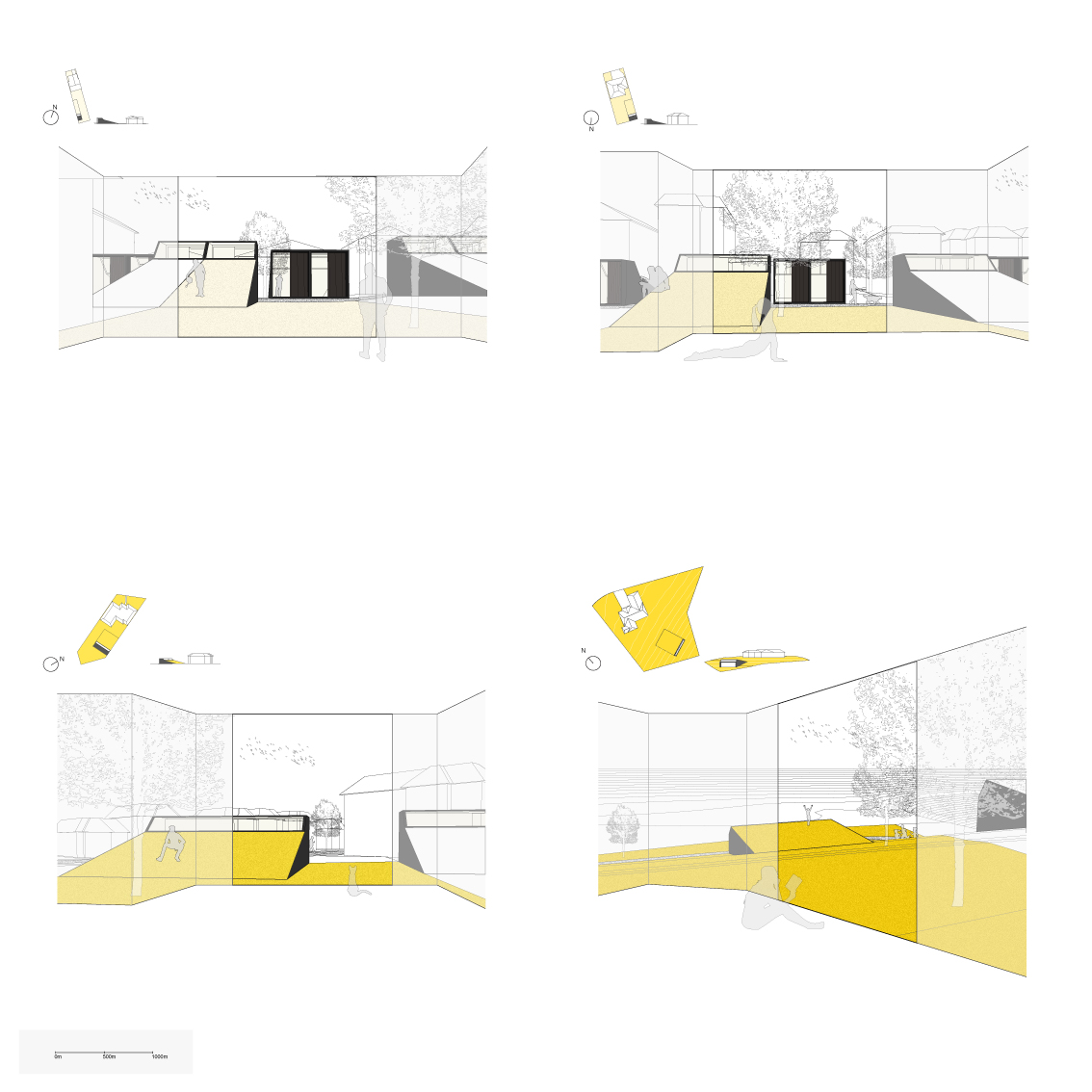
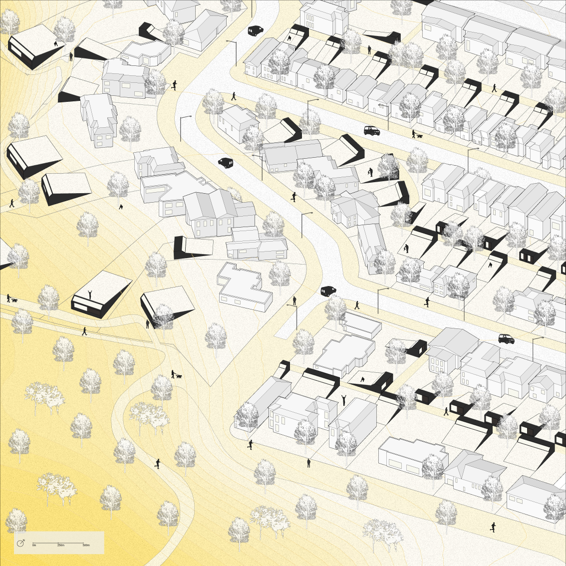
Elif writes: "In this project, I studied an area in North York, Toronto. Using a typological analysis, I found a proportional relationship between lot size and privacy: when one increases, so does the other. My design proposal seeks to find ways to maintain the level of privacy and personal space in each lot, while adding density. To achieve this, I made additions that look like extensions of the landscape in backyards of single-family houses. The slanted roofs of my additions blend into the ground and function as usable space, while minimizing visibility and increasing privacy."
(Instructor: Mohammed Soroor)
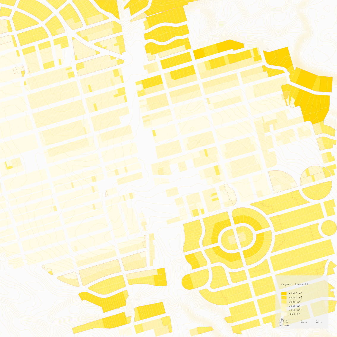
Veevsha Rana
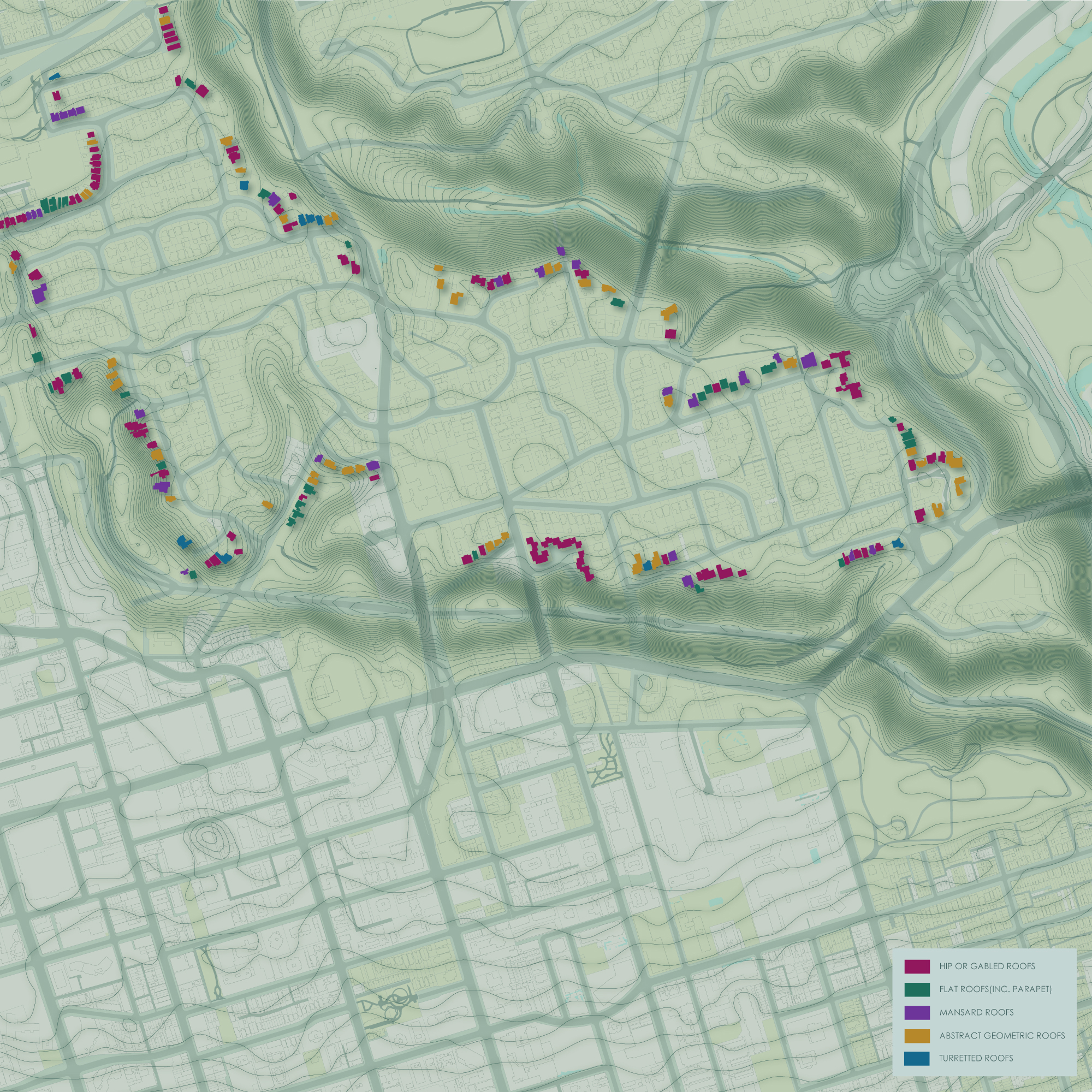
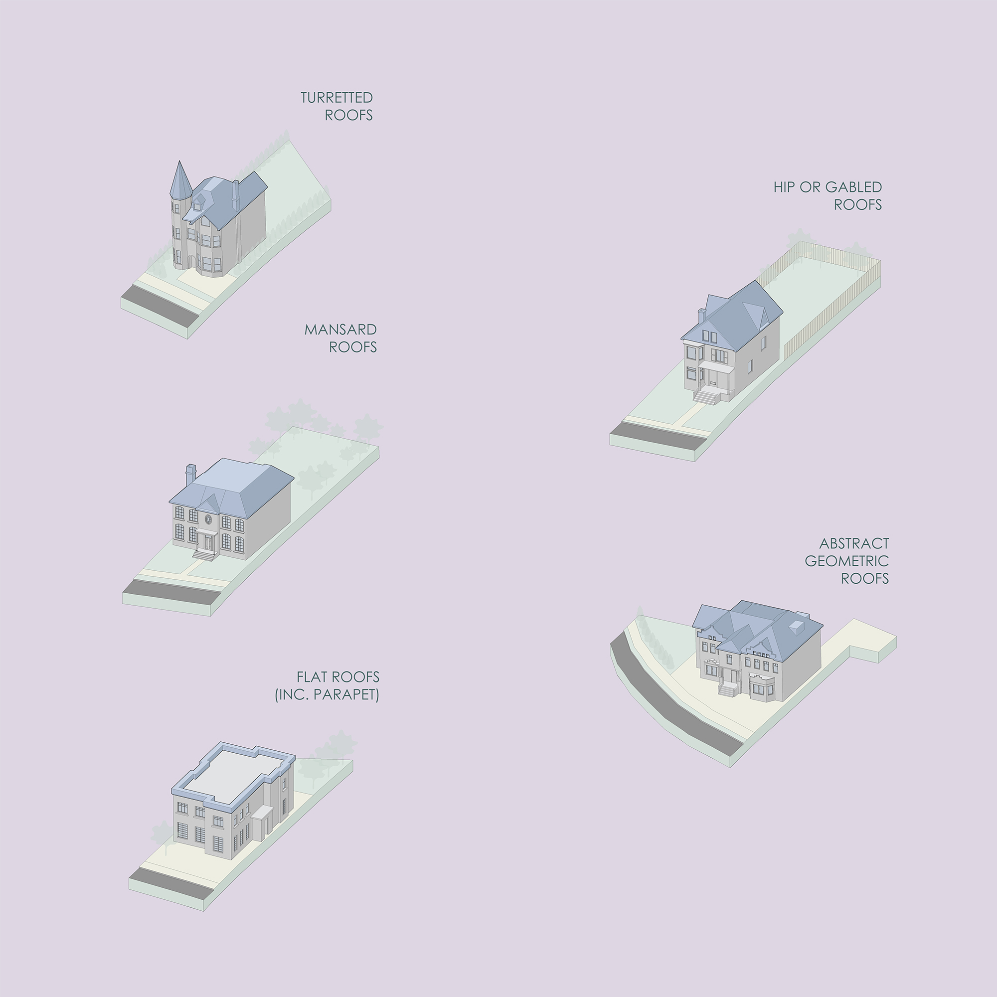
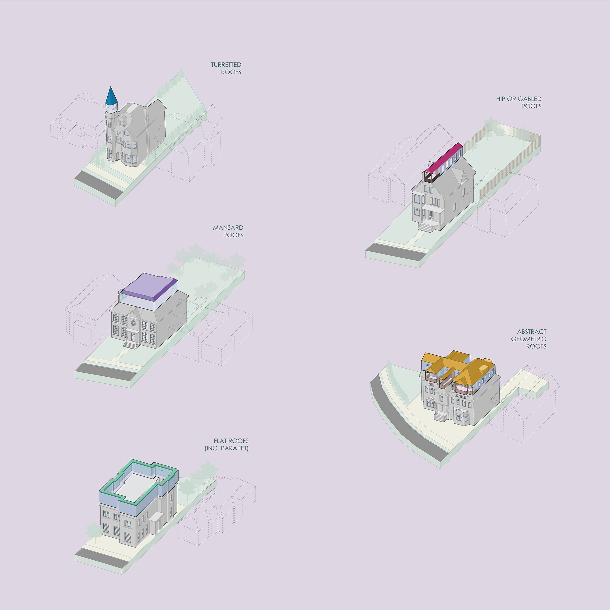
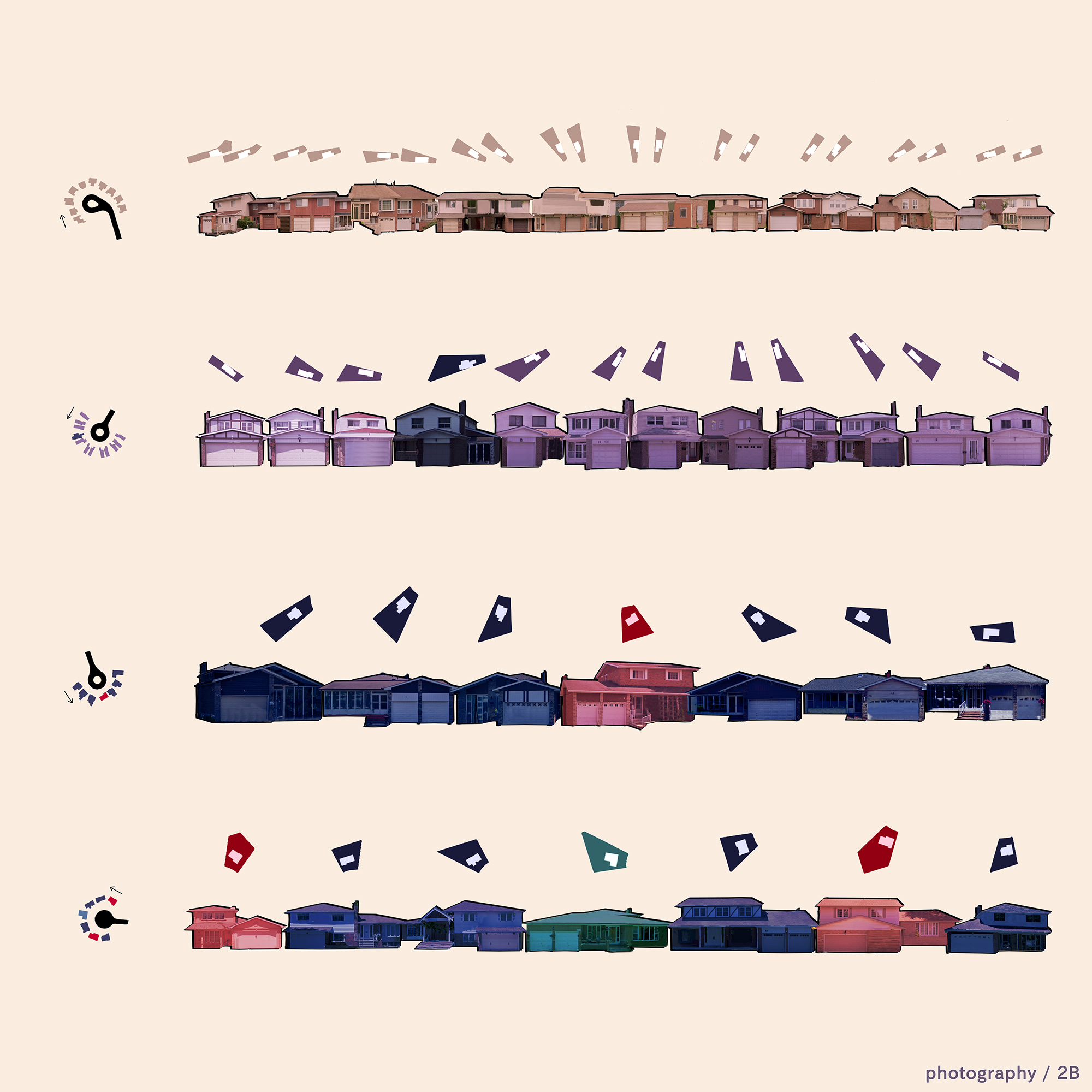
Veevsha writes: "This project focused on one of the wealthiest neighbourhoods in the world: Rosedale. Rosedale is surrounded by two ravines that cut through the landscape, and, as such, the houses that border the ravine are extremely expensive and have a variety of strange and interesting roofs. The roofs were categorized based on their visual and construction-based qualities (i.e. mansard, turreted, flat, hip/gabled, and abstract geometric). Roofs were cut along a planar surface, and an inhabitation space was created between the upper and lower halves. This emphasizes the massive scale of these houses, as well as the characteristic form of each kind of roof."
(Instructor: Sam Dufaux)
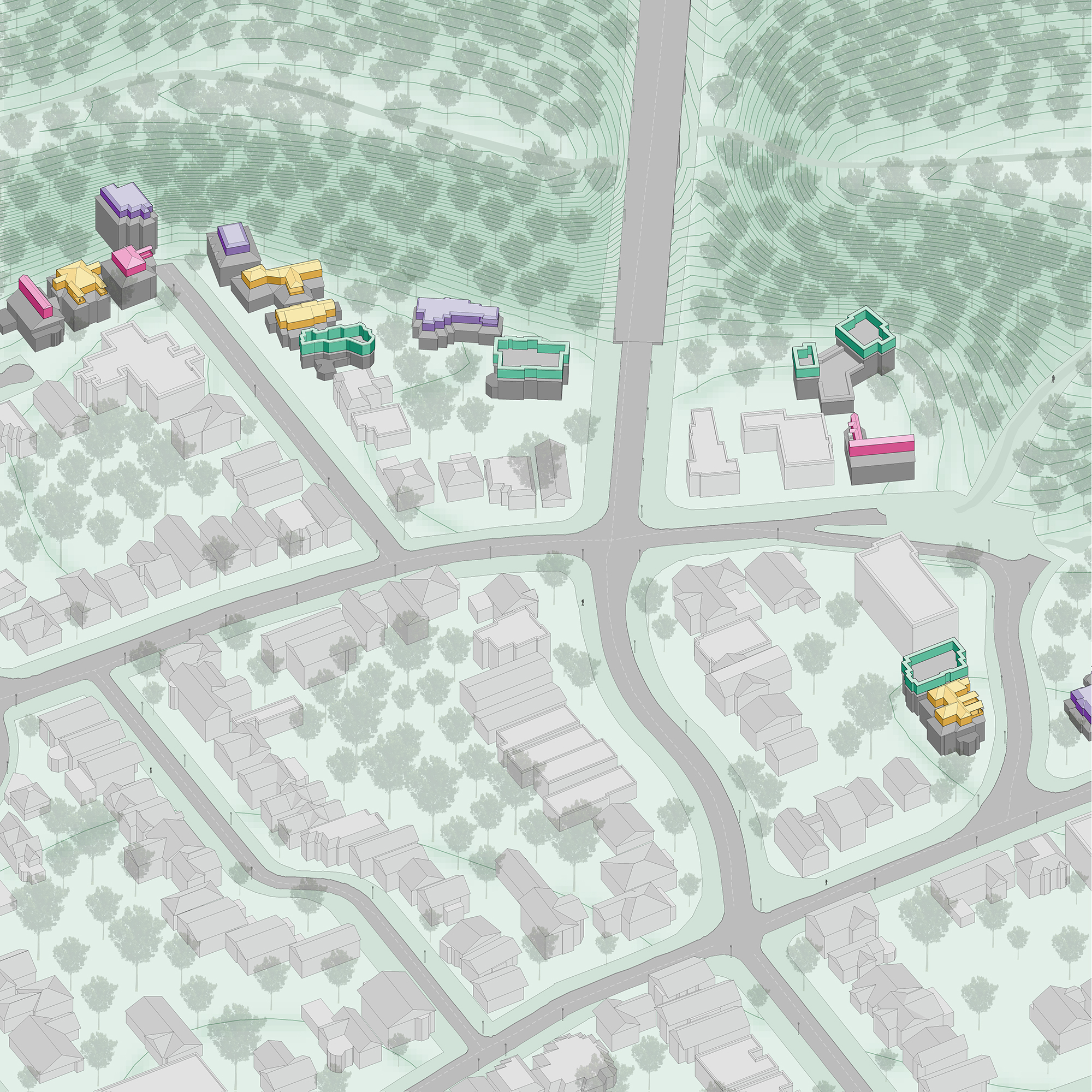
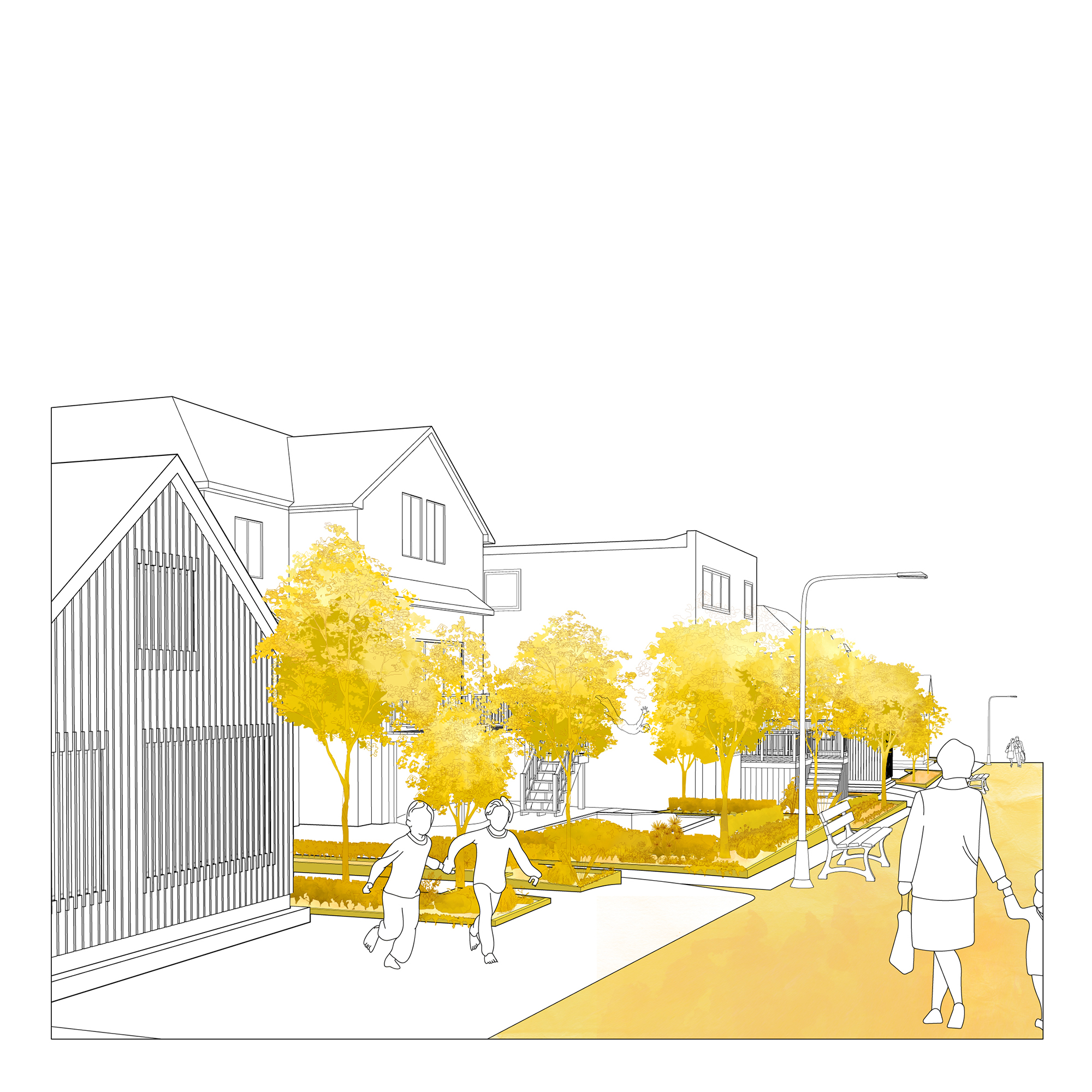
Adela Hua
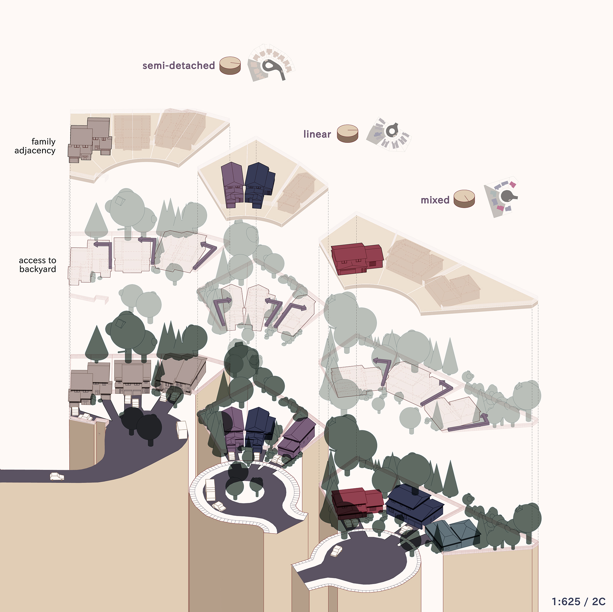
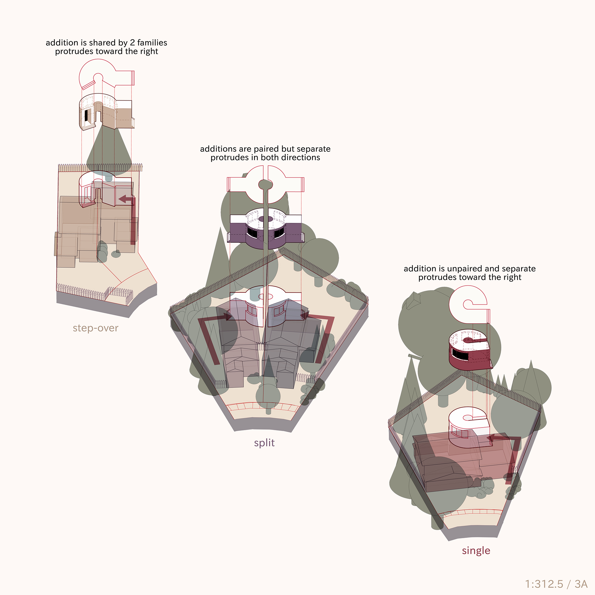
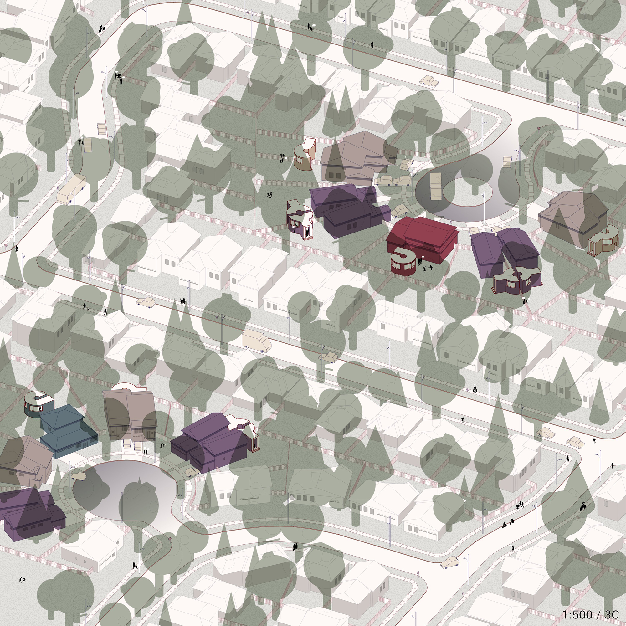
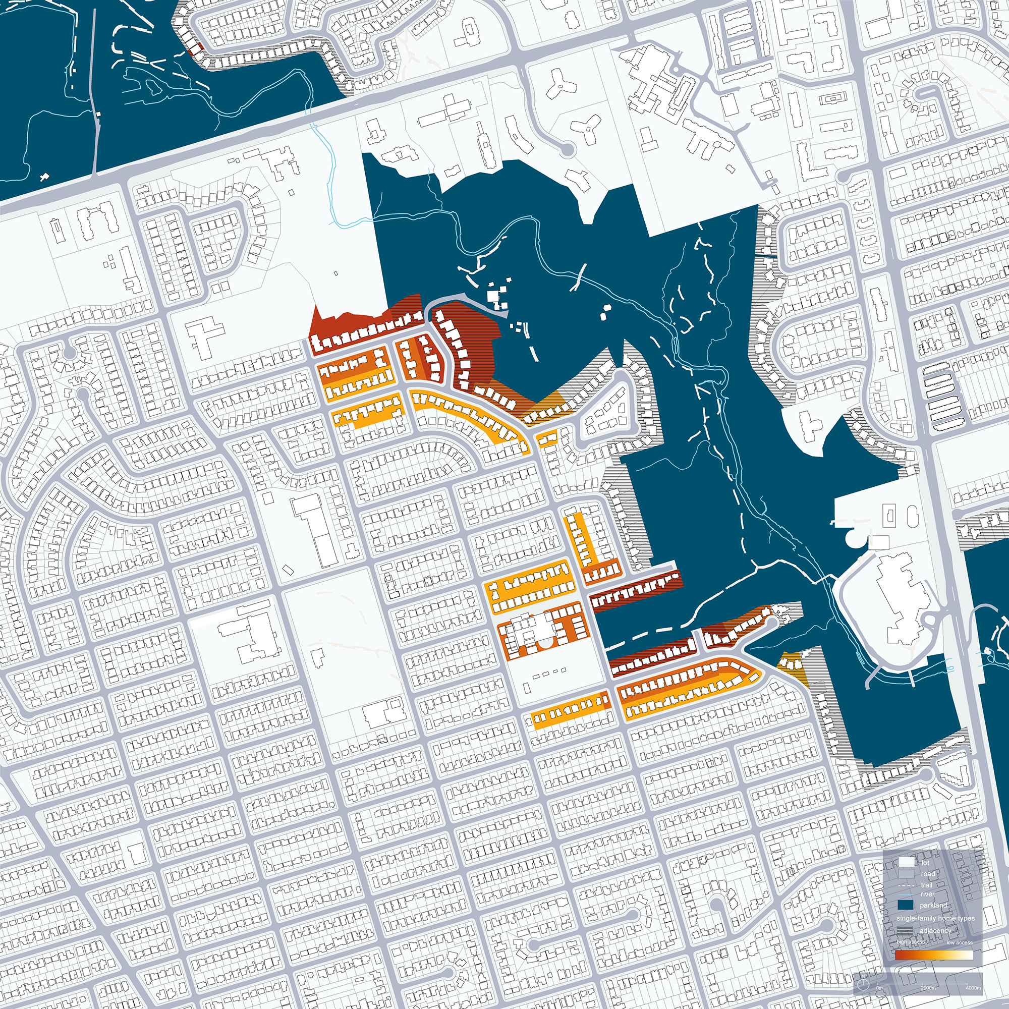
Adela writes: "My project for ARC200 is a graphic investigation into housing adjacency with regard to the handful of cul-de-sacs strewn across my residential site. In stringing together a constellation of conditions such as the access routes to backyards, typological classifications of mass and property, and variable position of vegetation, it becomes clear that whole cul-de-sacs are orchestrated to express different familial relationships, all of which work to inform the shape and position of my massing interventions. In the conclusive full-bleed isometric drawing, I imagine how houses and interventions that had previously been separated by classification could together comprise new types of cul-de-sacs."
(Instructor: Sam Ghantous)
Anu Manilal
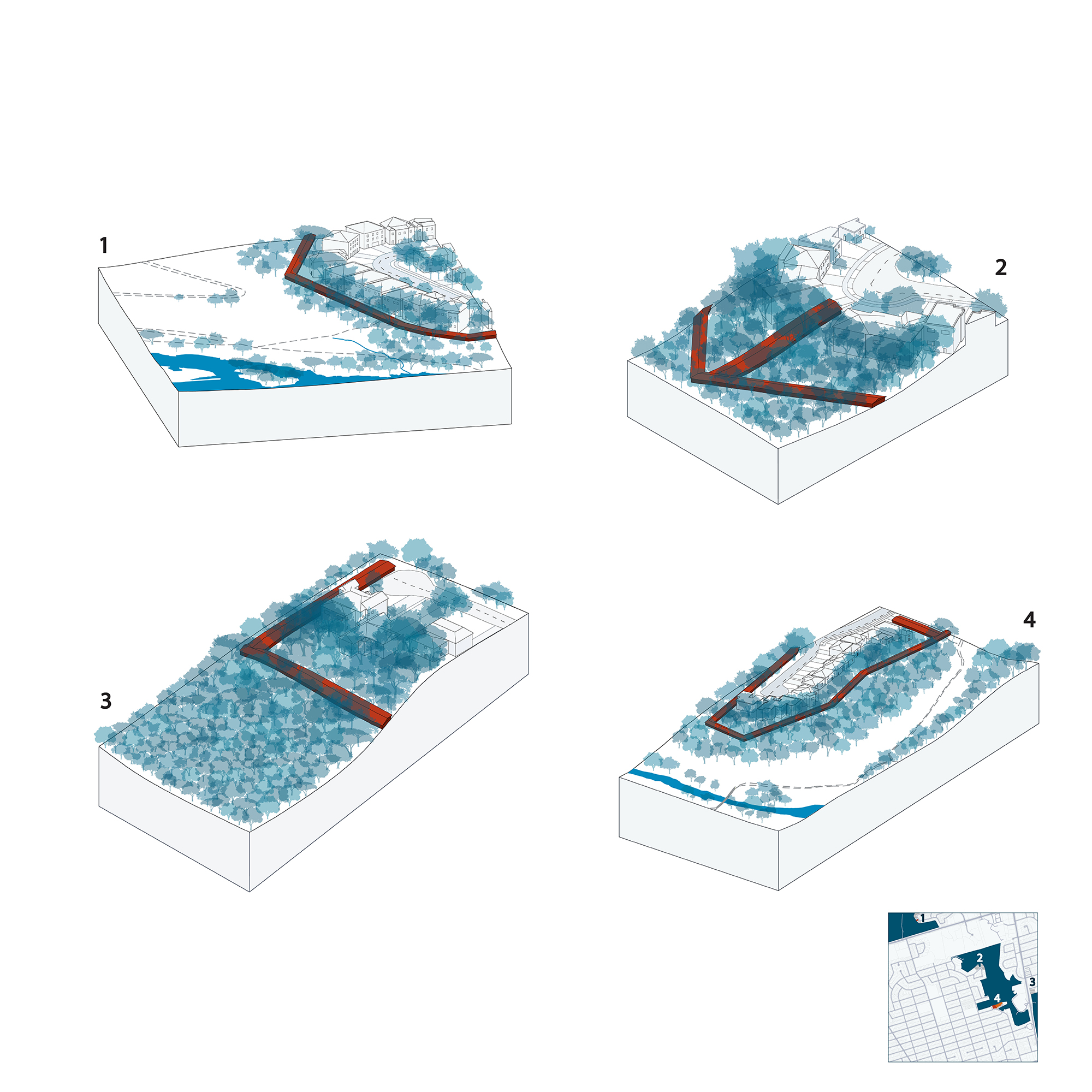
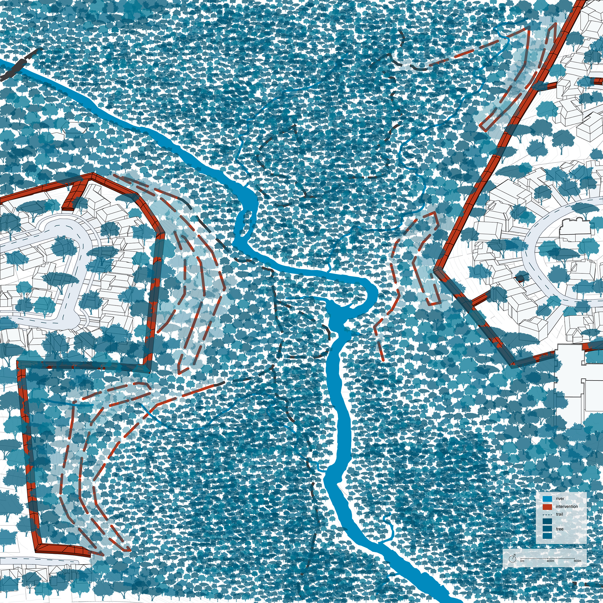
Anu writes: "When my family and I were following Covid-19 protocols, green space in our neighbourhood became a safe space to get out of the house. For this project, I focused on the ravine that cuts through my site, and the relationship it has with the single-family and semi-detached houses that back onto it. As I explored my site, I discovered that although homes may be adjacent to the ravine, they did not necessarily have access to it. Formalized pedestrian access to the trails that run through the ravine is severely lacking, with few entrance points in my site. Through my intervention, I seek to increase access to the ravine by increasing density. I propose the creation of a corridor in the backyards of the properties adjacent to the ravine, which can be used according to the needs of the neighbourhood."
(Instructor: Mohammed Soroor)
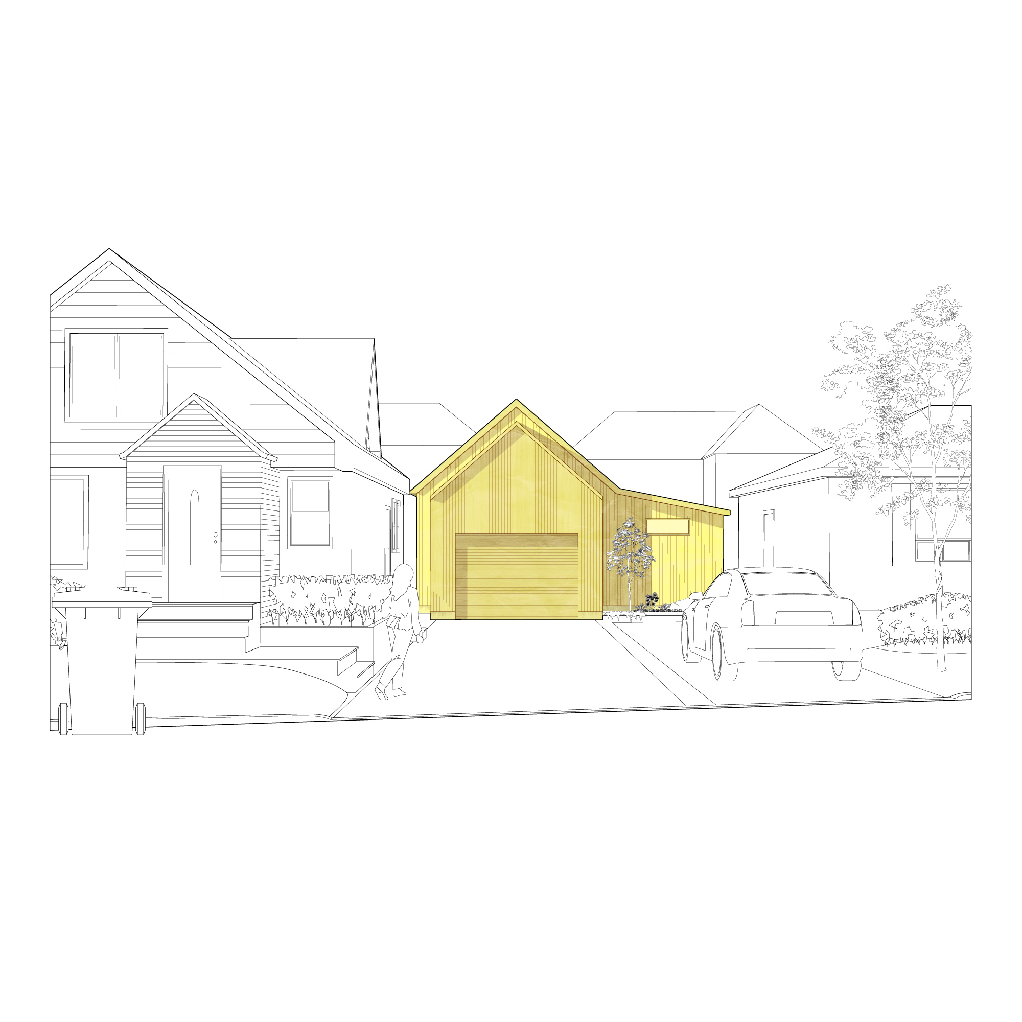
Cassandra Santaguida
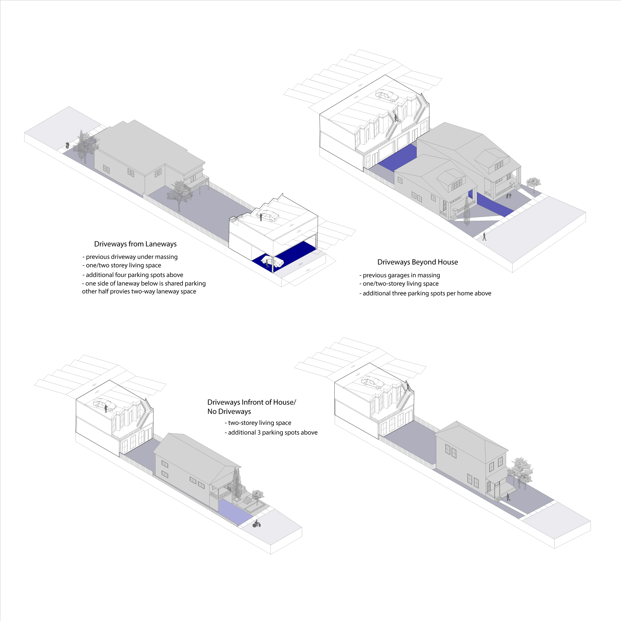
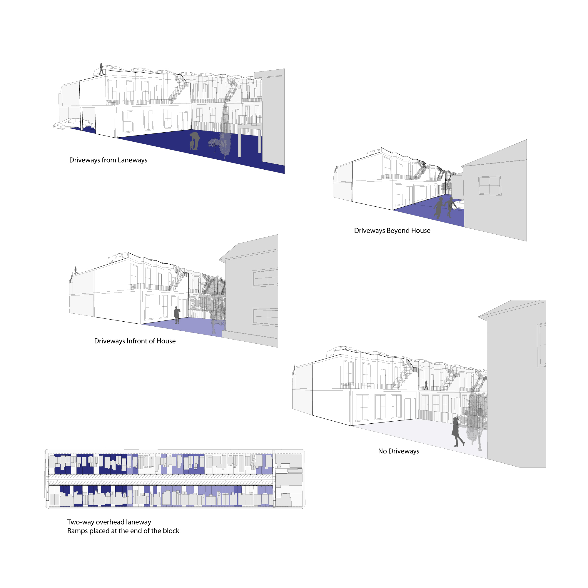
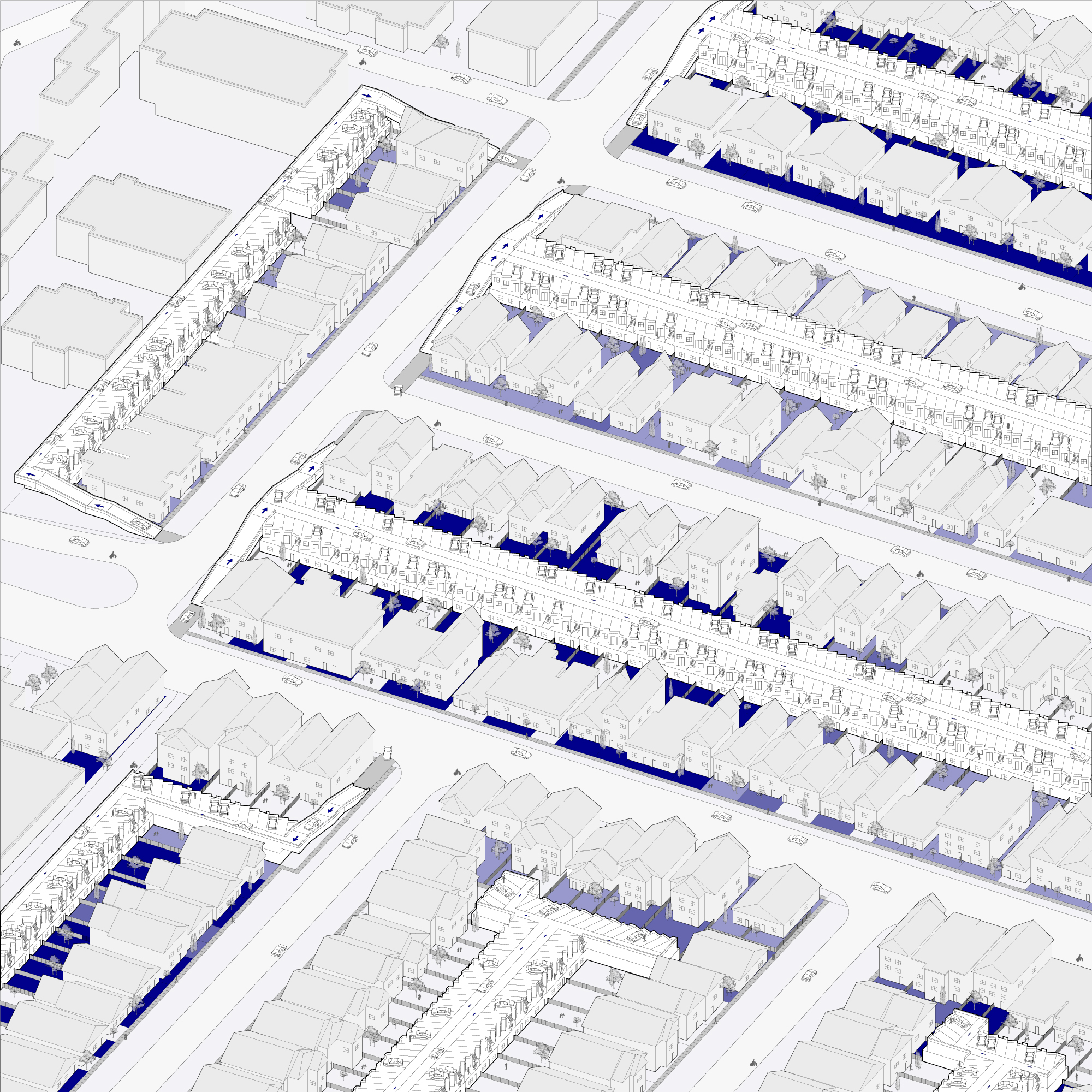
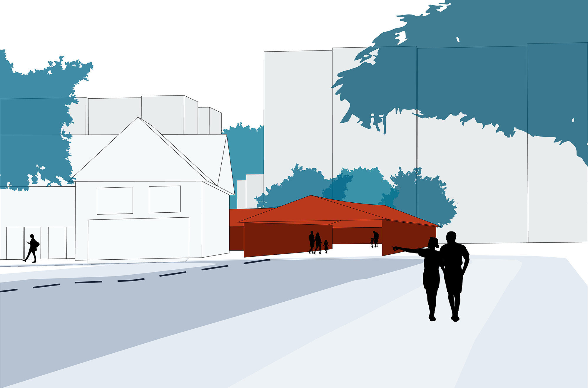
Cassandra writes: "I learned that the type of driveway each individual property has is specifically influenced by the amount of space that is available for that property. In general, the homes are quite close together, and in cases where properties do have driveways, only one or two cars can be parked at a time. My interventions/additions construct an elevated laneway system of slanted parking spots with additional living space below. The additions are all connected and the upper floors take the shape of the parking spots. This gives residents additional private parking areas and reduces the amount of density on the roads in front of the homes."
(Instructor: Sam Ghantous)
David Siddall
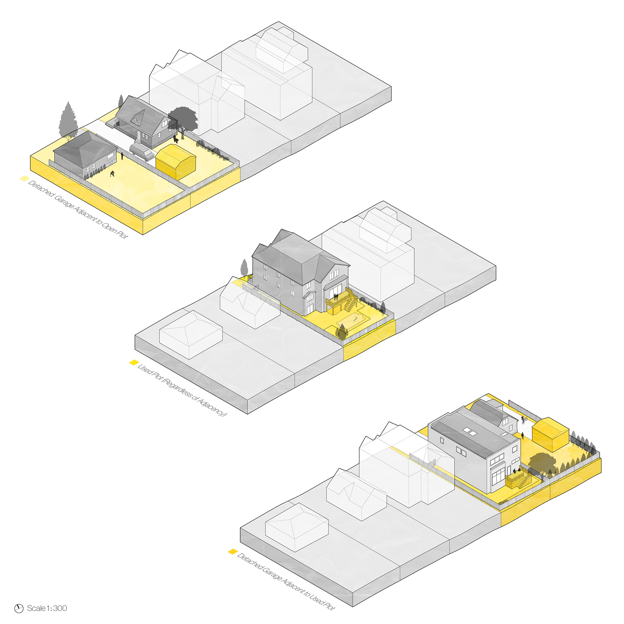
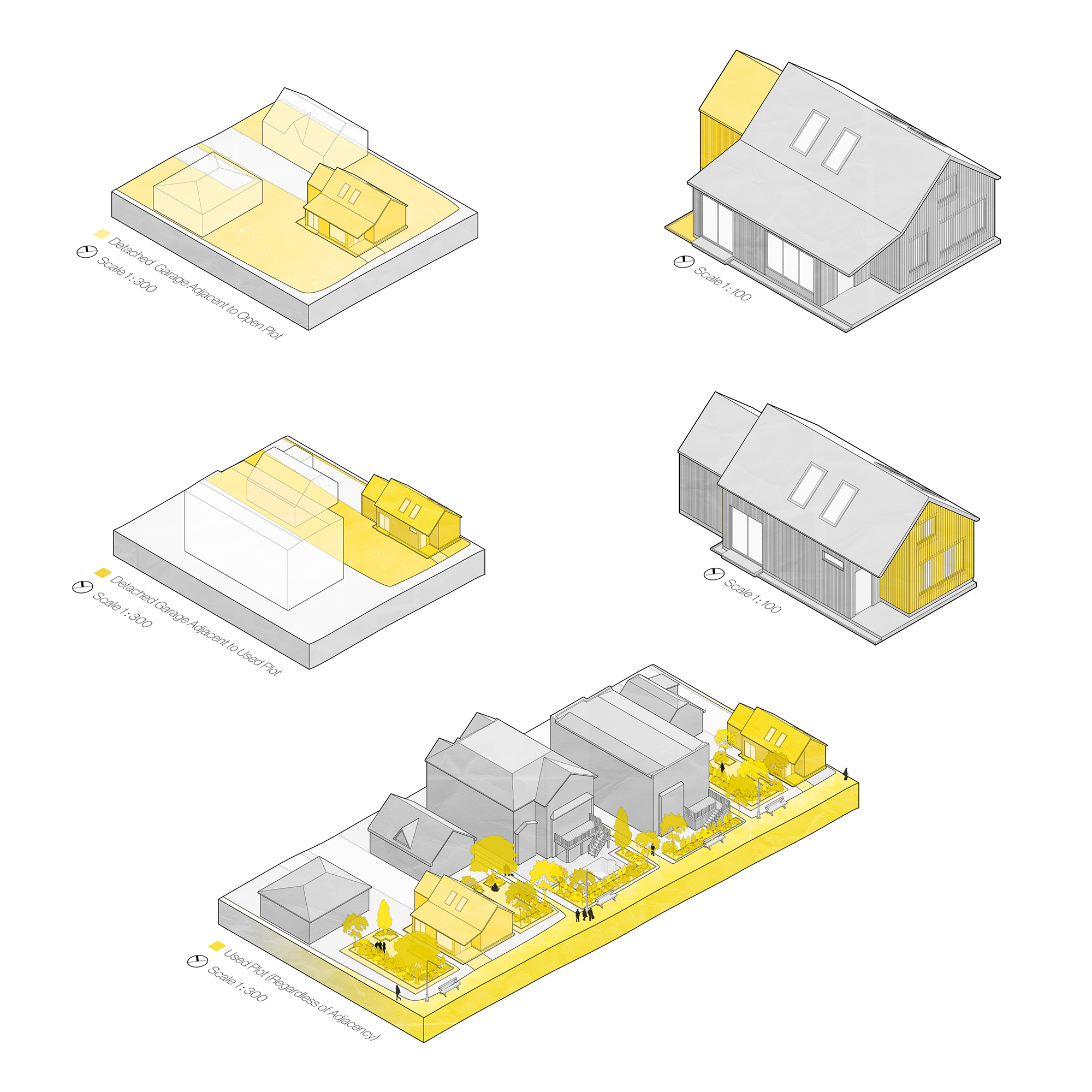
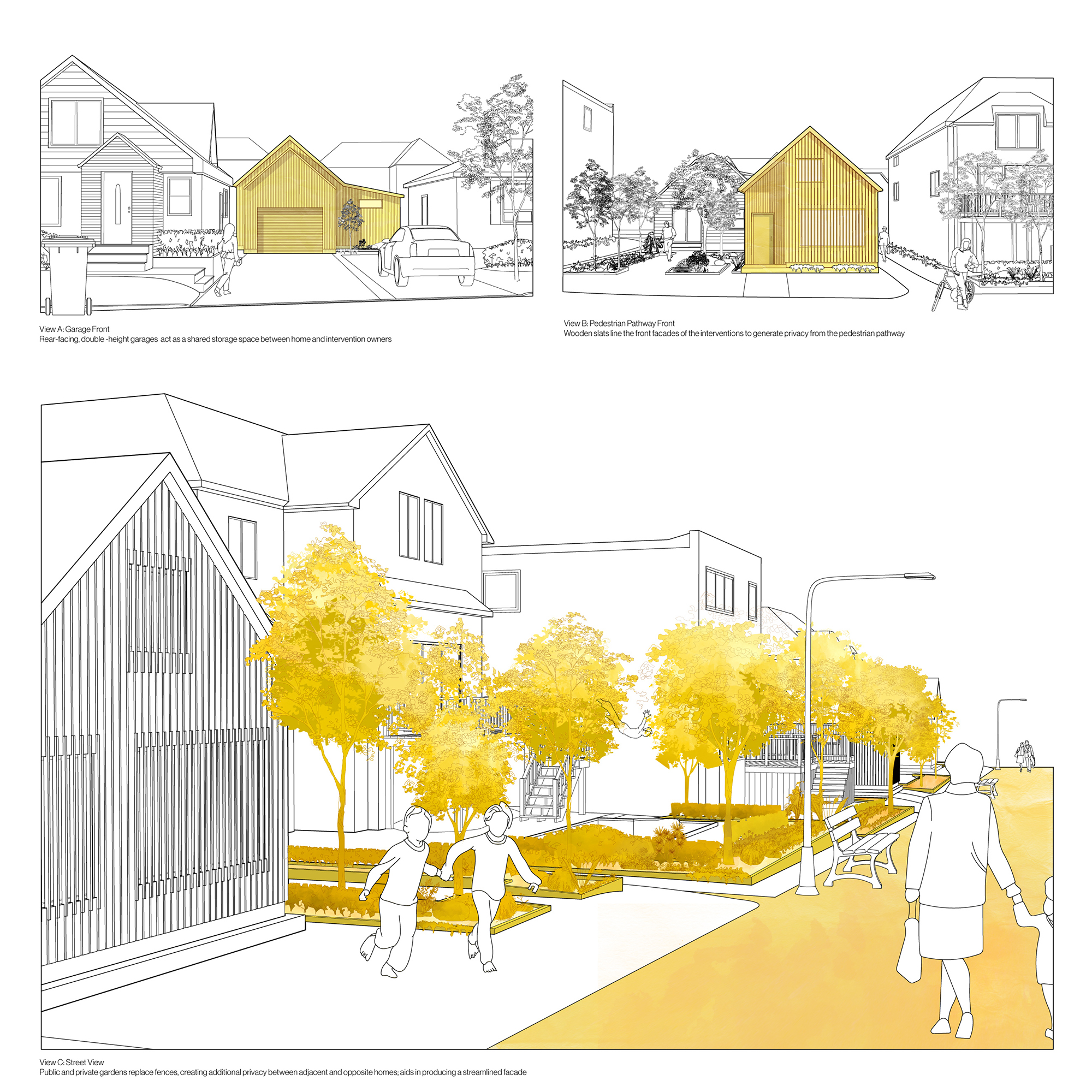
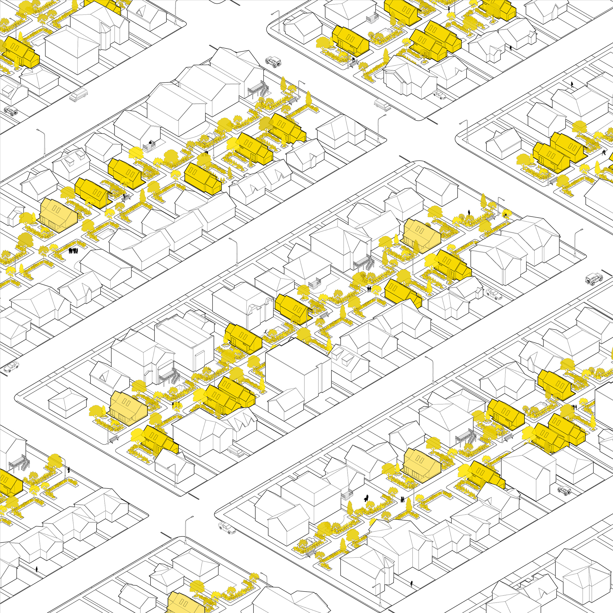
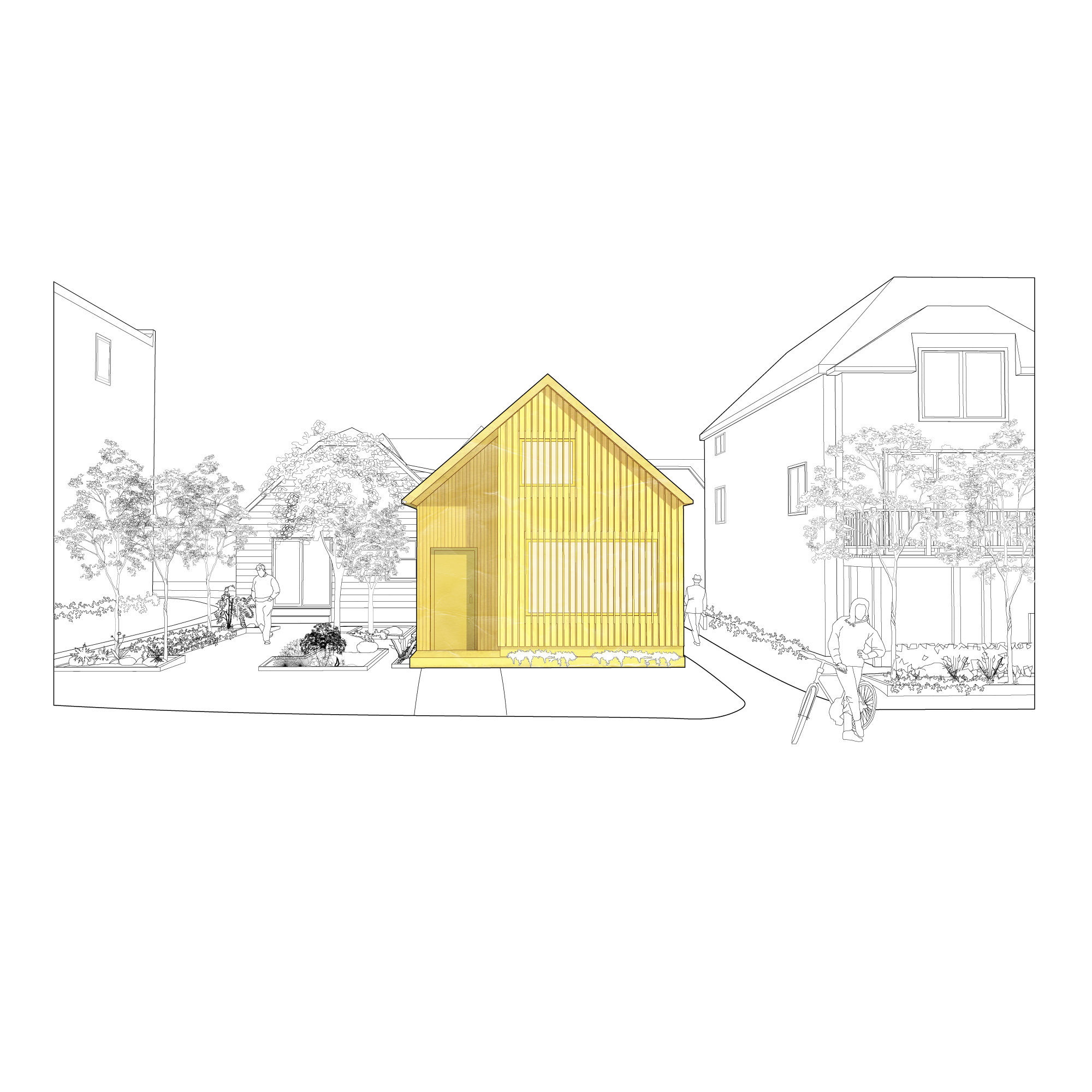
David writes: "I studied an area along the intersection of Sheppard Avenue West and Beecroft Road. I studied the uses of backyards, looking at what structures already exist. This study led me to develop a set of three typologies: backyard spaces that contain detached garages and are adjacent to unused plots, backyard spaces that contain detached garages and are adjacent to used plots, and any used plots regardless of adjacency. My main interventions are residential structures that are built according to the footprints of detached garages. For interventions adjacent to open plots, I increased the footprints of residences to spill over into the unused areas, preventing developers from developing the plots and constructing unnecessary mansions. Furthermore, I proposed the removal of all fences between neighbours, opting for pathways that lead to public walkways laid in the middle of residential blocks through what was a series of backyards. Lastly, I proposed a series of public and private gardens that sit along the edges of each backyard."
(Instructor: Monica Hutton)
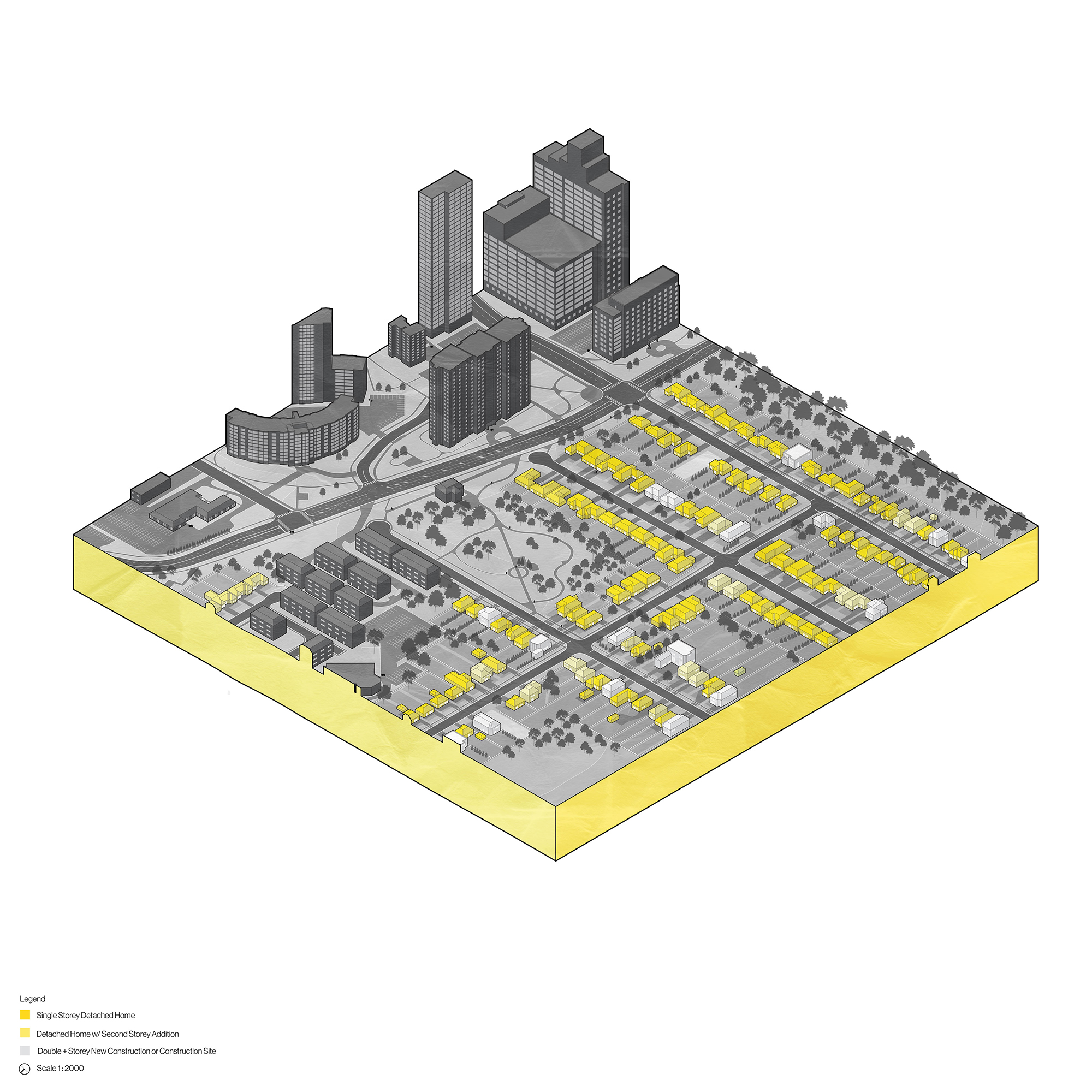
Kaitlyn Malave
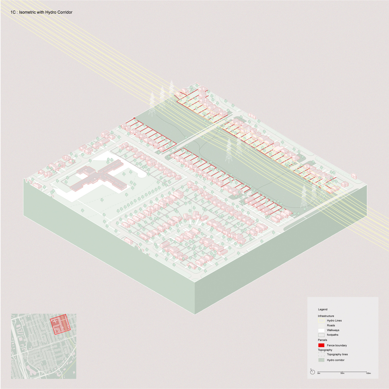
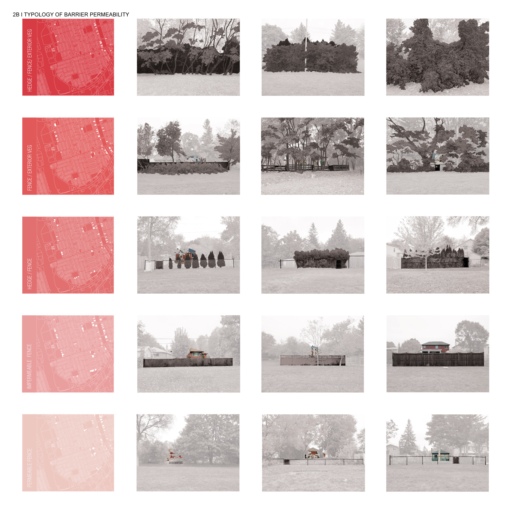
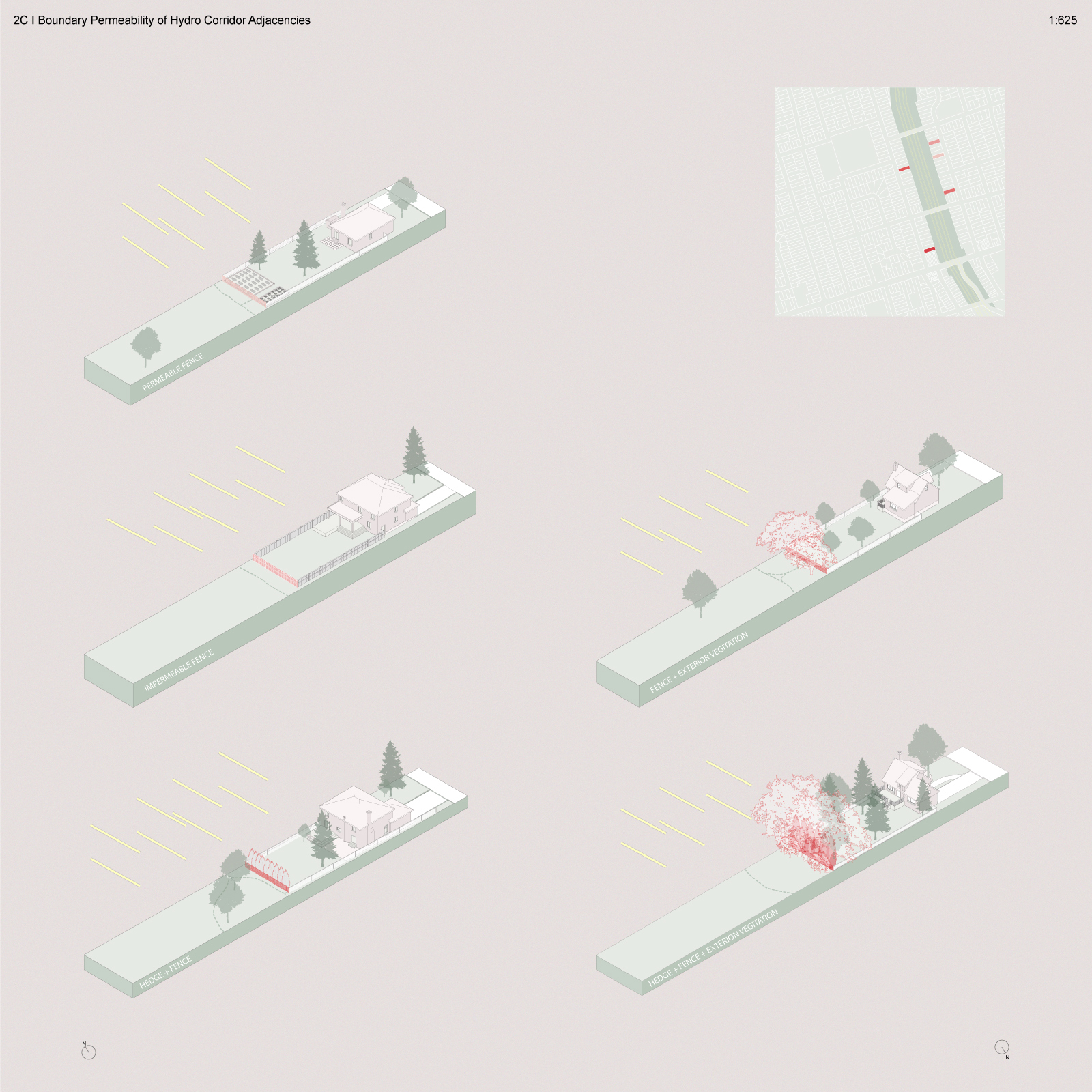

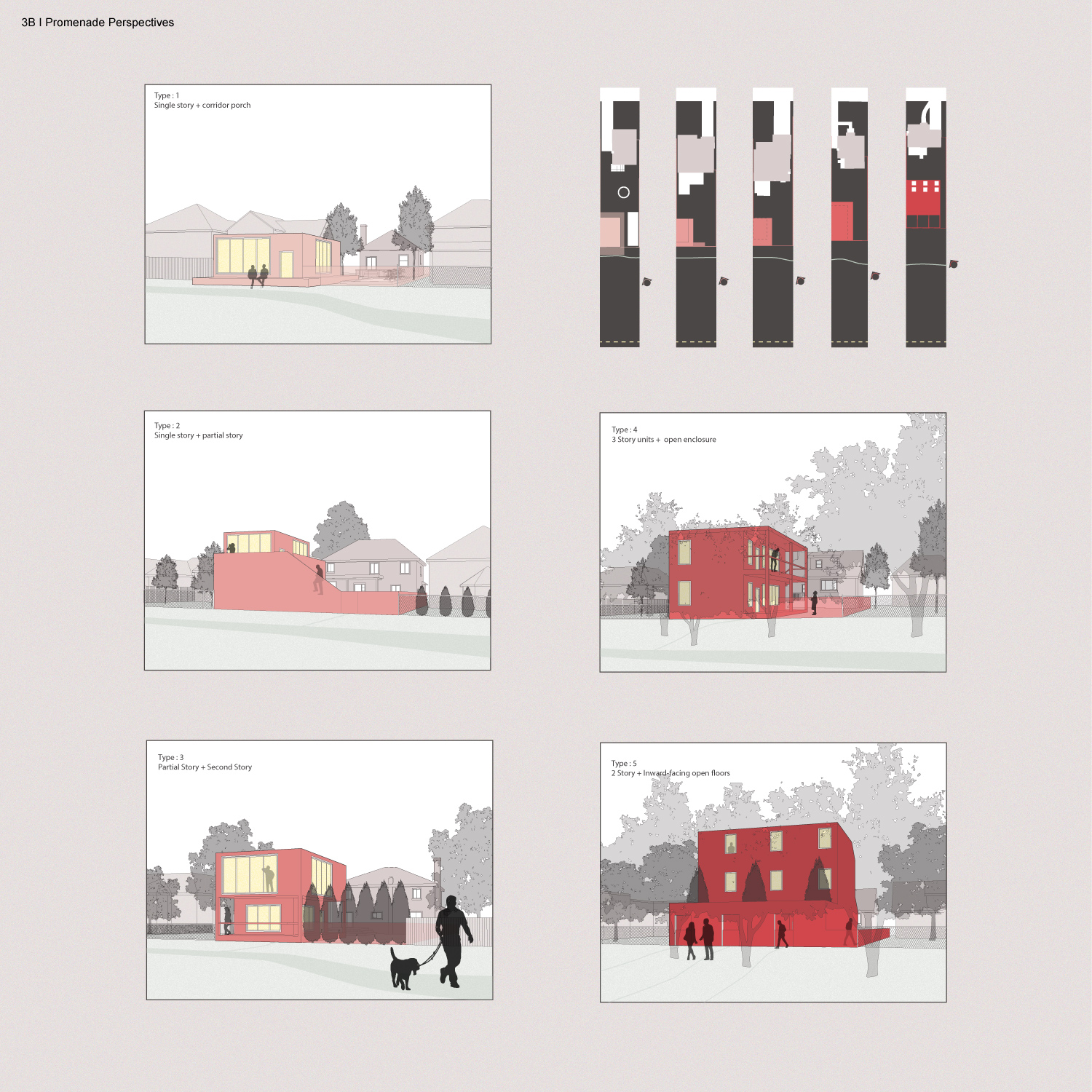
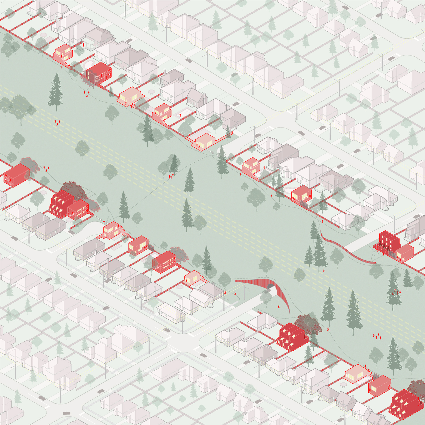
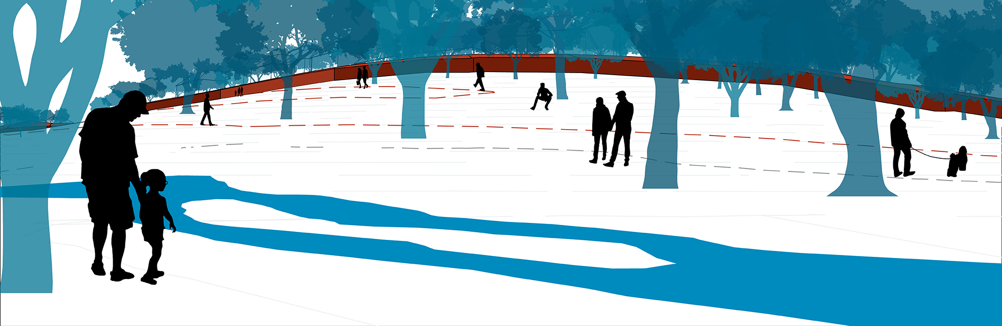
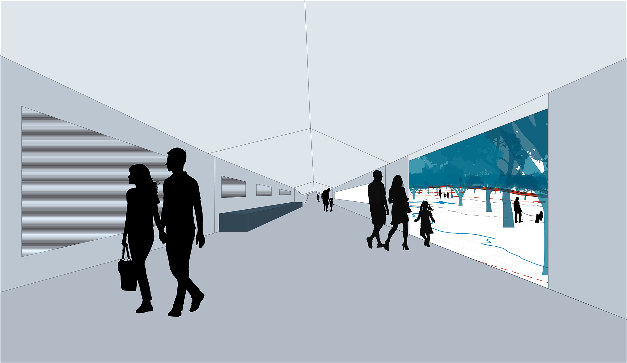
Kaitlyn writes: "I was assigned the Eatonville area of northwest Etobicoke. My project focuses on the backyard relationships of single-family detached homes to the nearby hydro corridor. I designed a methodology for additional housing that would seek to maximize density and rearticulate privacy conditions in a way that is more conducive to the corridor condition. The density of these additions would be relational to the amount of privacy/permeability of the existing boundary. This would engage and activate the corridor as a desirable property frontage and dynamic landscape, employing the freedoms expressed by the boundary condition to animate the space as a community resource for recreation, connection, and identity. To further optimize the corridor, I proposed to bury the hydro lines underground, removing the 'eyesores' and freeing up the land for the urban ecology and free program to act as the main agents of landscape design. I also added a land bridge over the intersecting roadways to liberate the corridor from the road system, superimposing and connecting the pedestrian networks along one unified green avenue. "
(Instructor: Mohammed Soroor)
Yunong Cao
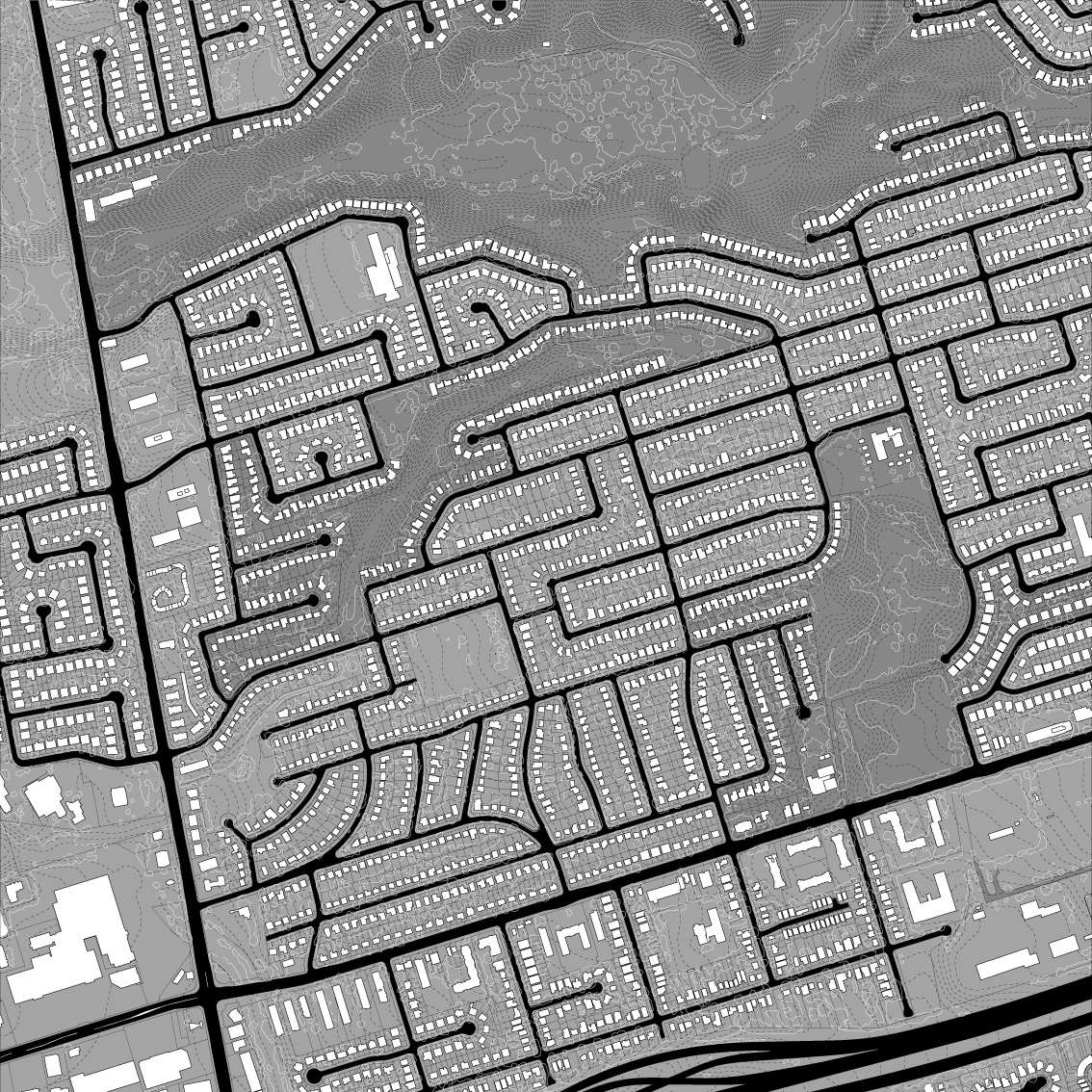
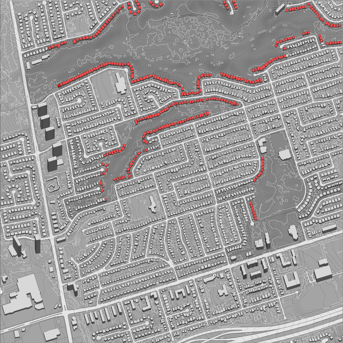

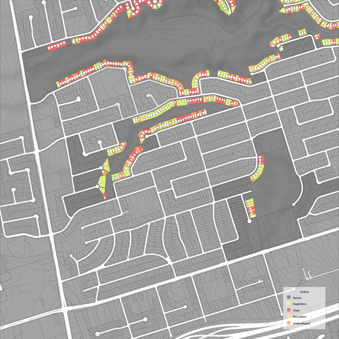
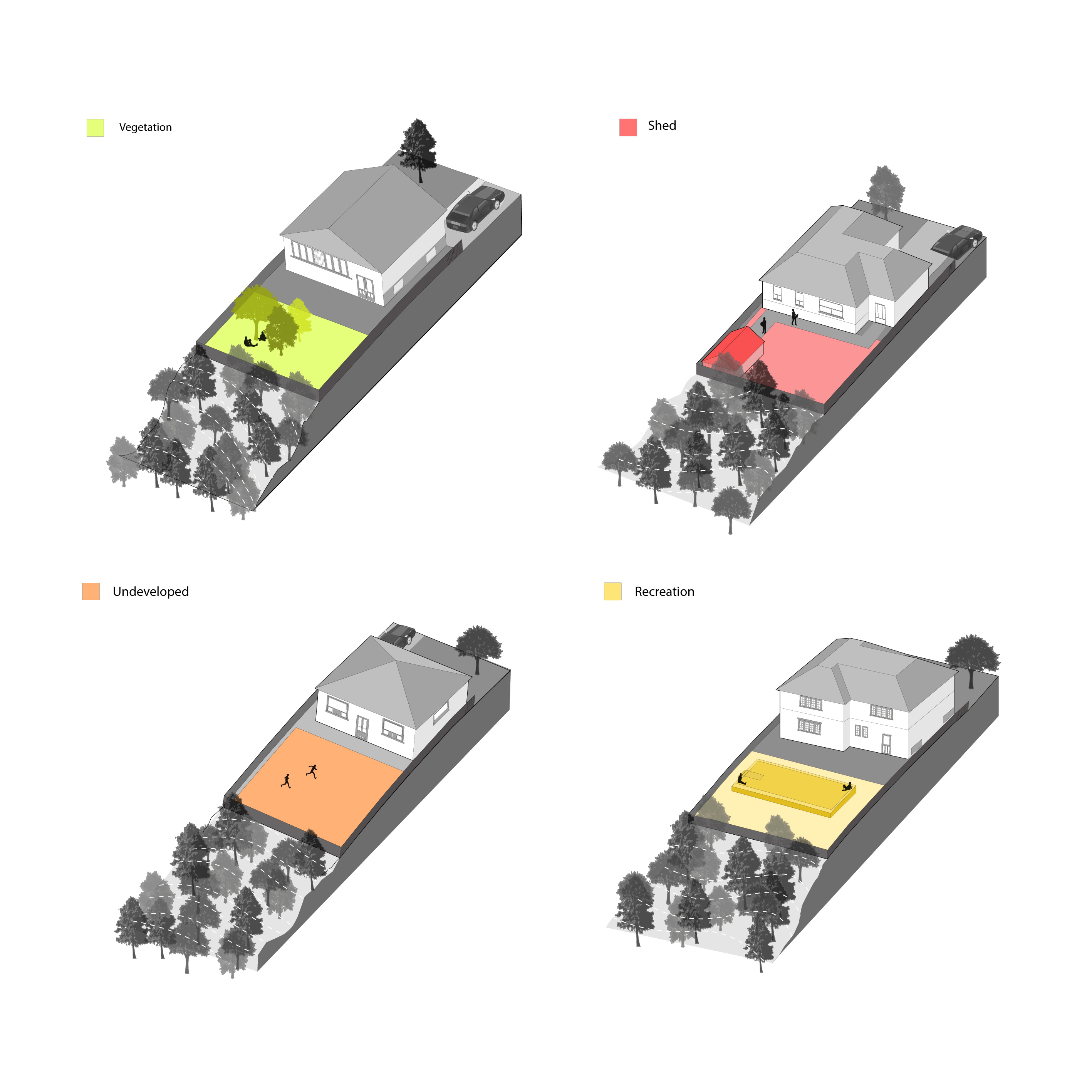
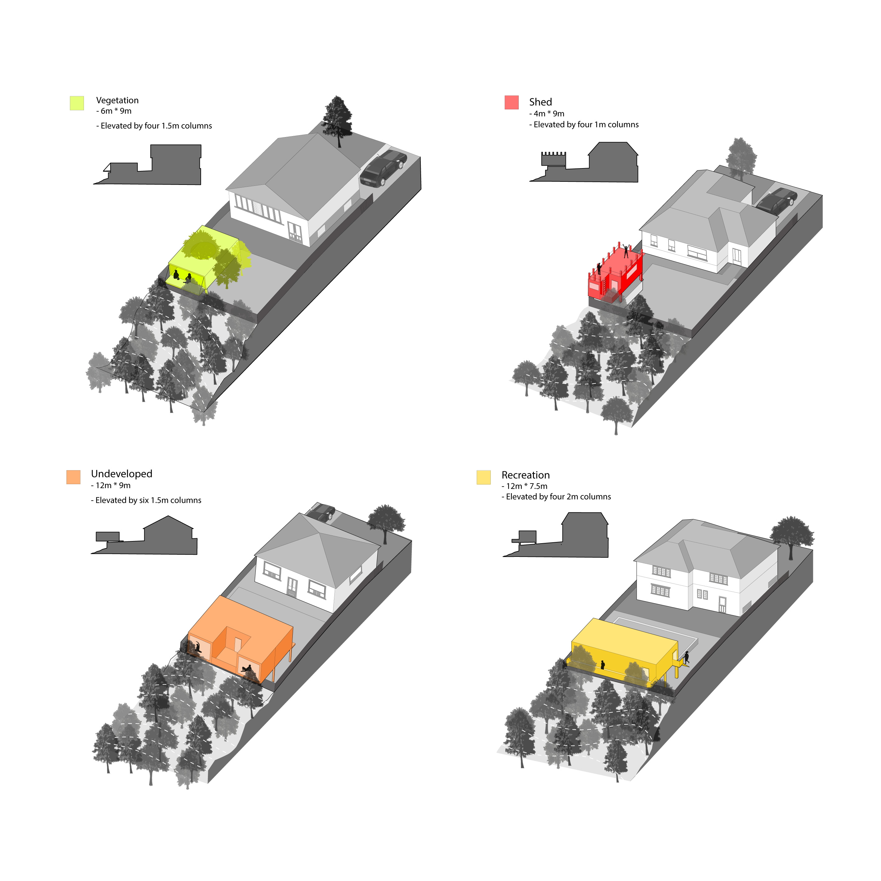
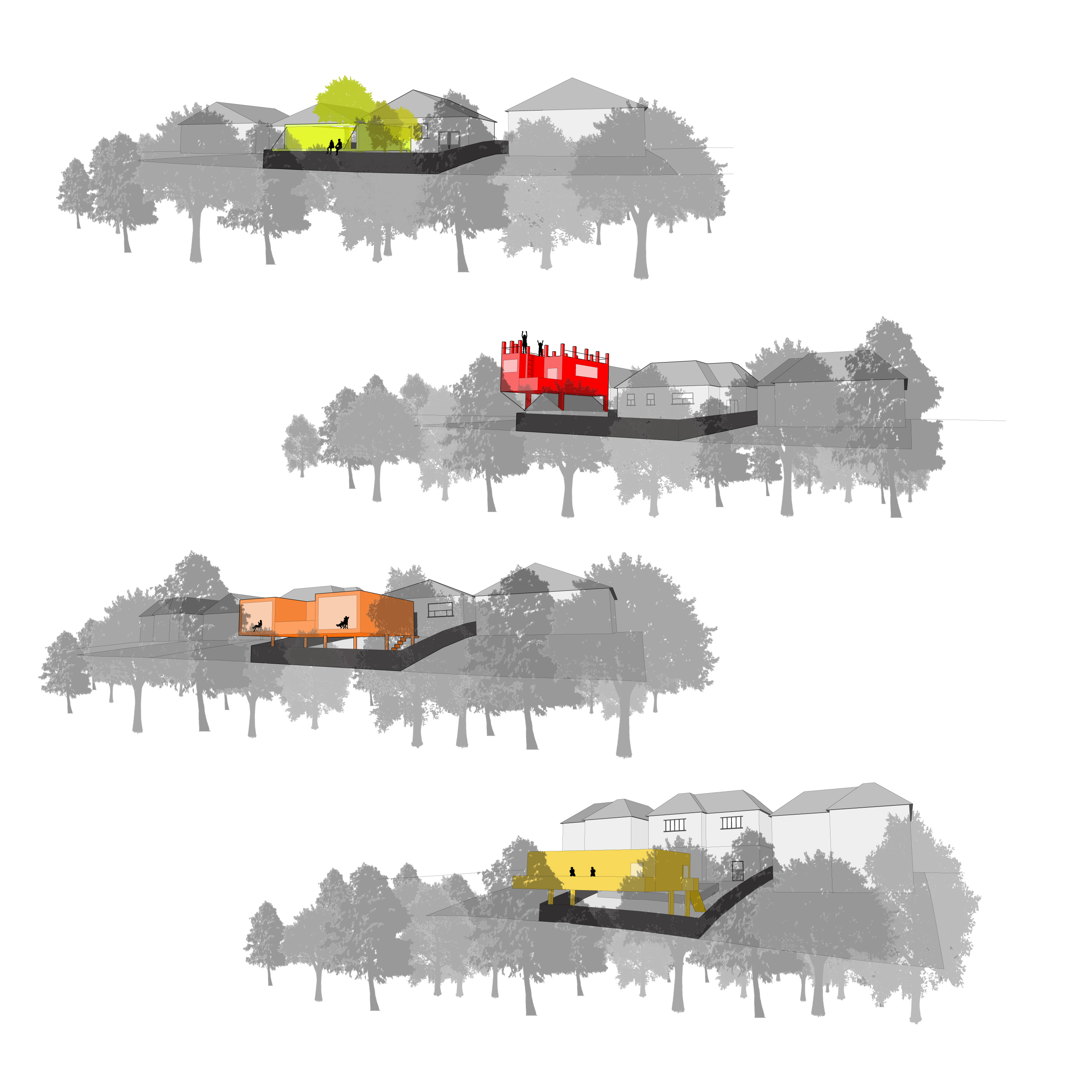
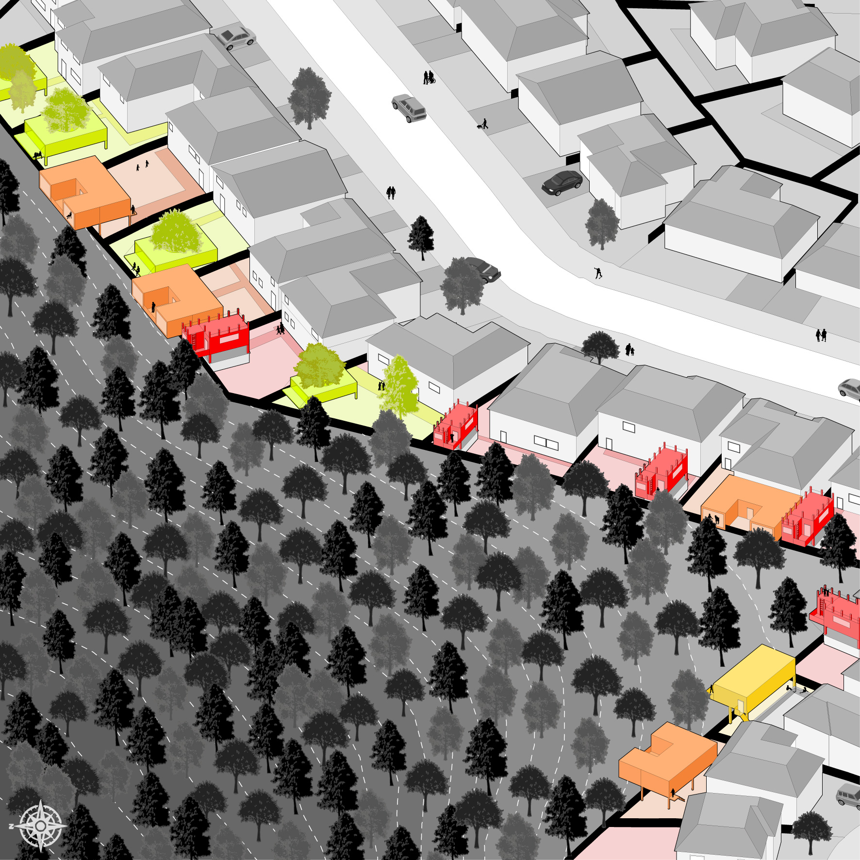
Yunong writes: "My focuses are ravines and the single family homes adjacent to them. The single family homes I chose to study are right beside the ravines, which is a unique geographic advantage for them. I developed typologies by analyzing and classifying the major backyard usage of the single family homes. I categorized them into four types: vegetation, recreation, shed, and undeveloped. For the design proposal, my strategy was to create extra living space and enable people to engage with the ravines. In order to have part of the backyard still available for other uses, I tried to limit the sizes of the interventions."
(Instructor: Sam Ghantous)