

Integrated Urbanism Studio
Design Studio 3 is an integrated urbanism studio, in which students from all three of the Daniels Faculty's design disciplines — architecture, landscape architecture, and urban design — collaborate on shared projects. In the fall 2020 semester, student groups were required to investigate and reimagine Toronto's postwar neighbourhoods, taking into consideration social inequality and the environmental imperatives of the Green New Deal.
Joey Chiu, Agata Mrozowski, Tina Cui, and Nadia Chan
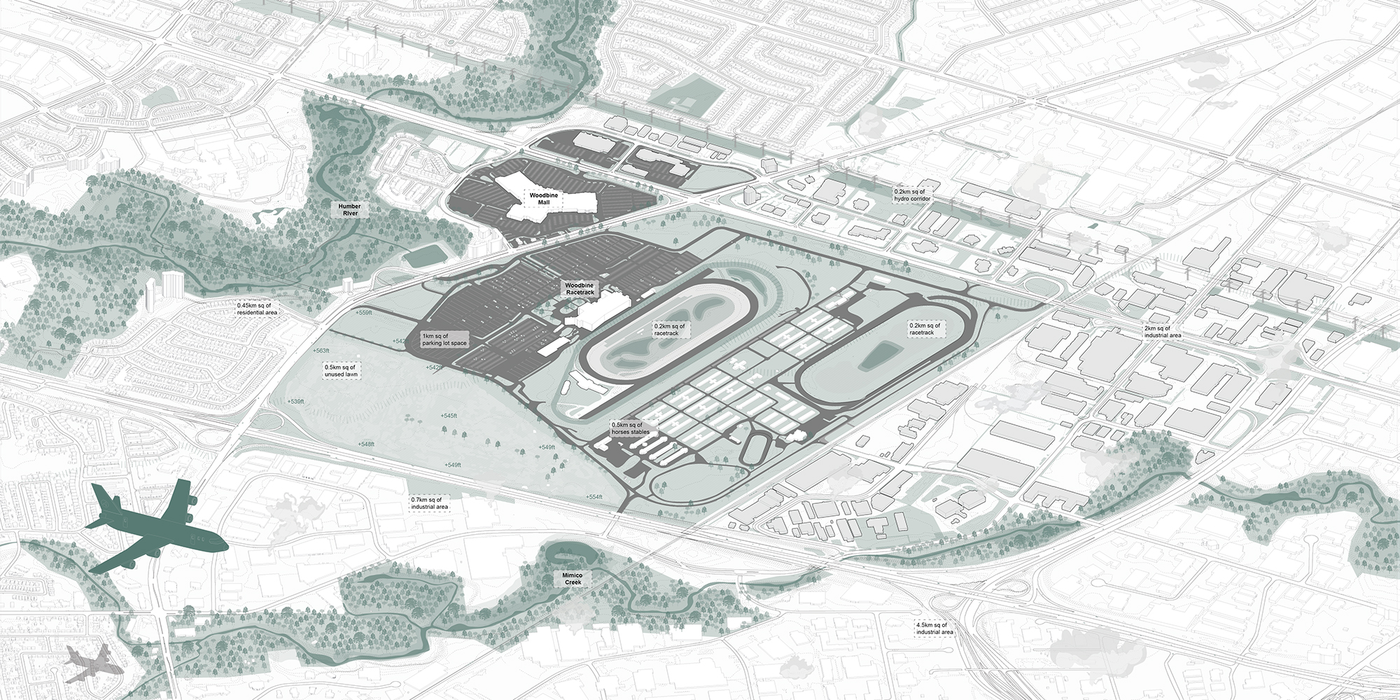
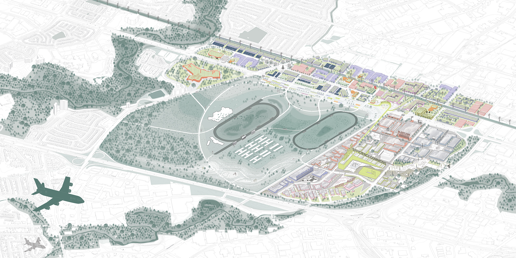
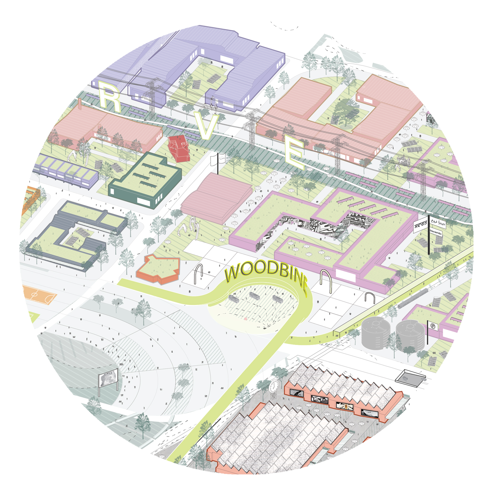
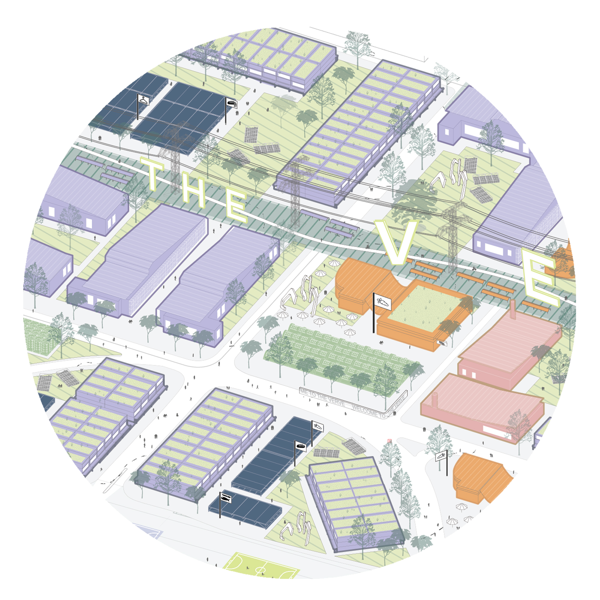
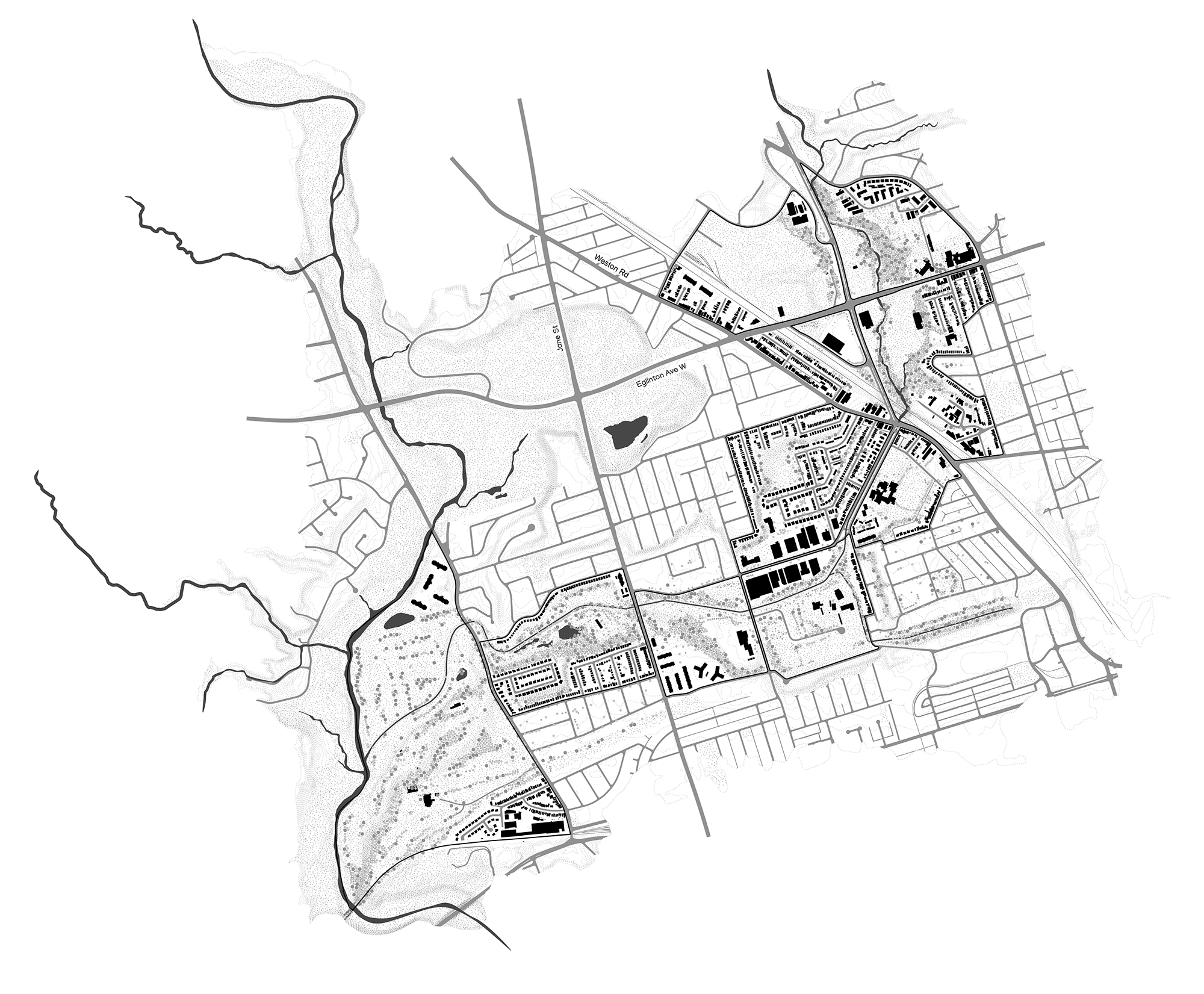
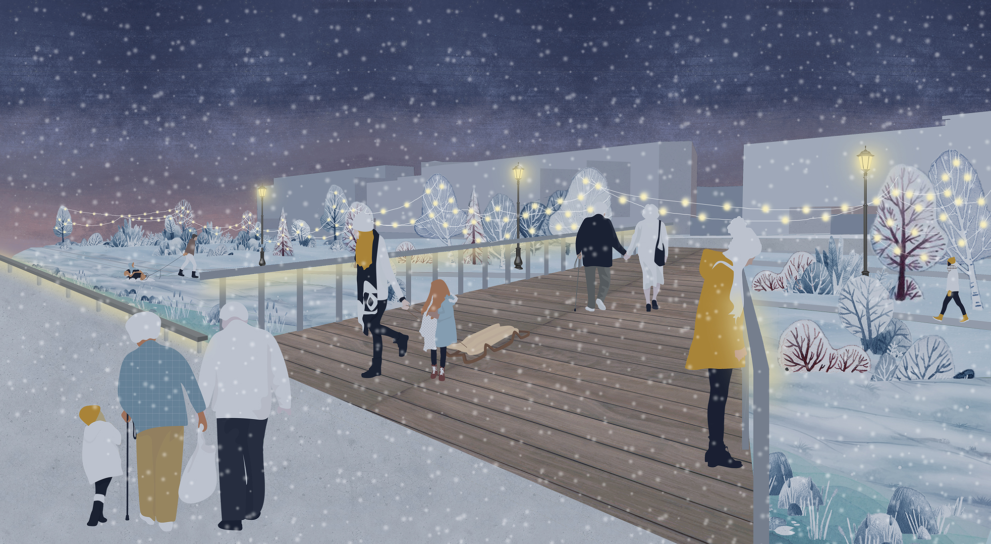
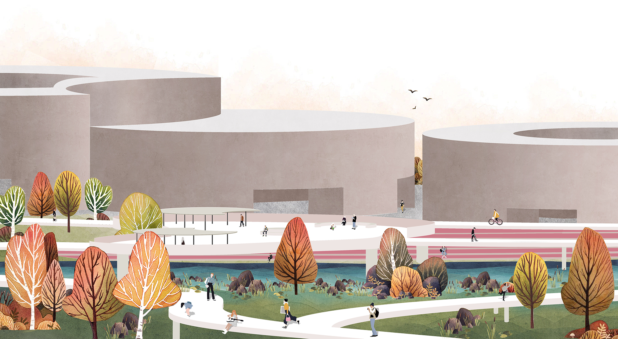
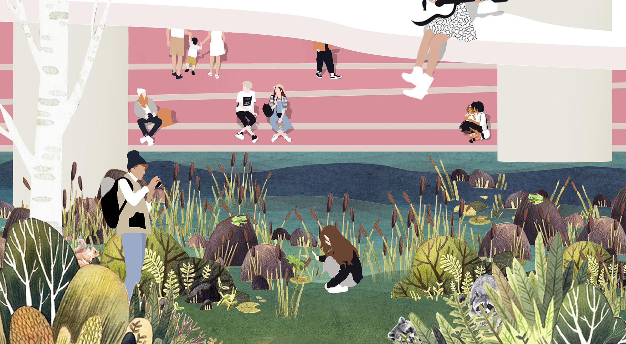
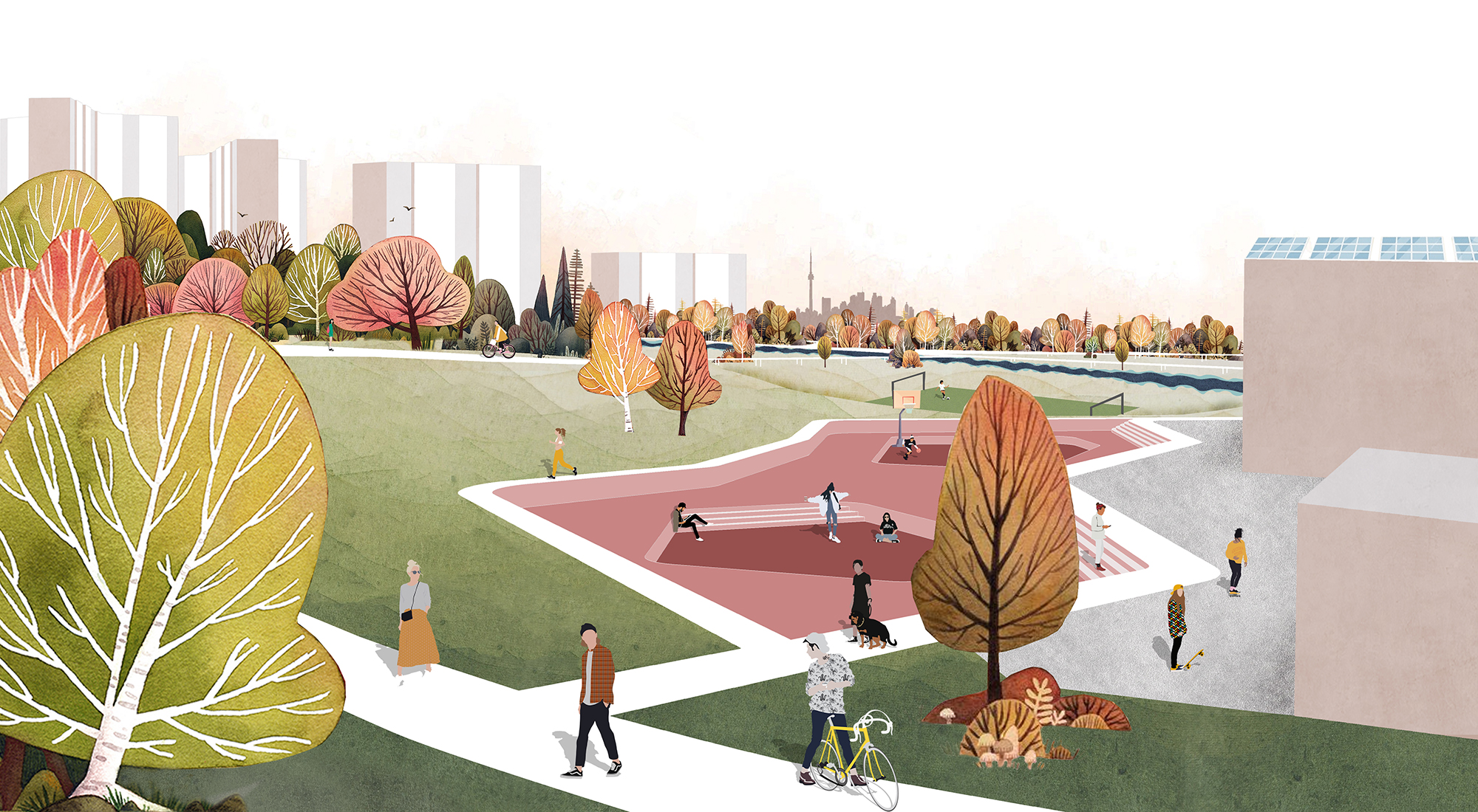
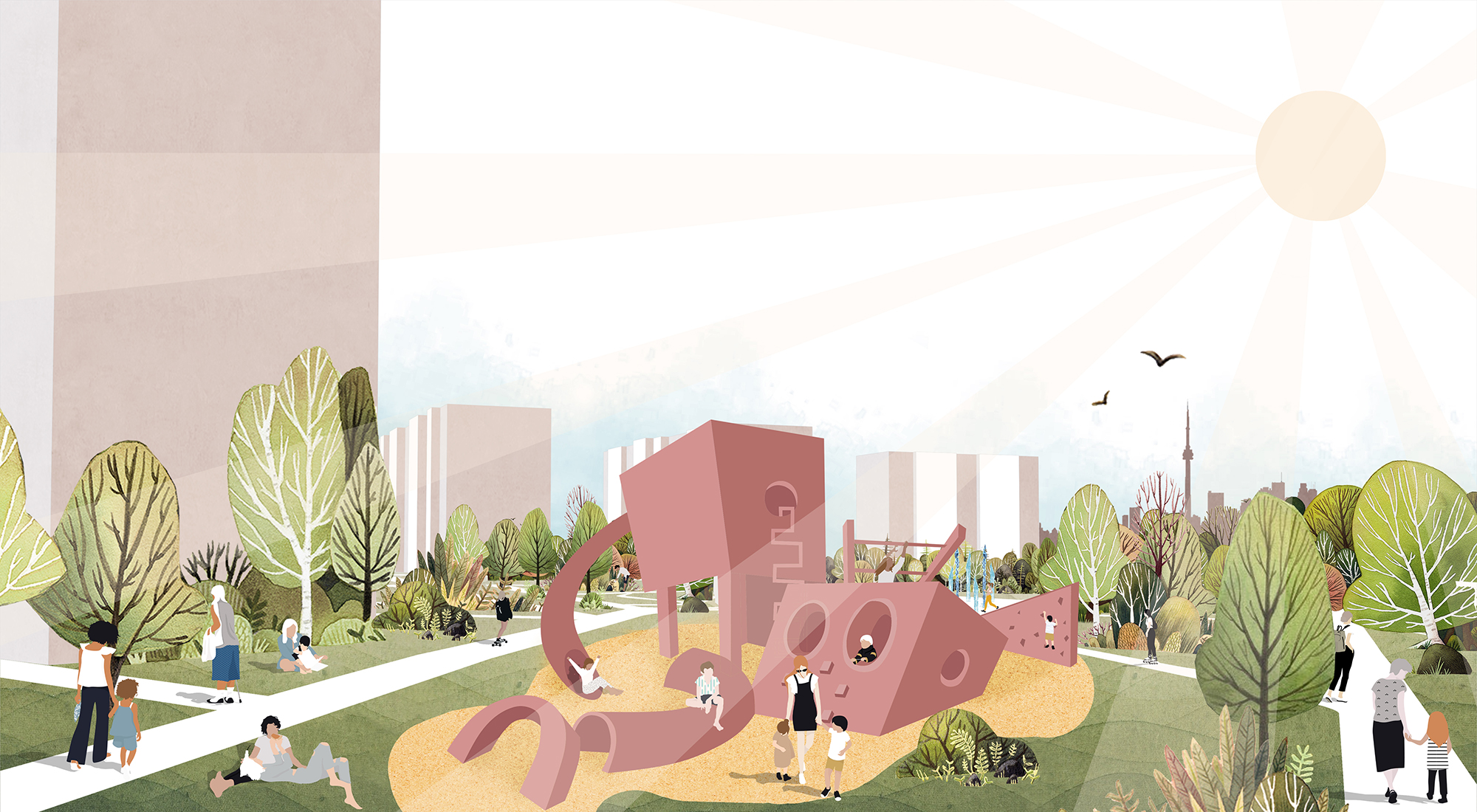
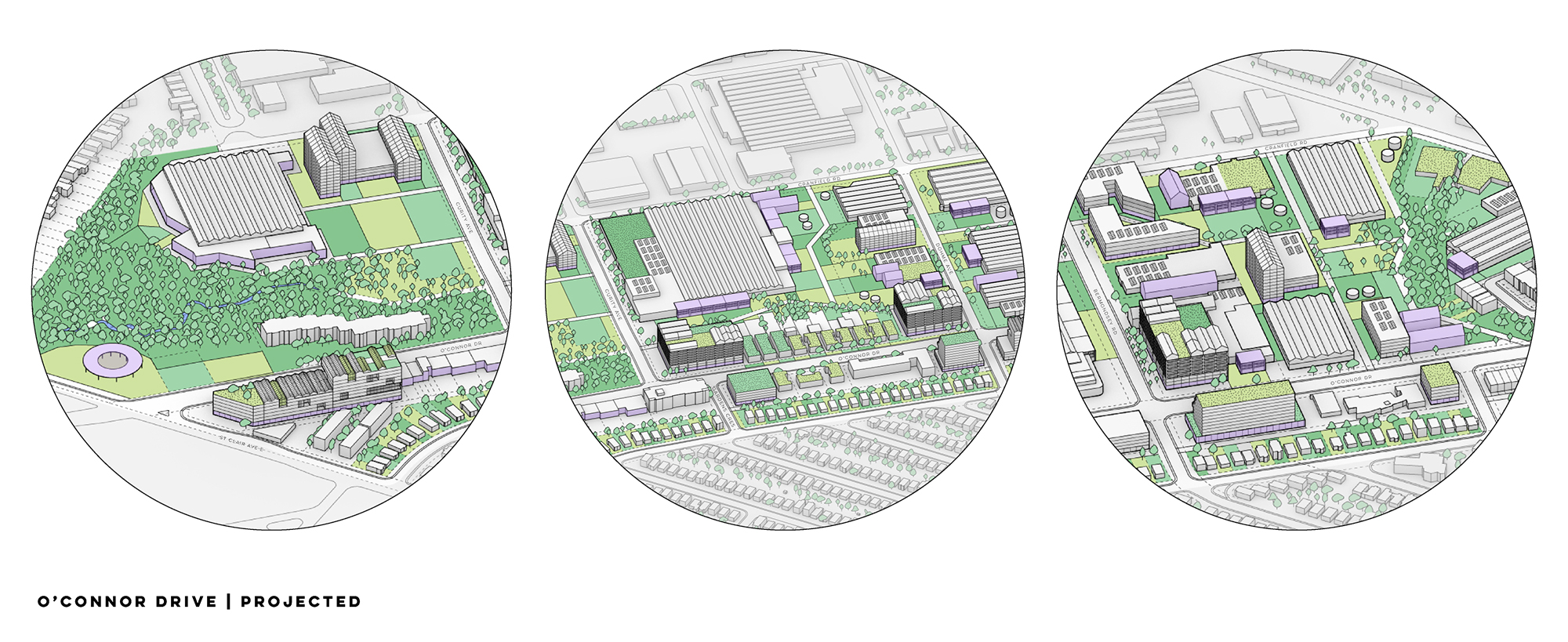
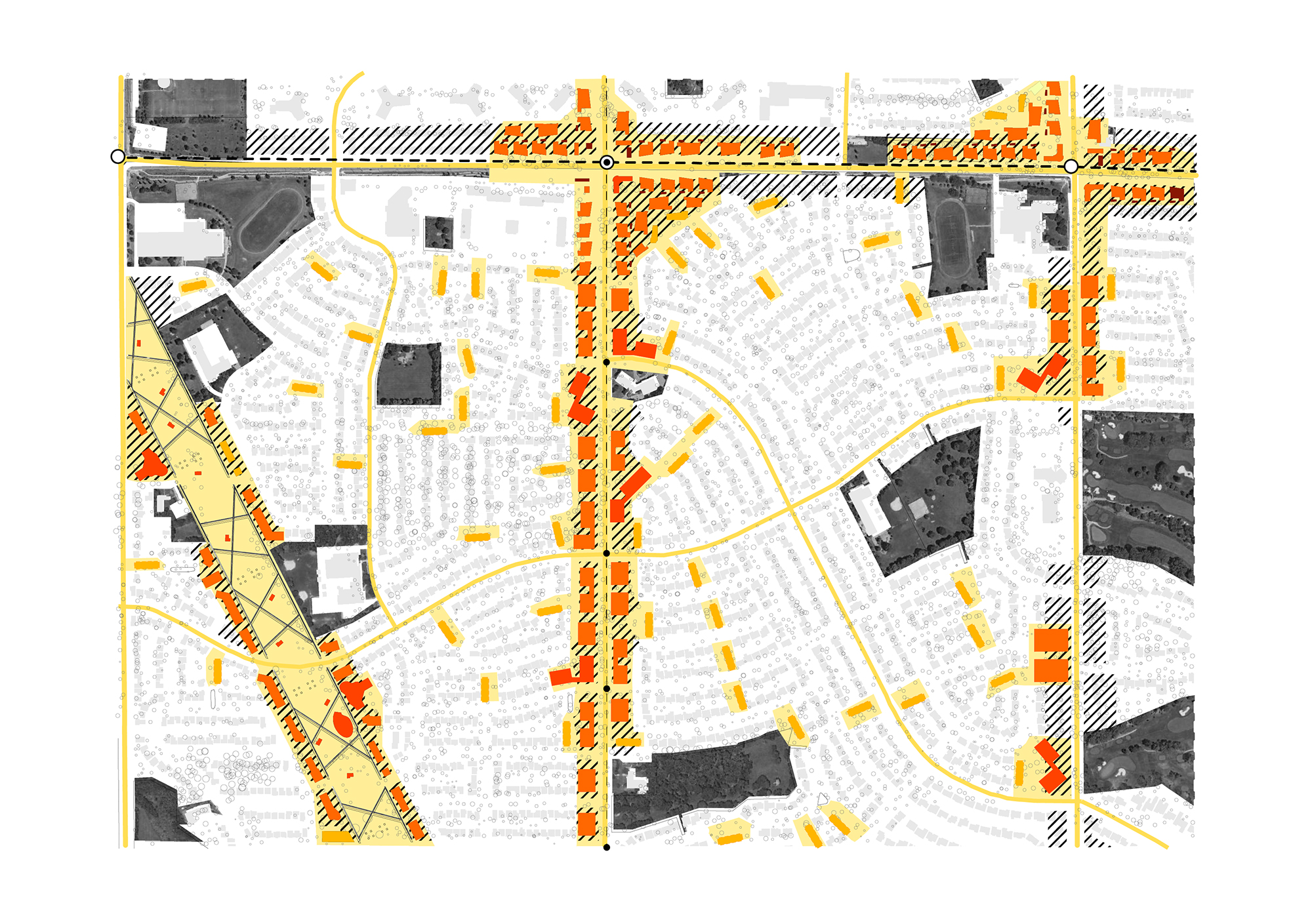
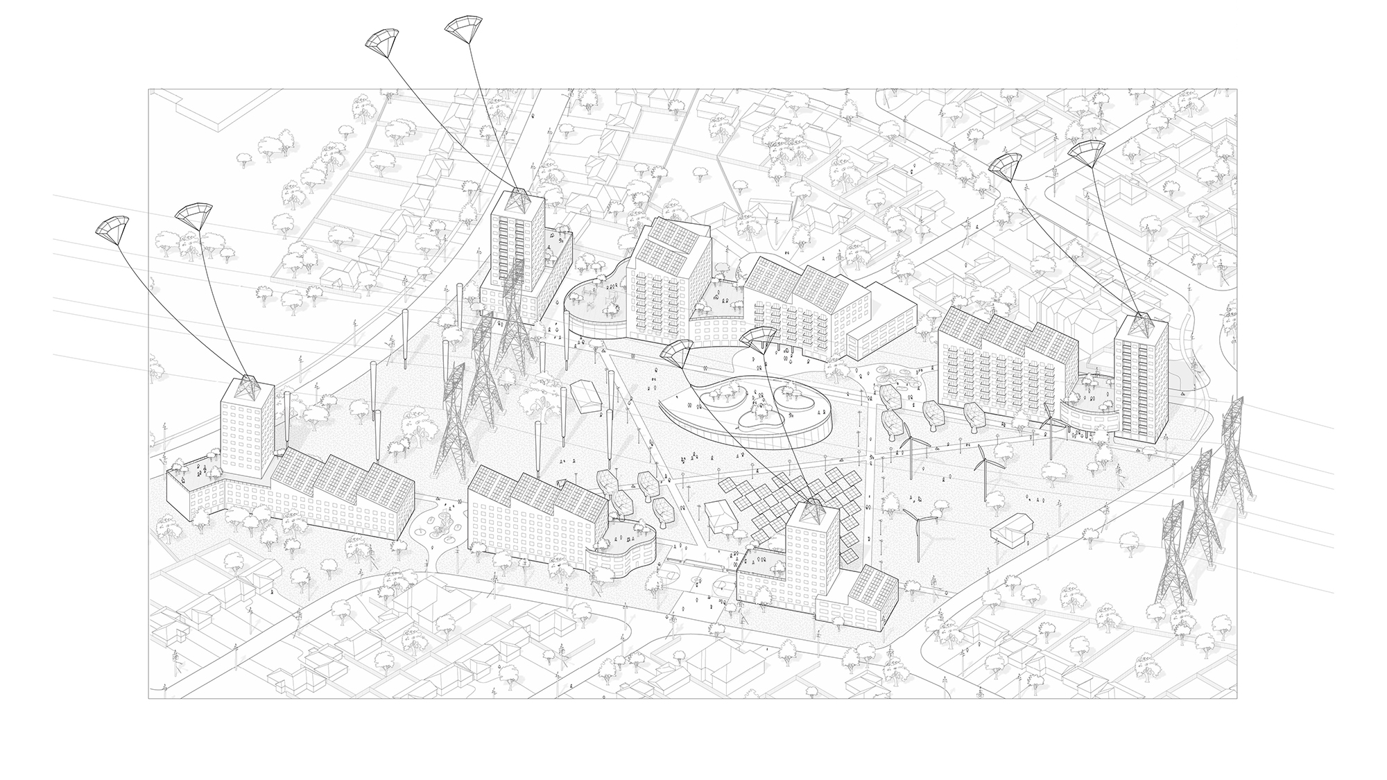
Joey, Agata, Tina, and Nadia write: "Our project is called Re:charge. It looks at redefining the existing technology, industry, and open spaces of West Rexdale through the lens of the Green New Deal. Most of the site is currently occupied by the Woodbine Racetrack and Casino, with plans for a mega entertainment complex. However, we envision a different development approach that prioritizes community investment and climate change adaptation and mitigation. Our proposals centre around investing in local renewable energy production to power community infrastructure and empower the community. There are three main programmatic areas.
The Efficiency Commons takes the existing warehouse and manufacturing district and retools it for new green energy generation and green manufacturing jobs. It will house new high-tech industries and the Sleepless Circuit, a new entertainment destination. The Common Sink is a large central green space on the defunct Woodbine Racetrack. This new park will include a horse sanctuary, a large wetland green space, a successional forest that connects the two ravines, and a land-art sculpture park that takes into consideration hydrology and habitat connectivity. The Verve is a long north-south mixed-use residential, manufacturing, and employment corridor that has a unique typology of warehouse co-op housing and civic amenities that do not currently exist. It includes artist-run galleries, and the Knowledge is Power Community Center. The corridor creates connections between residential areas within West Rexdale and provides connection to a new GO transit hub near Pearson."
(Instructors: Fadi Masoud and Megan Esponeko)
Yuhan Mao, Chengfan Liang, Xinran Sui, and Hongyu Wu
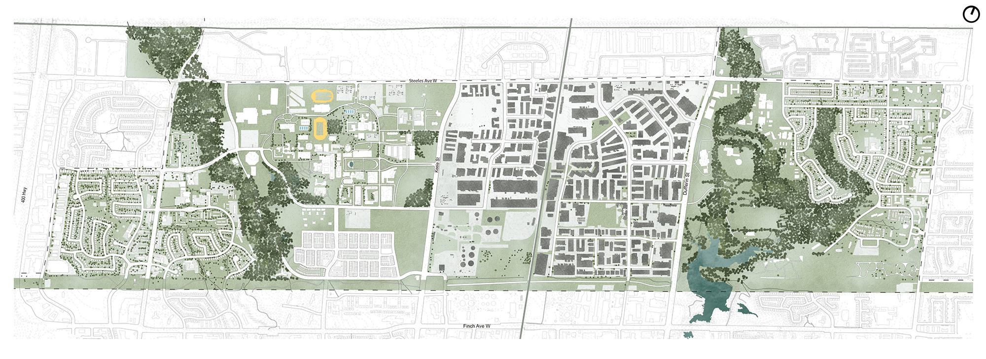
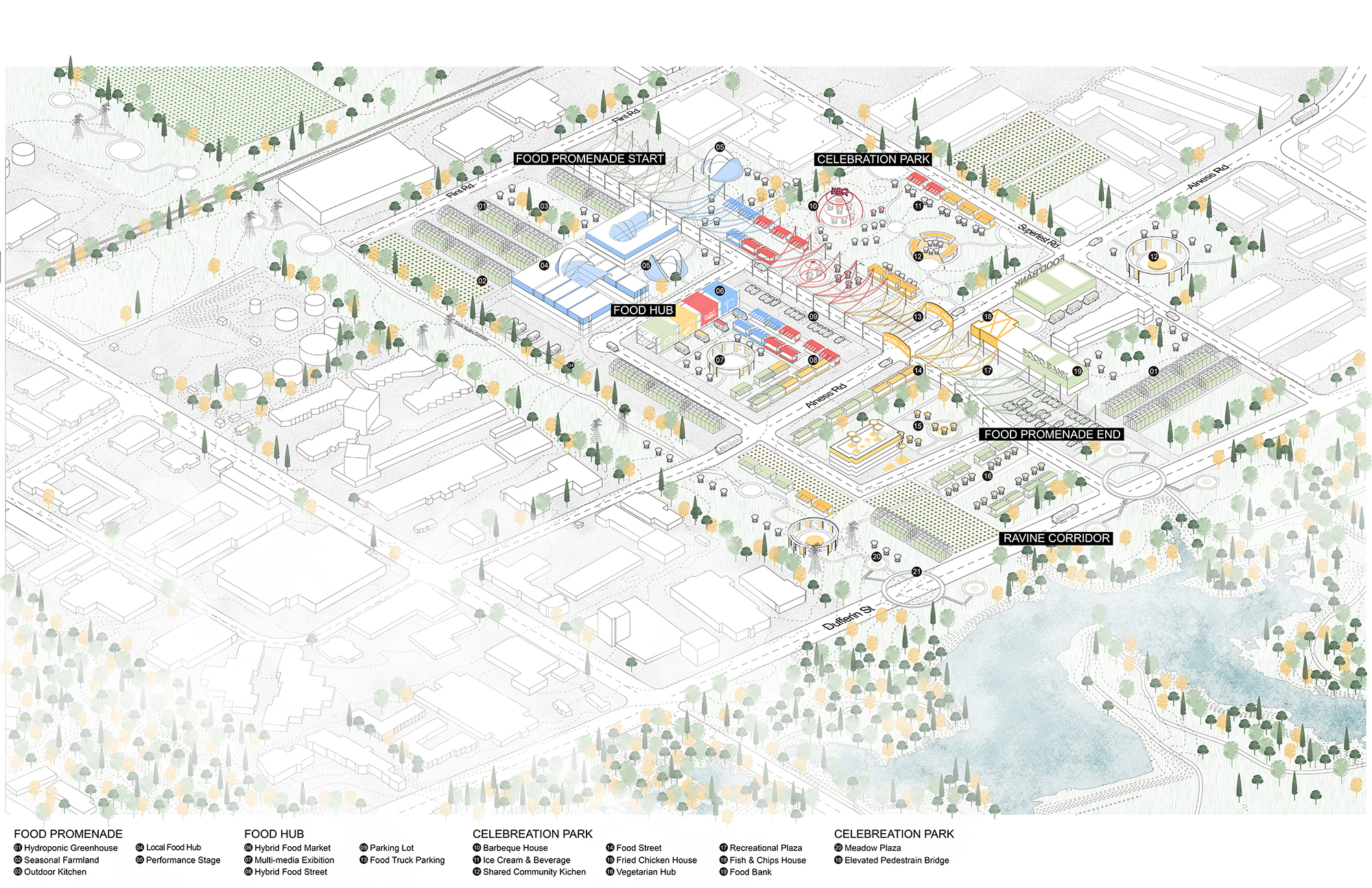
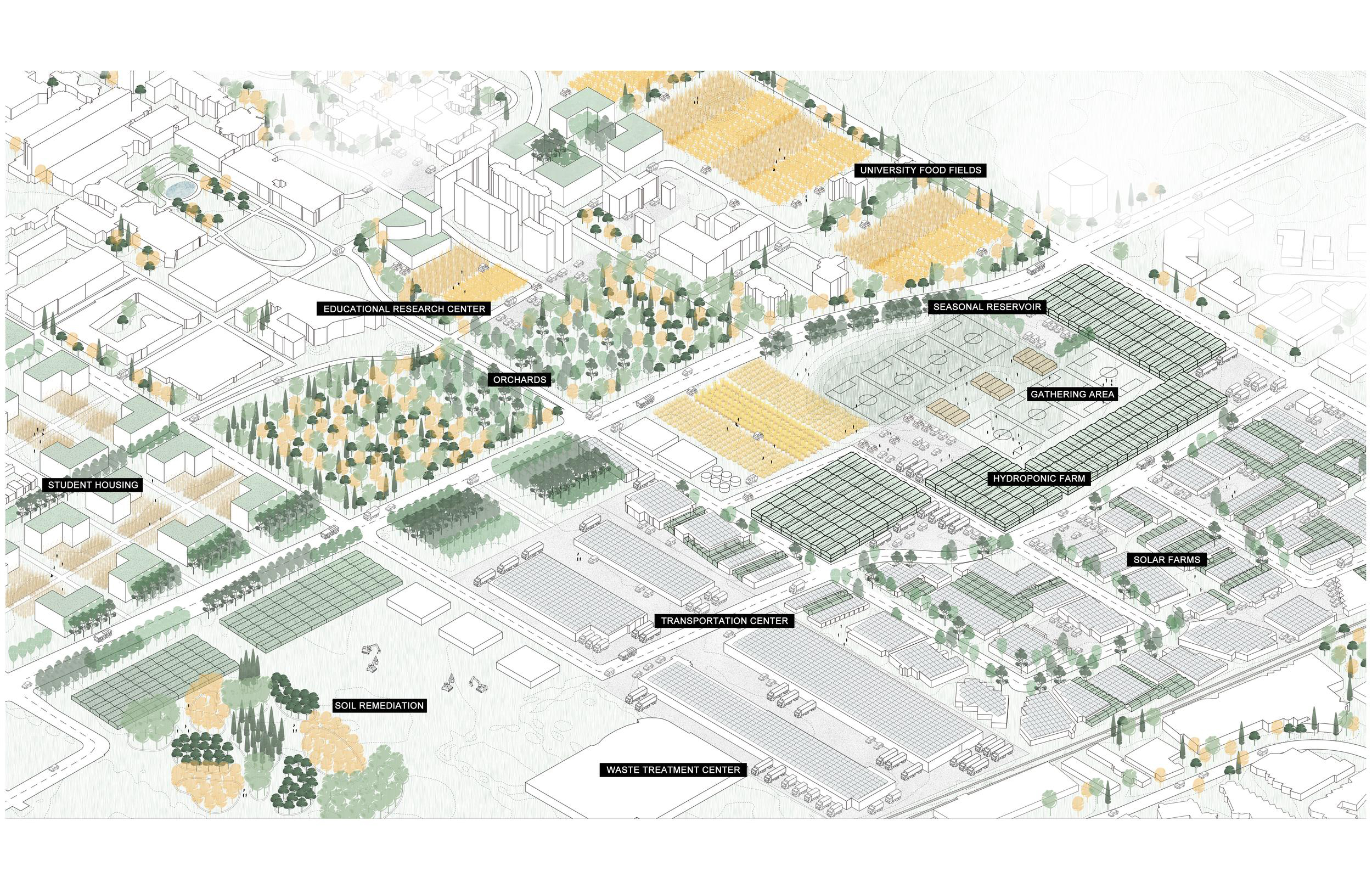
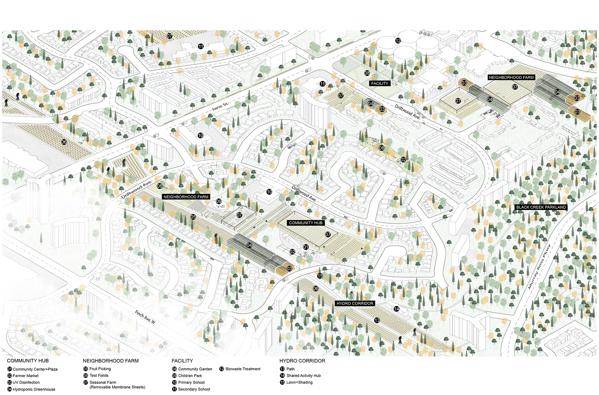
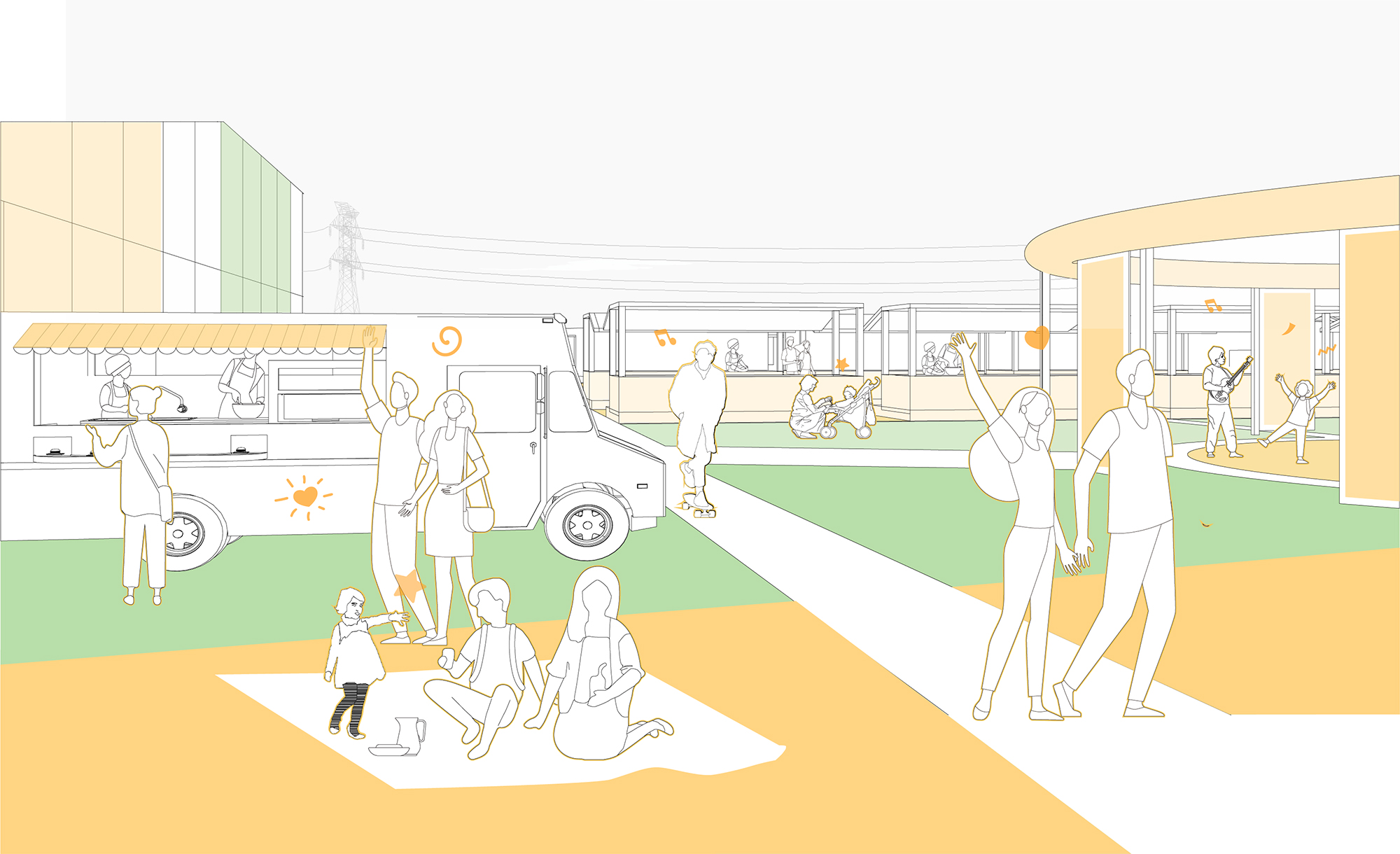
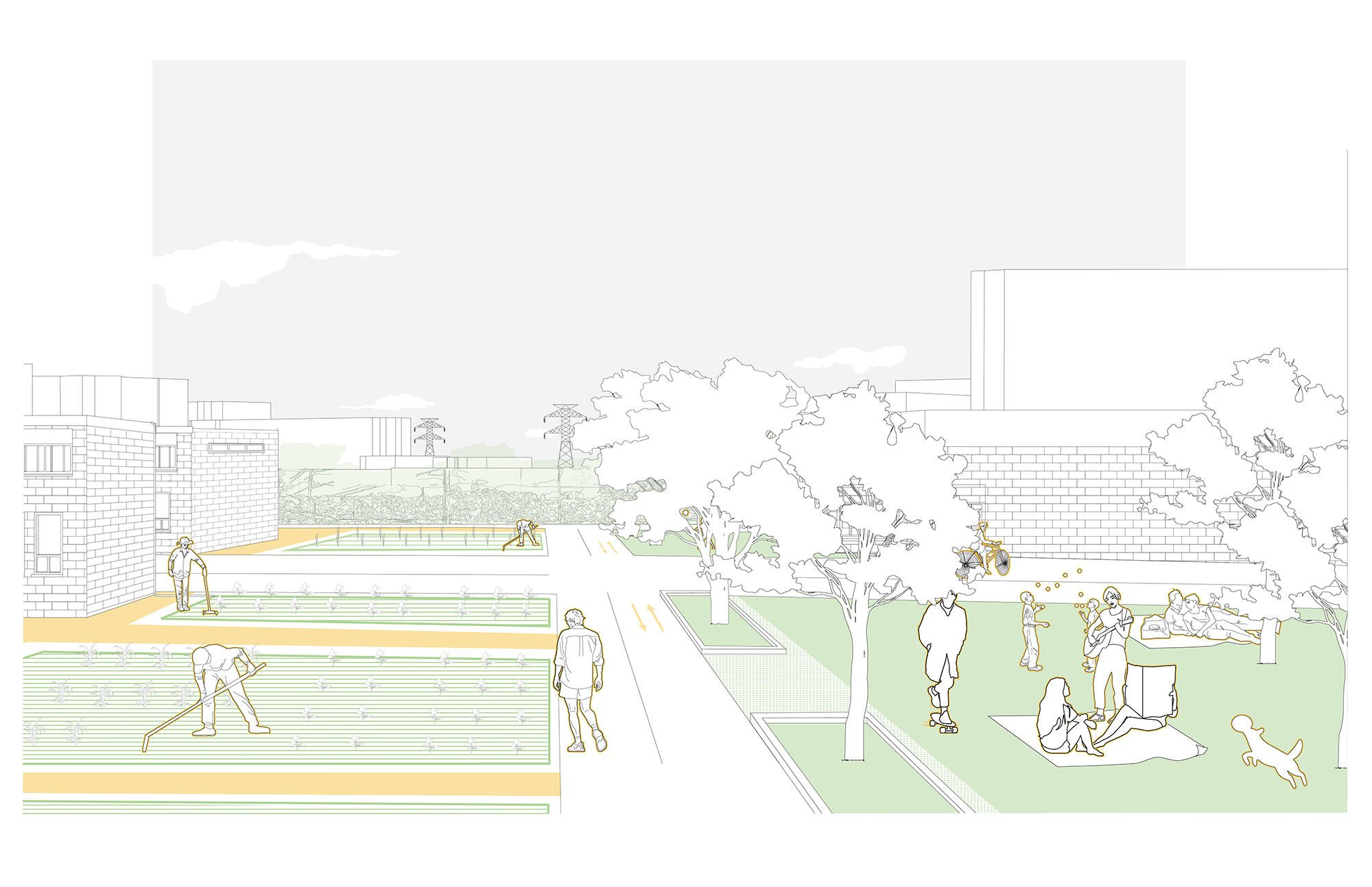
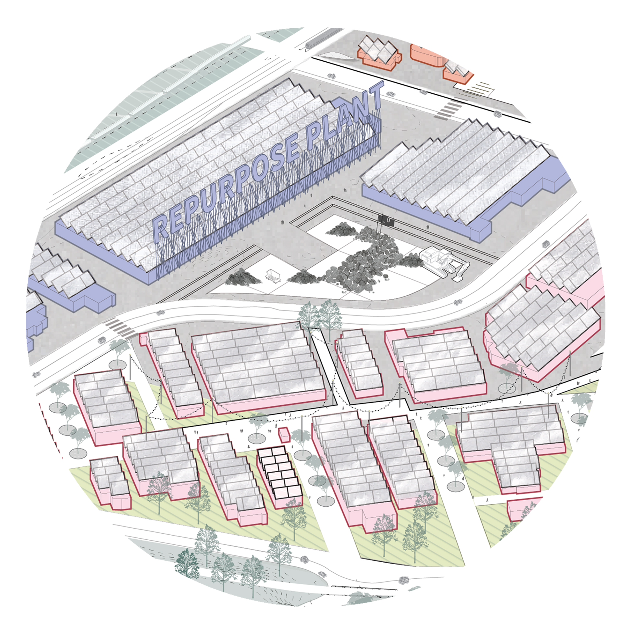
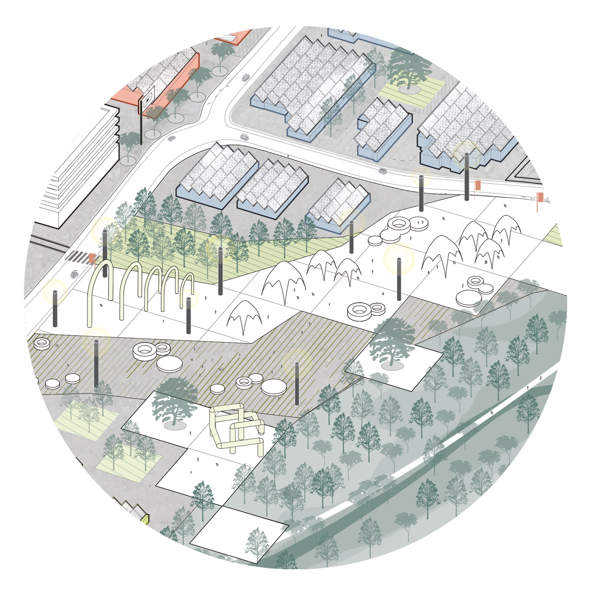
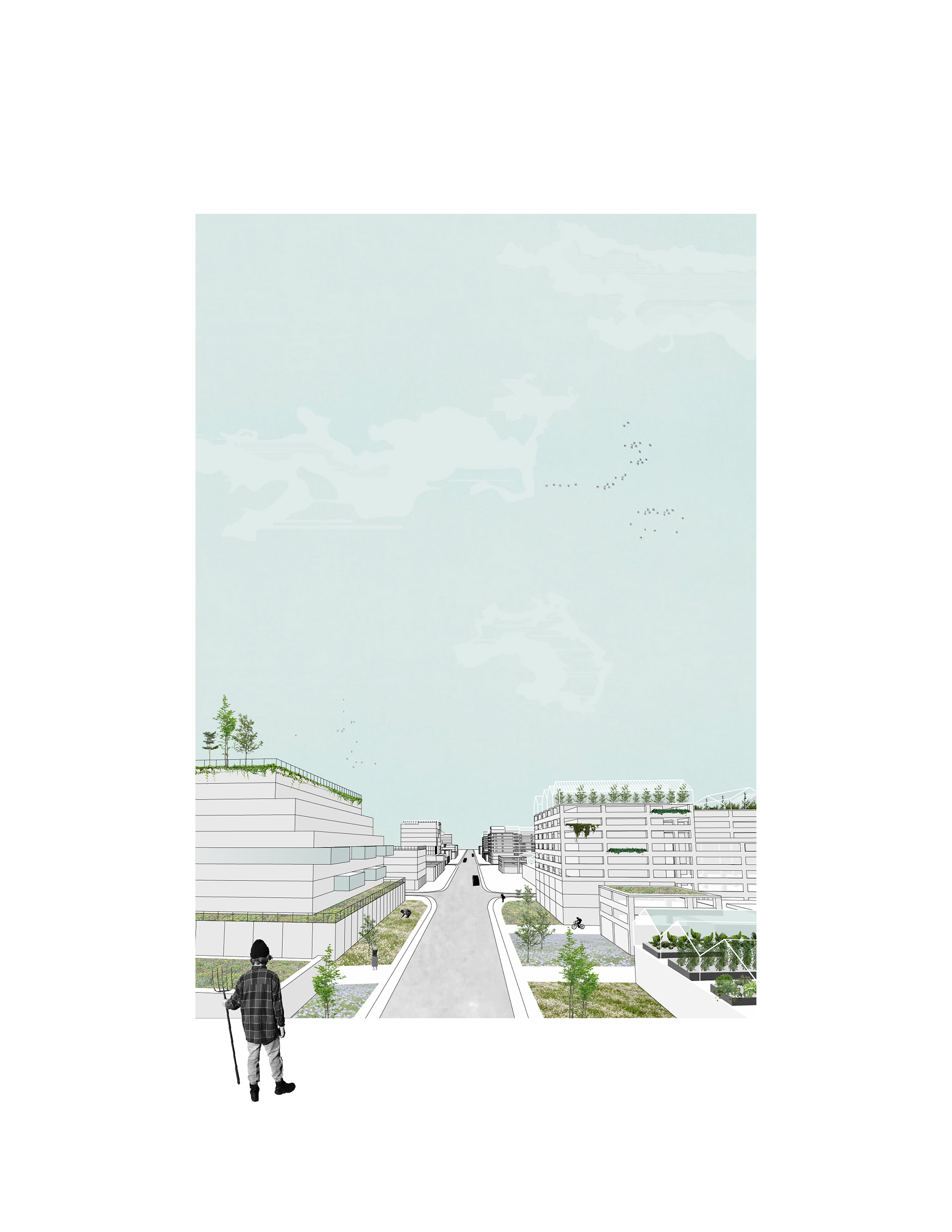
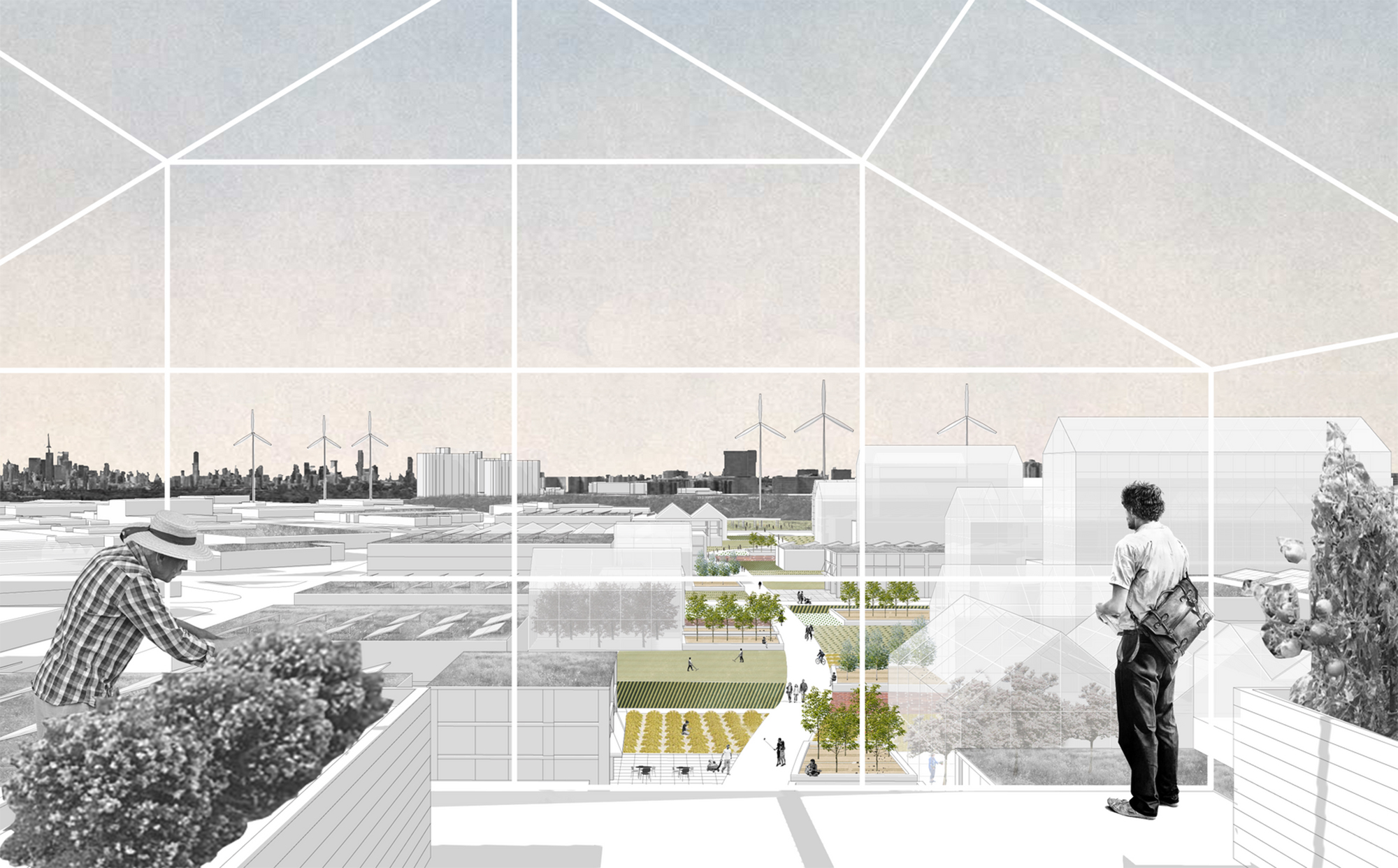
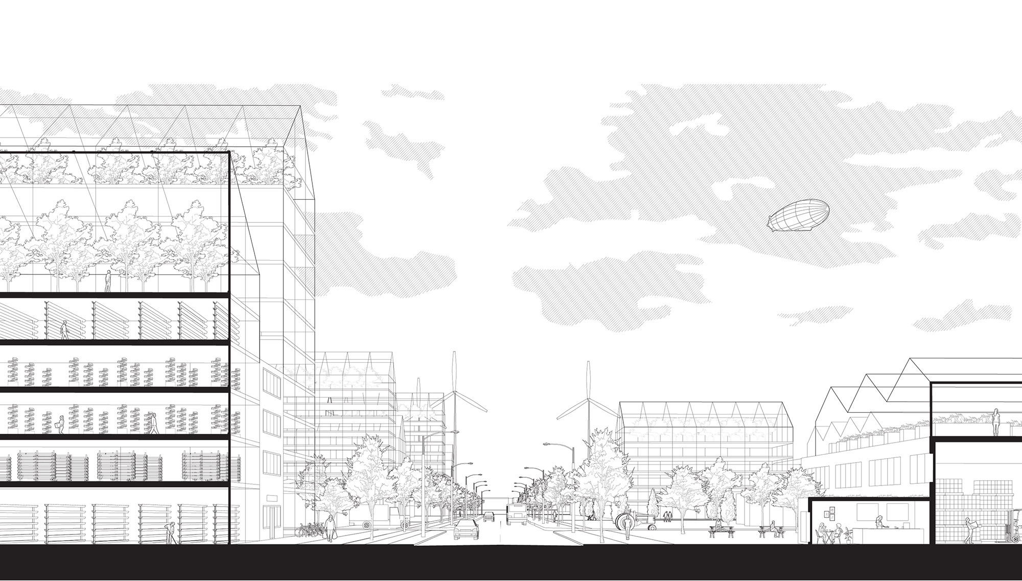
Yuhan, Chengfan, Xinran, and Hongyu write: "This project is called Reconnect the Fragments, Foodscape Palette. The design action zone is located in the northwest corner of Toronto, at the intersection of highways 400 and 407. From the east to the west are the Westminster community, G. Ross Lord Park, an area of concentrated factories and warehouses, the York University campus, the Black Creek Parkland, and the Black Creek community. The Finch hydro corridor is located in the south. The foodscape palette looks for a way to link these entities locally and regionally through food production, and uses food as a medium to solve problems on site. On a regional scale, the foodscape helps to grow food in the urban context, which helps the city not rely too much on imports and promotes food security for low-income communities."
(Instructors: Fadi Masoud and Megan Esponeko)
Alex Sheinbaum, Agata Molendowski, Evelyn Babalis, Natasha Raseta
Alex, Agata, Evelyn, and Natasha write: "The reality is that WE ARE IN A CLIMATE CRISIS. While we understand the normalcy of a fluctuating landscape, our urban systems and regions are built with static, unchanging infrastructure that can rarely withstand modern ecological disasters.
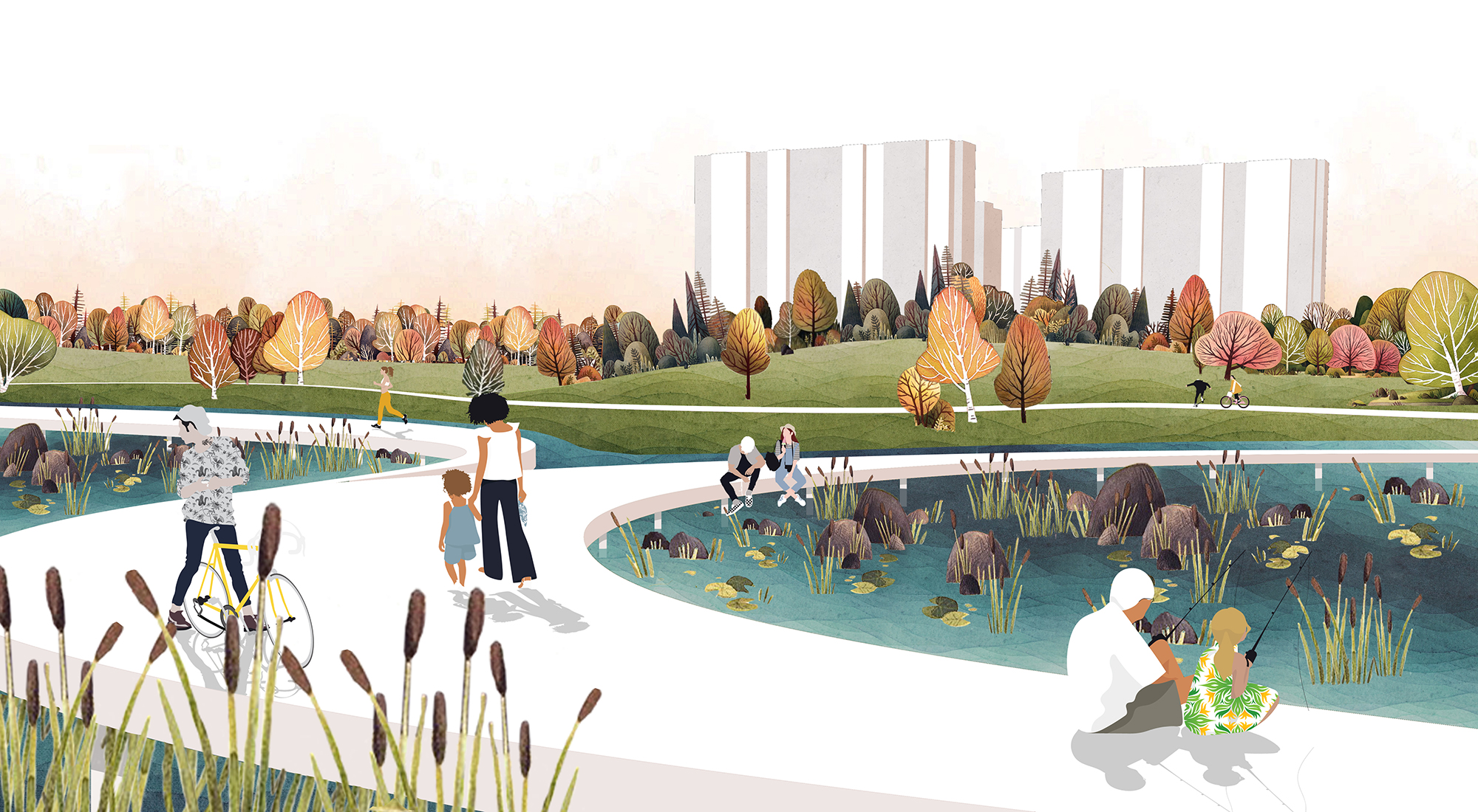
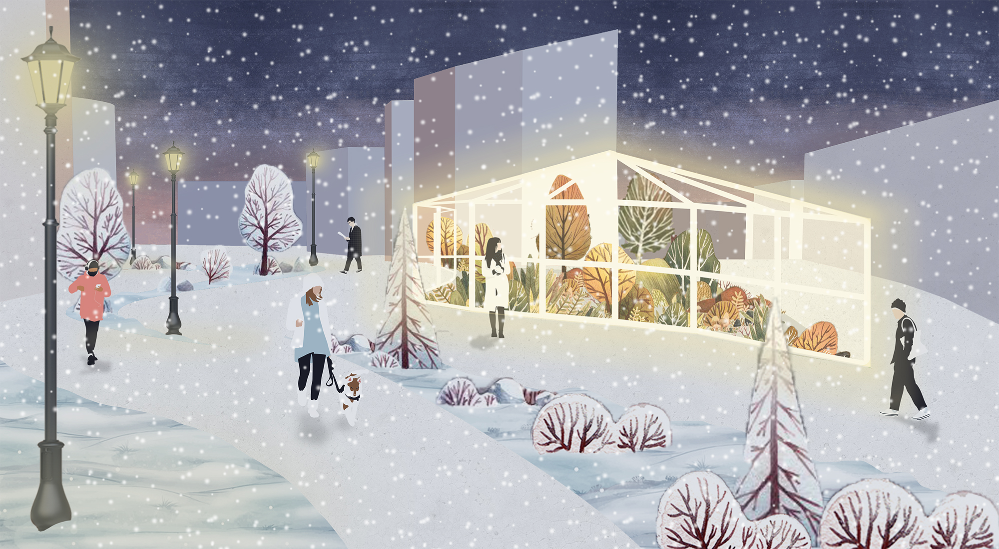
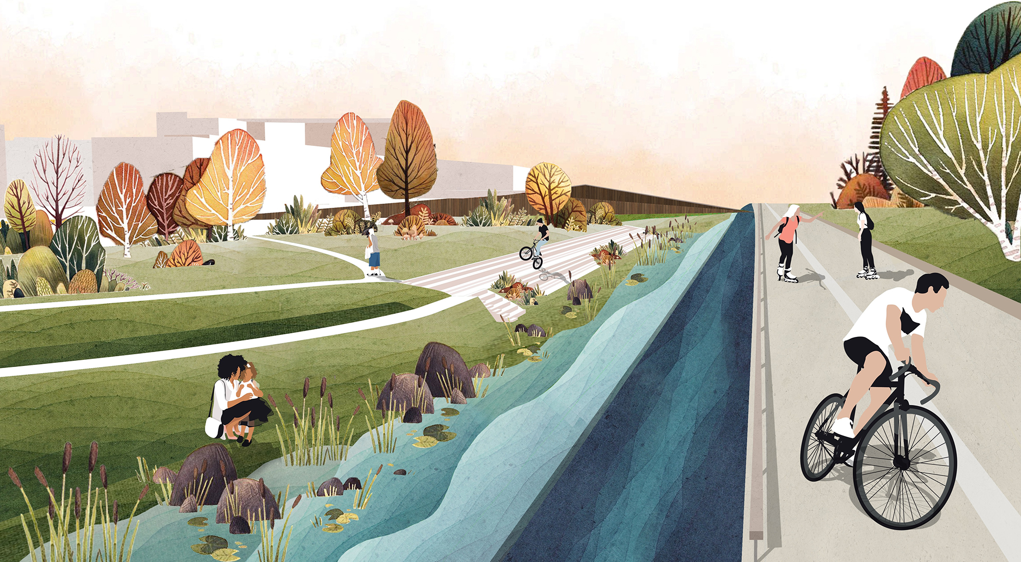
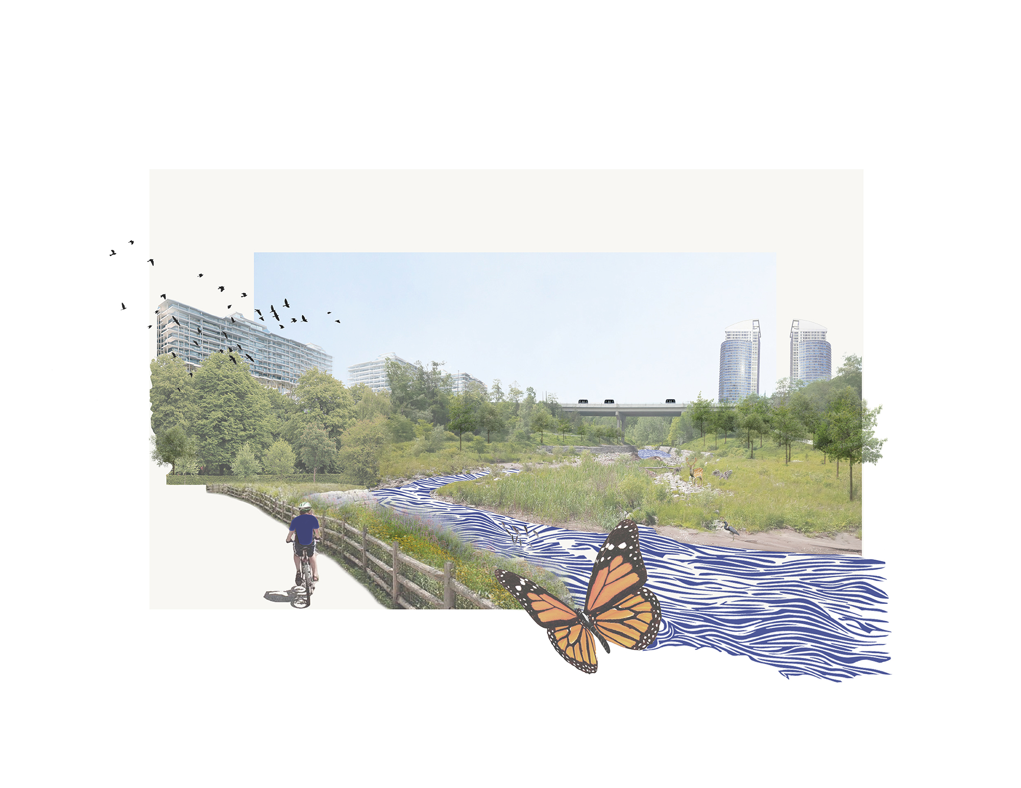
In identifying Rockcliffe-Smythe and the Black Creek as a significant design action zone in Toronto, this project strives to gain a better understanding of the relationship between water as infrastructure and water as life, since both the natural and built systems exist symbiotically within our urban environment.
Though there is no perfect solution to the growing ecological crises faced by Toronto's vulnerable communities, the project's thoughtful design integrates and innovates socio-ecological resiliency strategies tailored to the Rockcliffe-Smythe neighbourhood, including new housing programs, research facilities, floodable programming, and spaces for engagement. These interventions desegregate human and natural communities and reconnect people to their environments within newly designed spaces full of life, all grounded by the Black Creek."
(Instructors: Fadi Masoud and Megan Esponeko)
Stefan Herda, Madison Appleby, Howard Rosenblat, and Bernardo Juan Velasco Canela
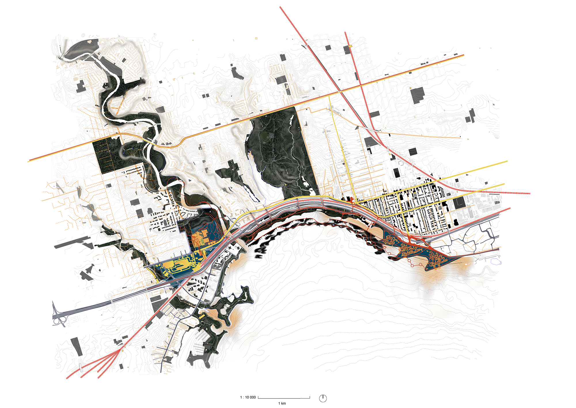
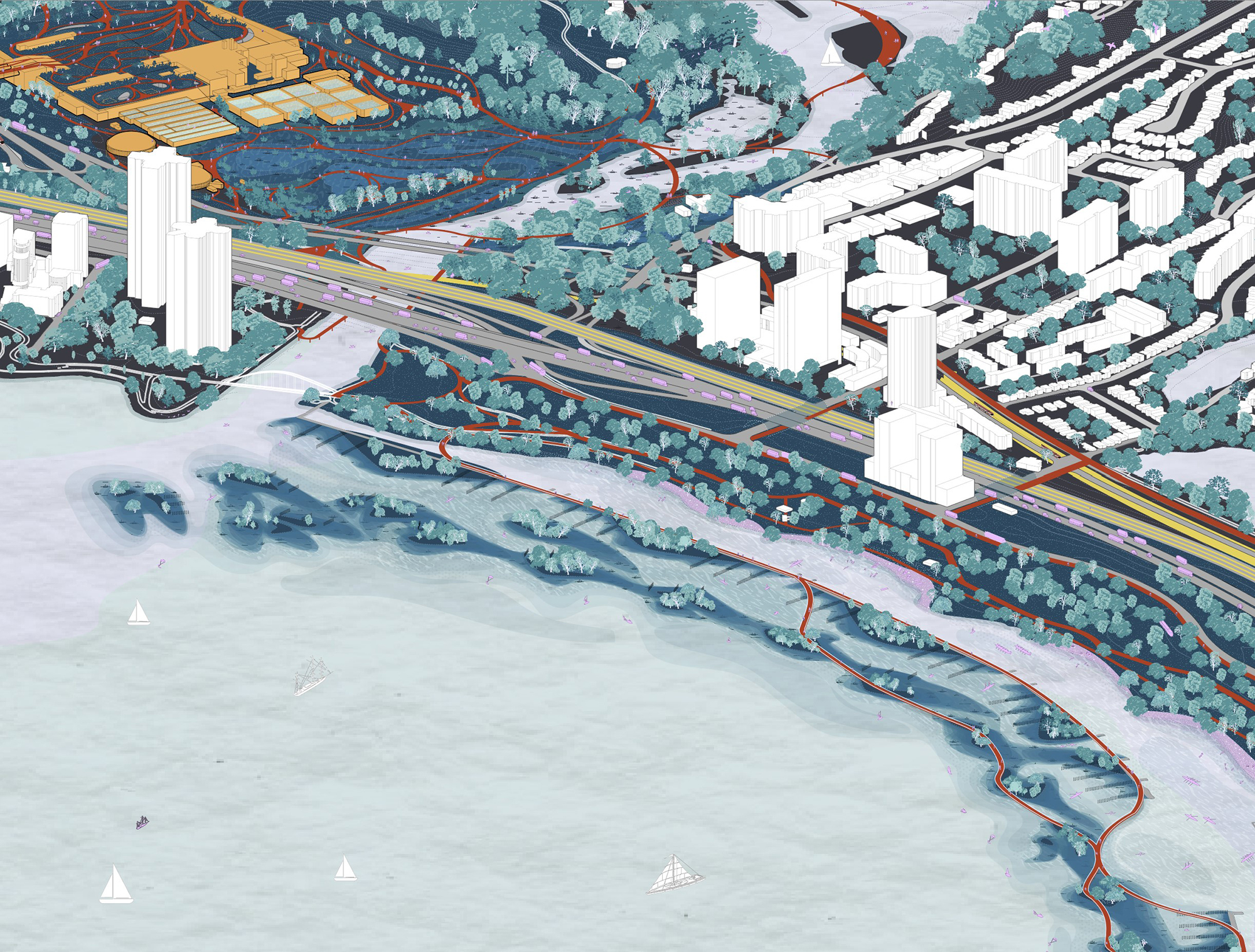
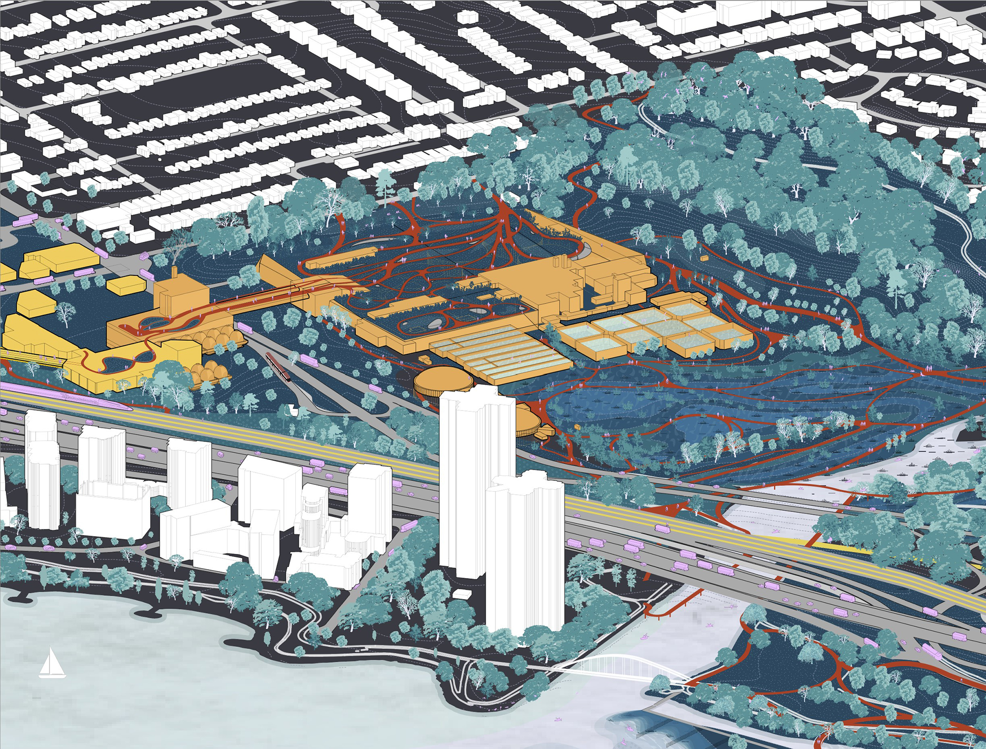
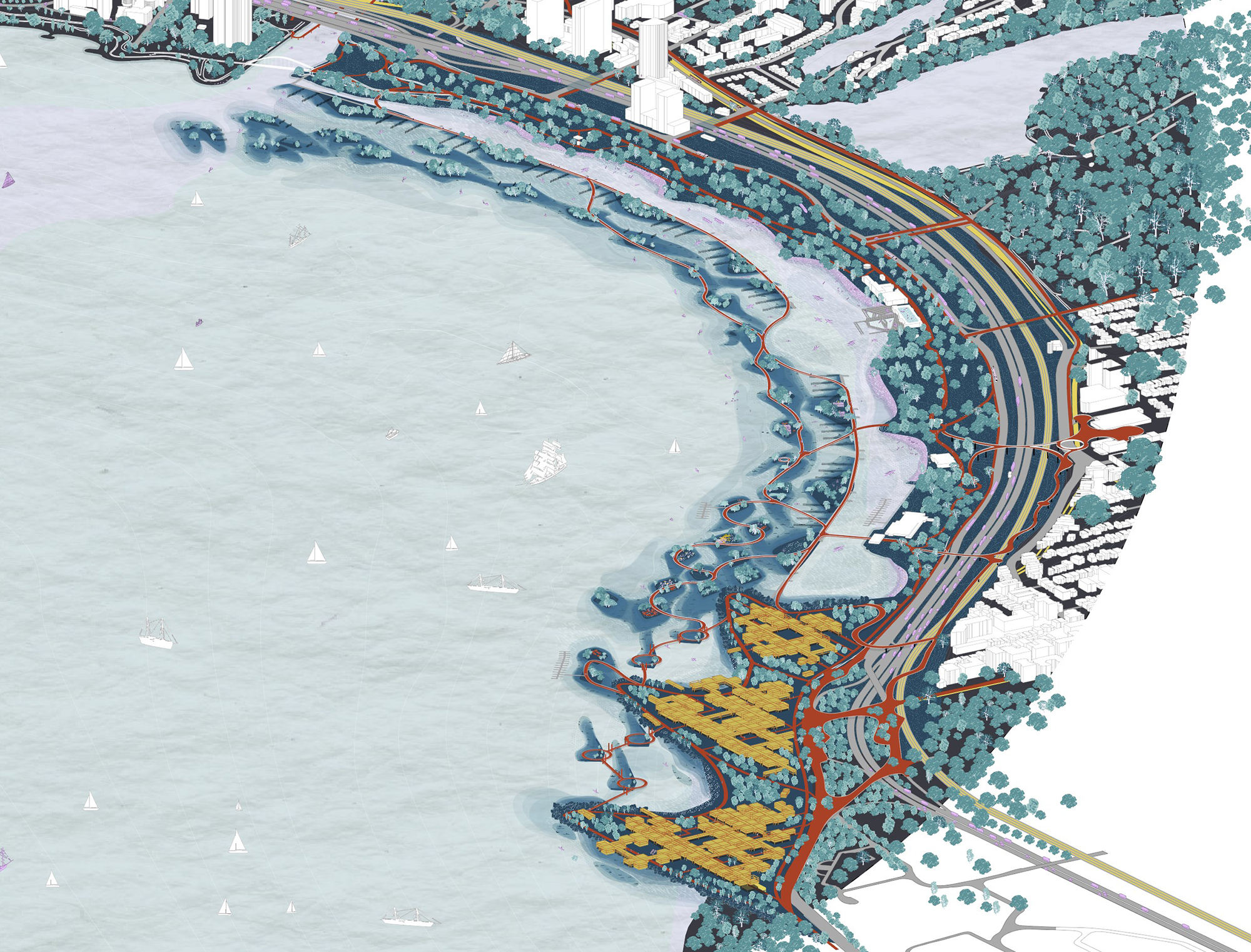
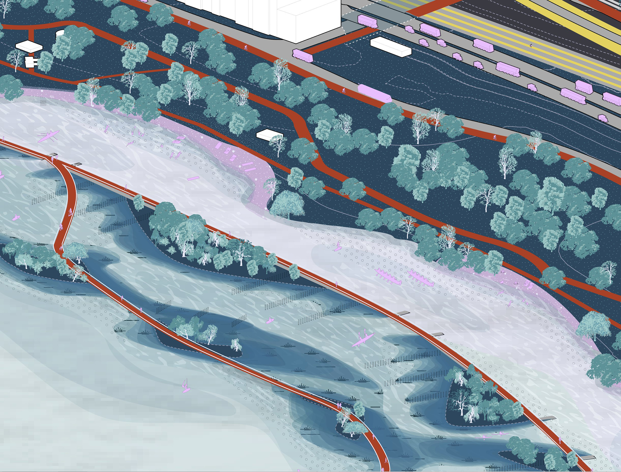
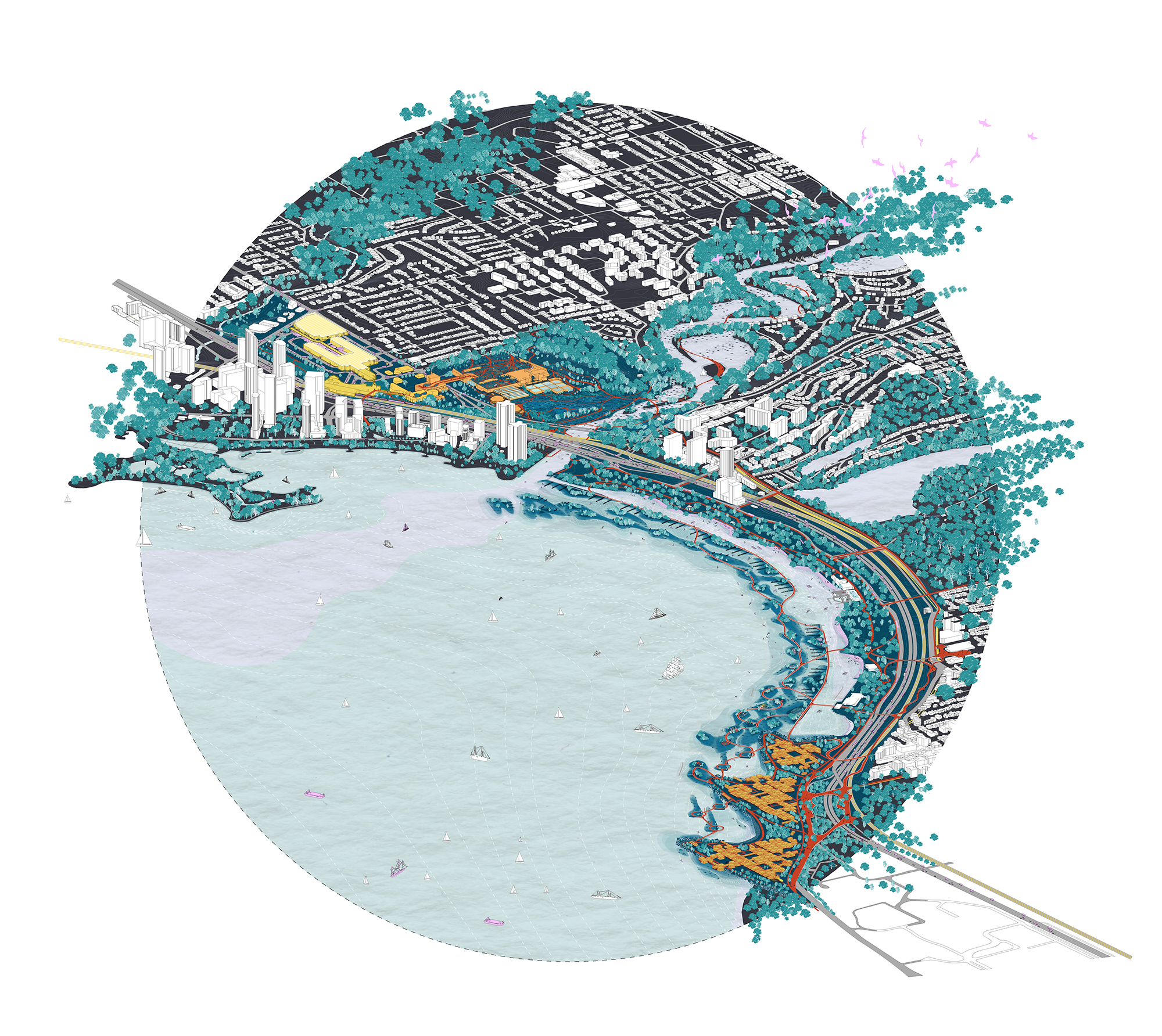
Stefan, Madison, Howard, and Bernardo write: "Within the Humber Bay district, various flows of energy and industry are seemingly unplanned. Watersheds, aging sewage networks, food distribution, income disparity, and wastewater treatment all converge within the Humber Bay, but flow separately from one another.
We developed a framework to engage in new opportunities for integrating programming, waste efficiencies, food distribution, and community engagement to foster a resilient and adaptive community.
Under the Humber proposed four major interventions following the principles of a metabolic landscape. This circular economy realizes the potential of energy flows, food, waste, water, and people in a closed-loop system by reimagining the interface between the Ontario Food Terminal, the Humber Bay Wastewater Treatment Plant, a series of filtration islands that create a new shoreline experience, a mixed-use community development built atop recycled construction fill, and an extensive circulation network that stitches these major systems seamlessly together."
(Instructors: Fadi Masoud and Megan Esponeko)
Dagmar Ivanenko, Gabriela Gallo, Temira Bruce
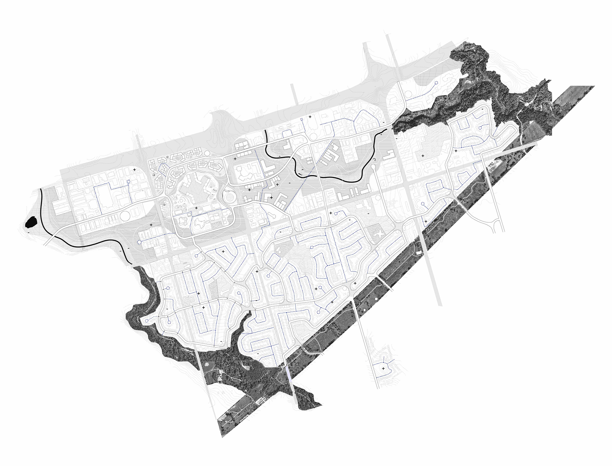
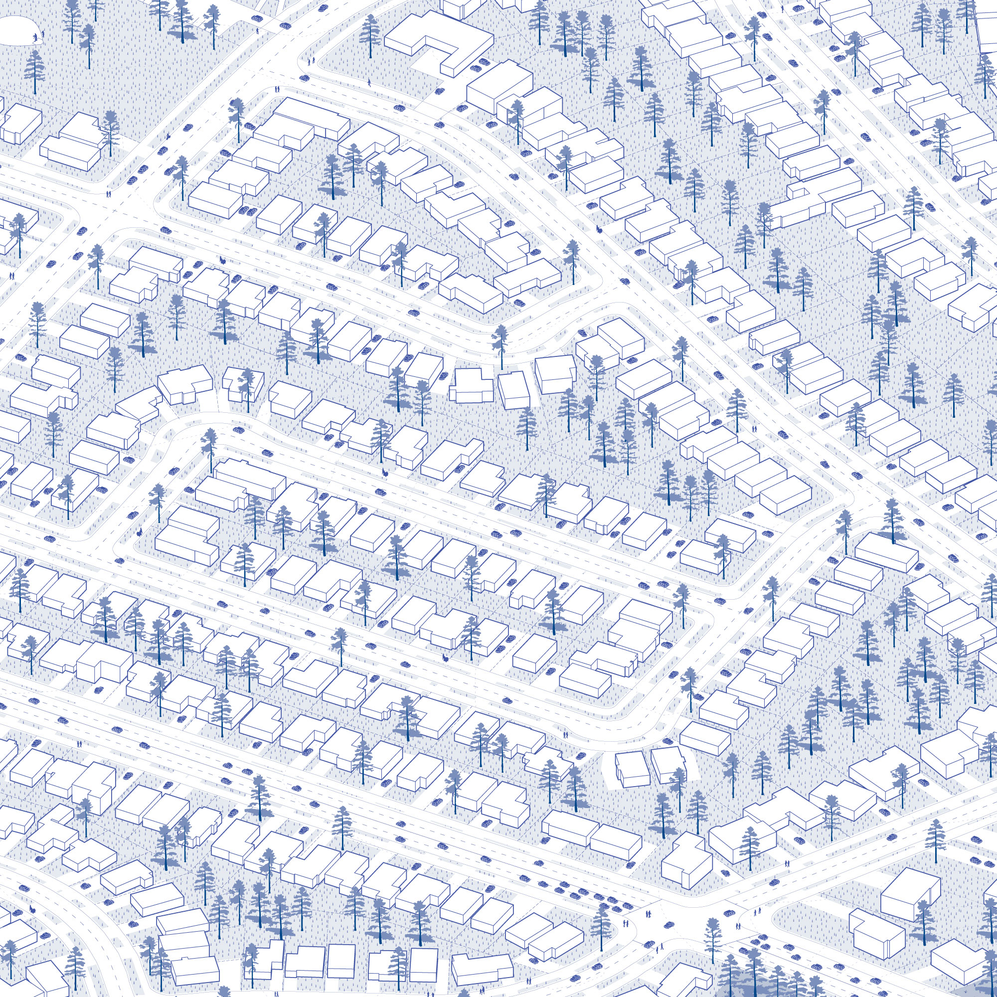
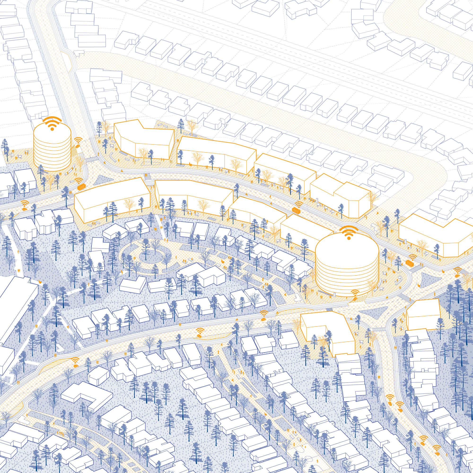
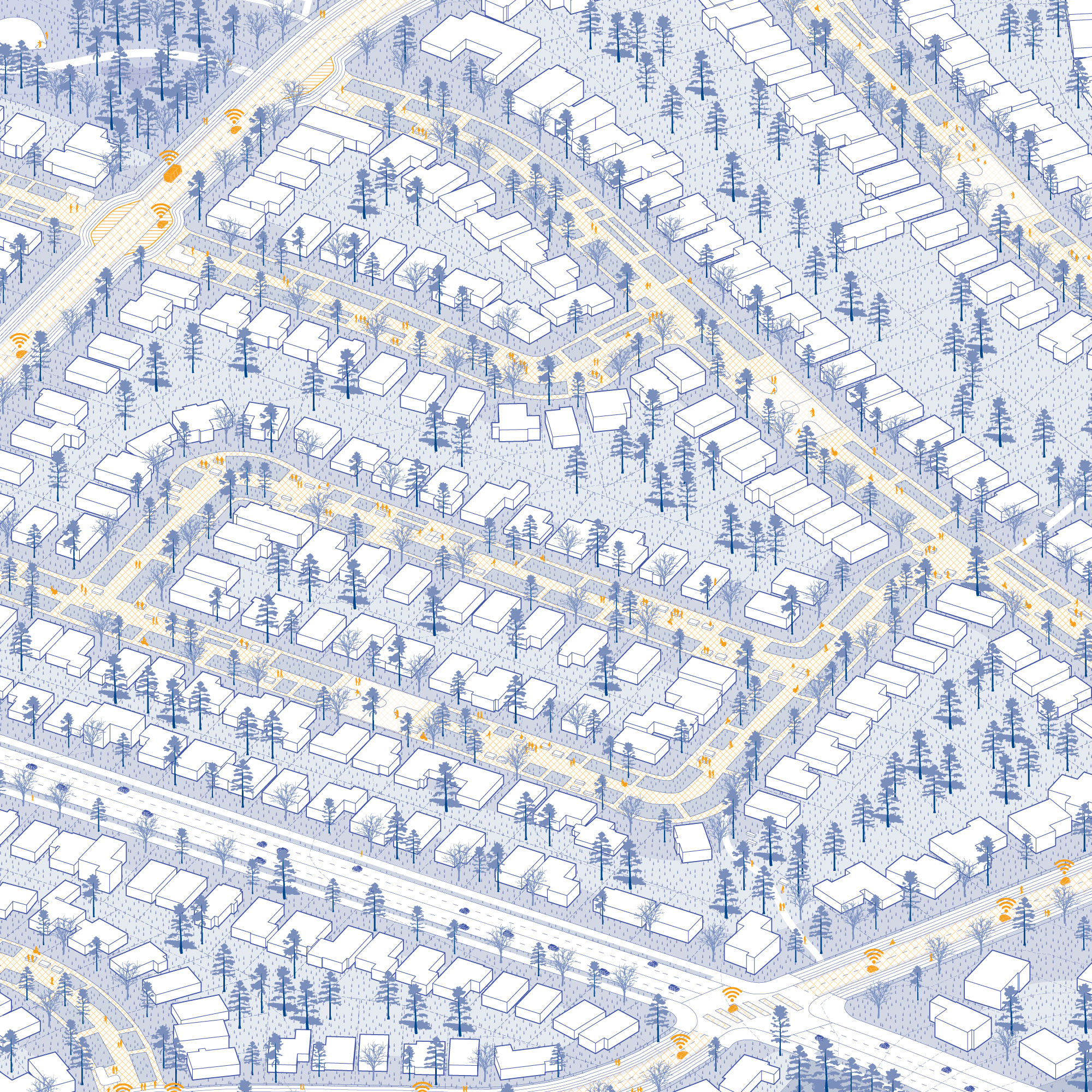
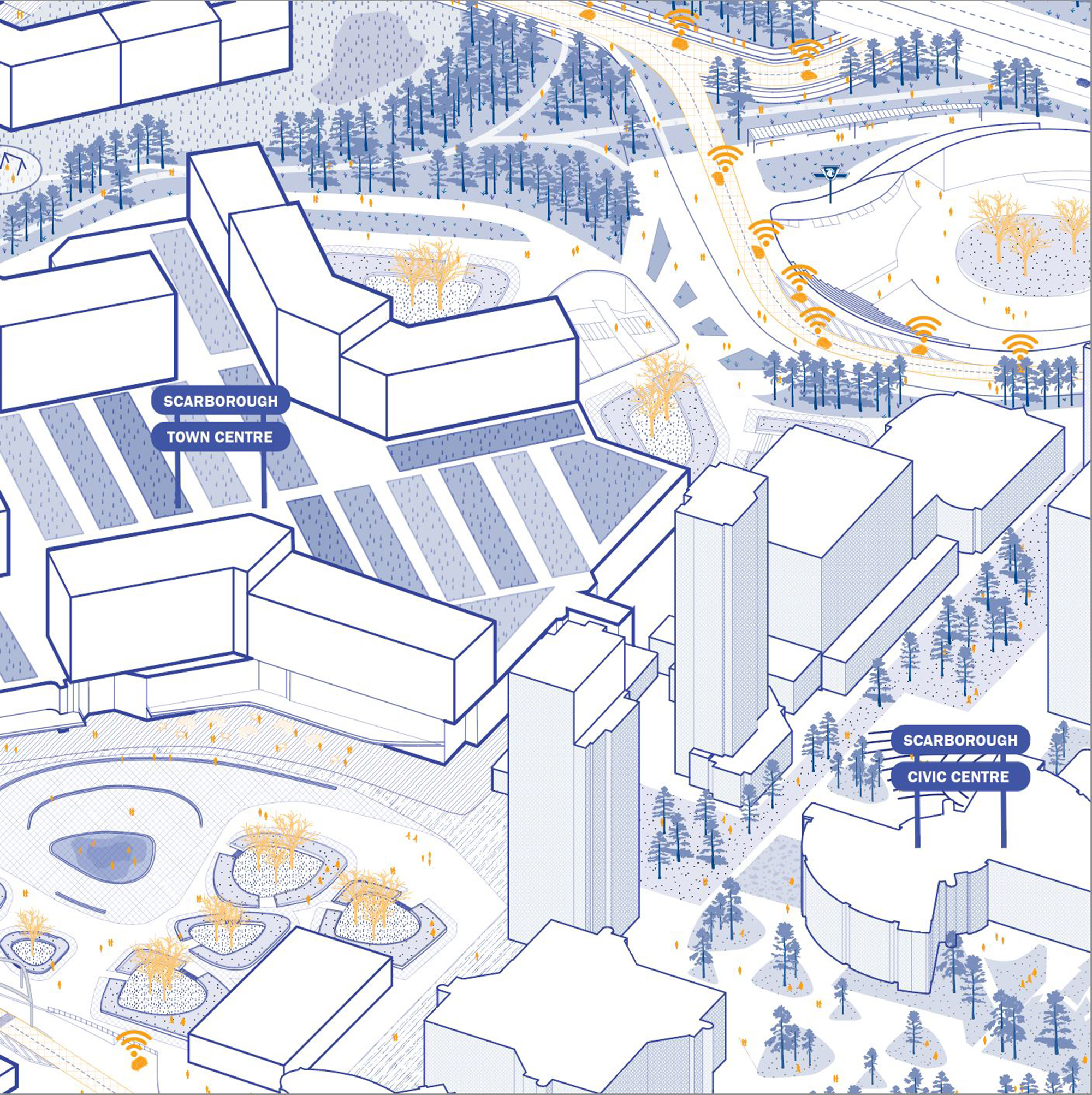
Dagmar, Gabriela, and Temira write: "Between Creeks is an in-depth examination of a landscape hugged by the branches of the Highland Creek in Scarborough, Toronto. The design action zone remains highly entrenched in the fabric laid out in the 1950s and 1960s, when single-family living was at peak desire, leaving the site in a strange middle ground: not quite suburban, not quite city, but certainly not the forested or rural agricultural land it once was. Adapting the landscape to respond to the looming climate crisis as well as to support equitable access to public space and green space was at the heart of the proposed transformation. An introduction of an autonomous vehicle network supports this intent by creating a new transit hierarchy, enabling the removal of redundant residential roads and parking lots."
(Instructors: Fadi Masoud and Megan Esponeko)
Ophelia Kin-Tung Lau, Tanner Field, and Houda Alkhatib
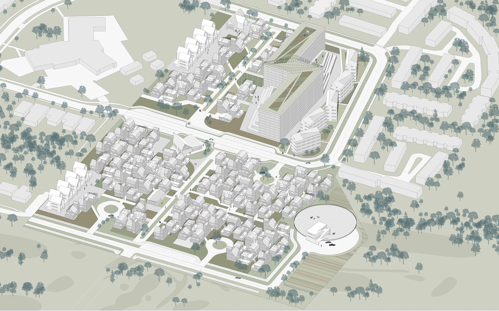
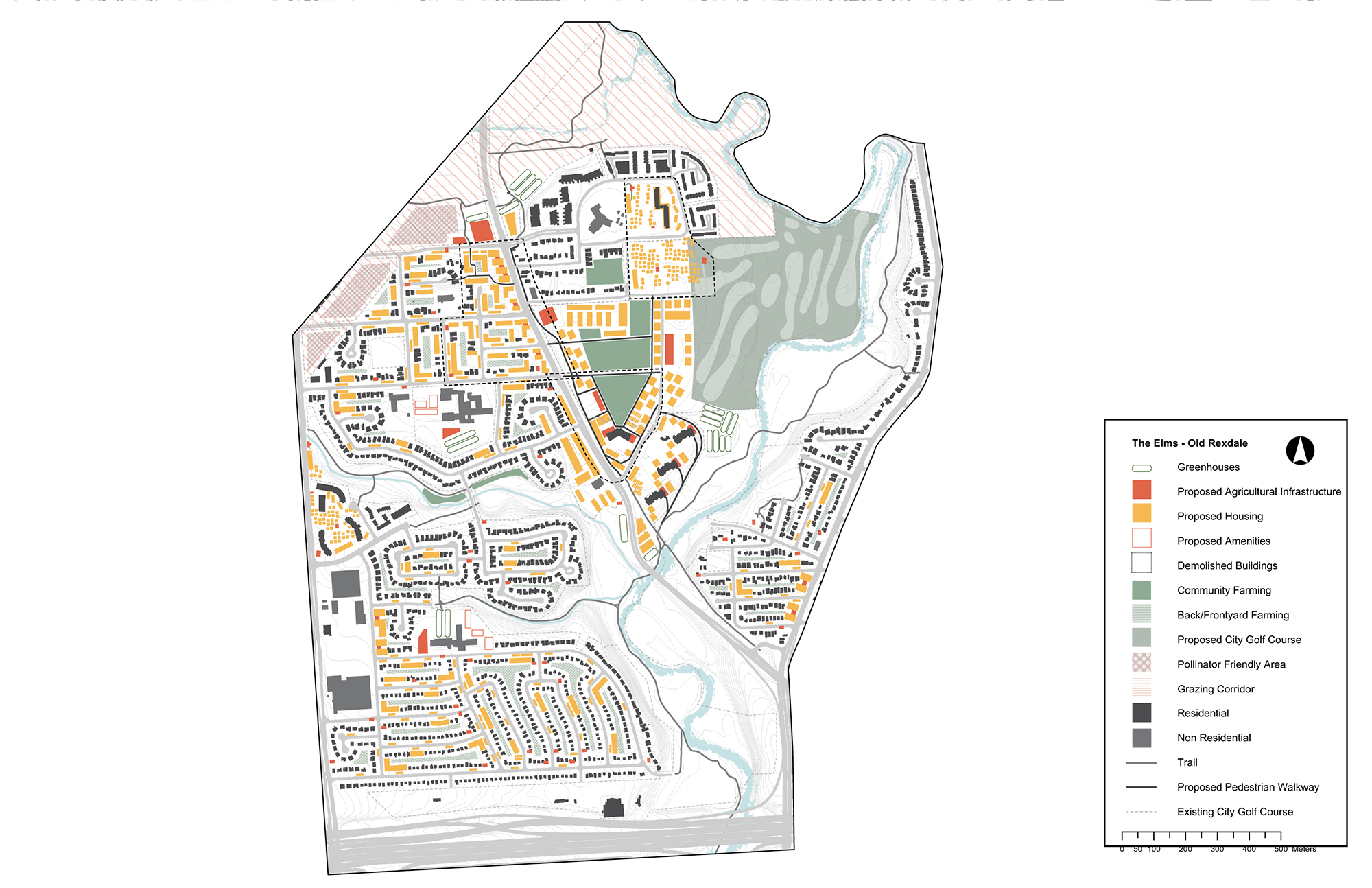
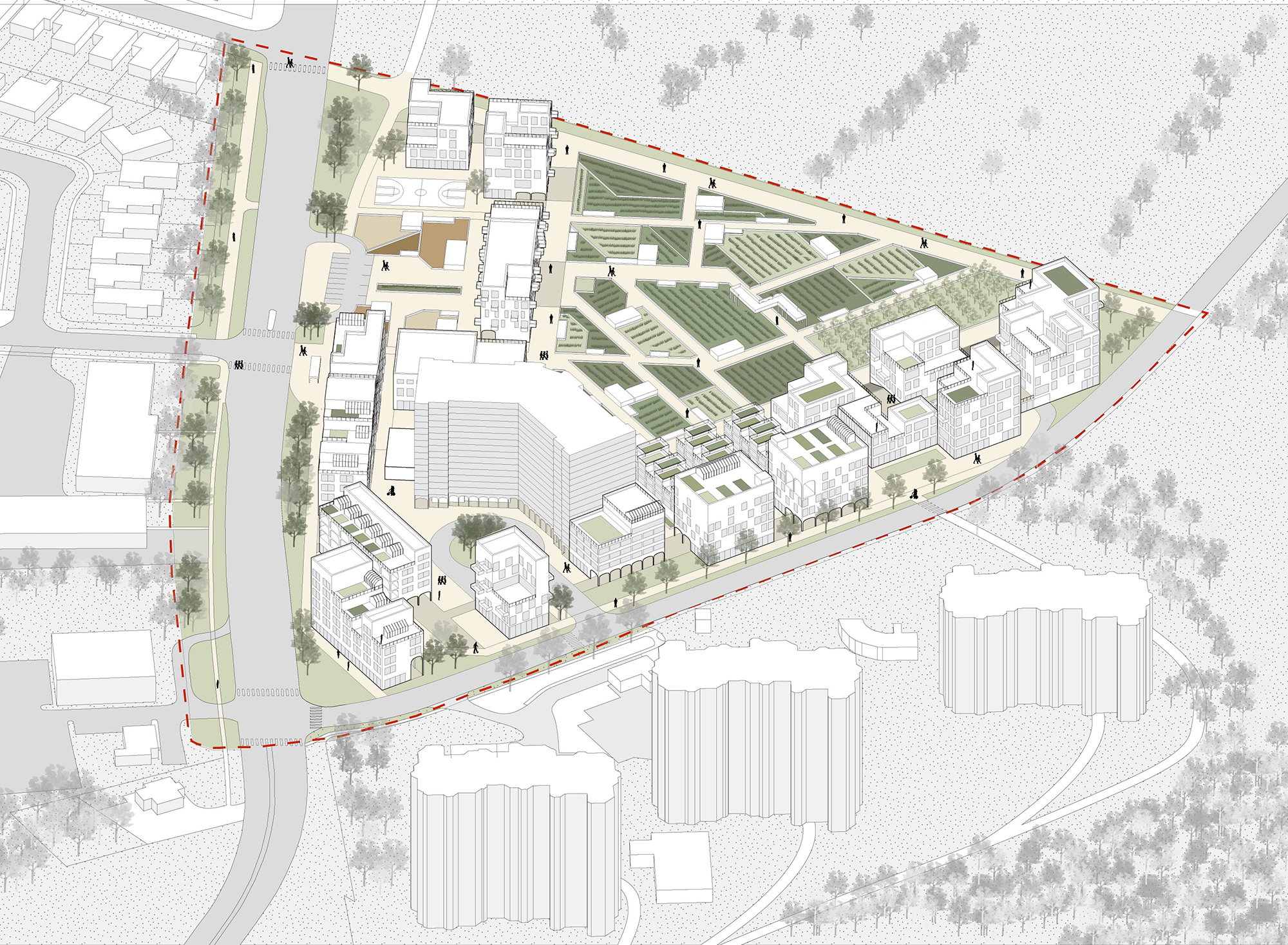
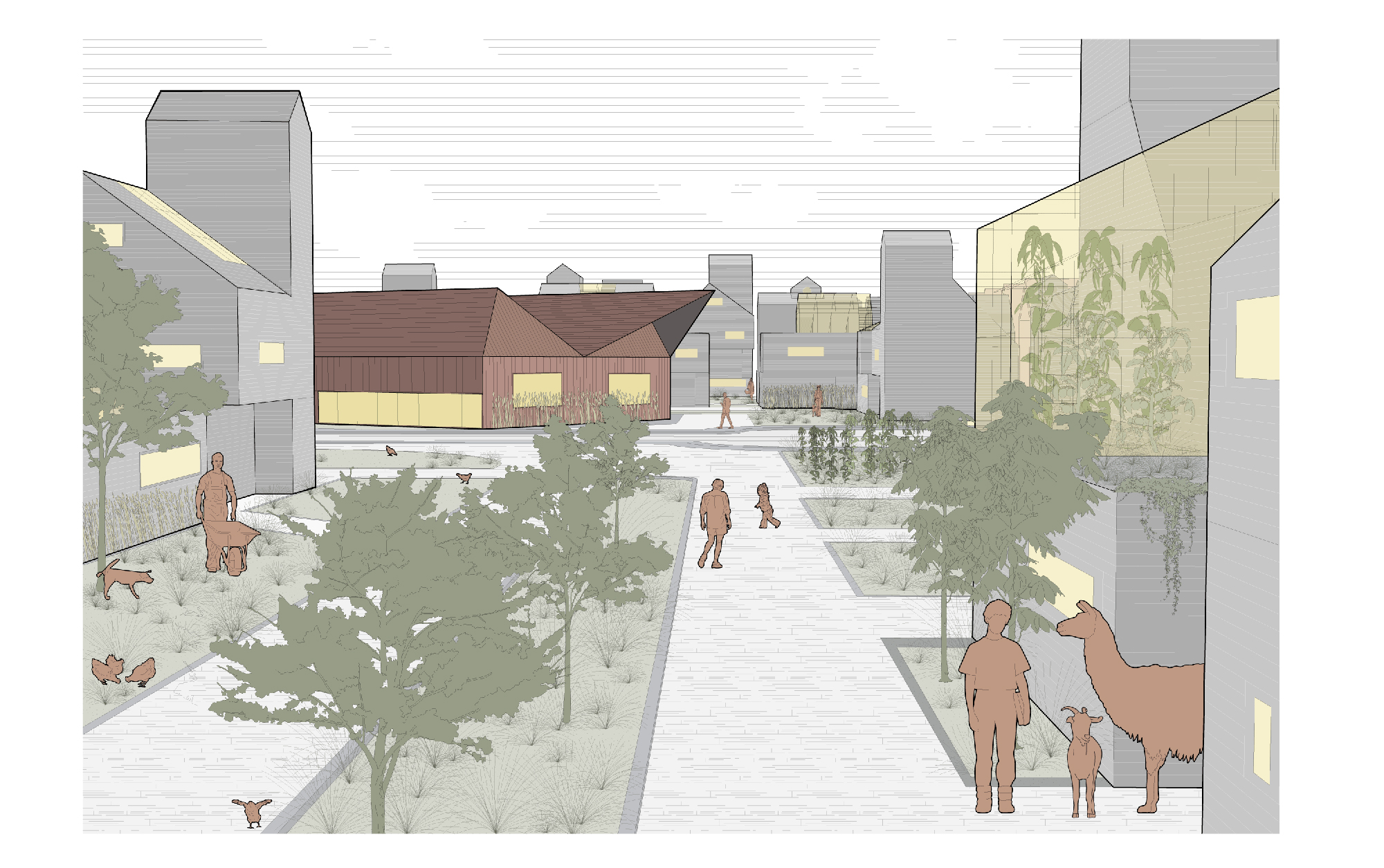
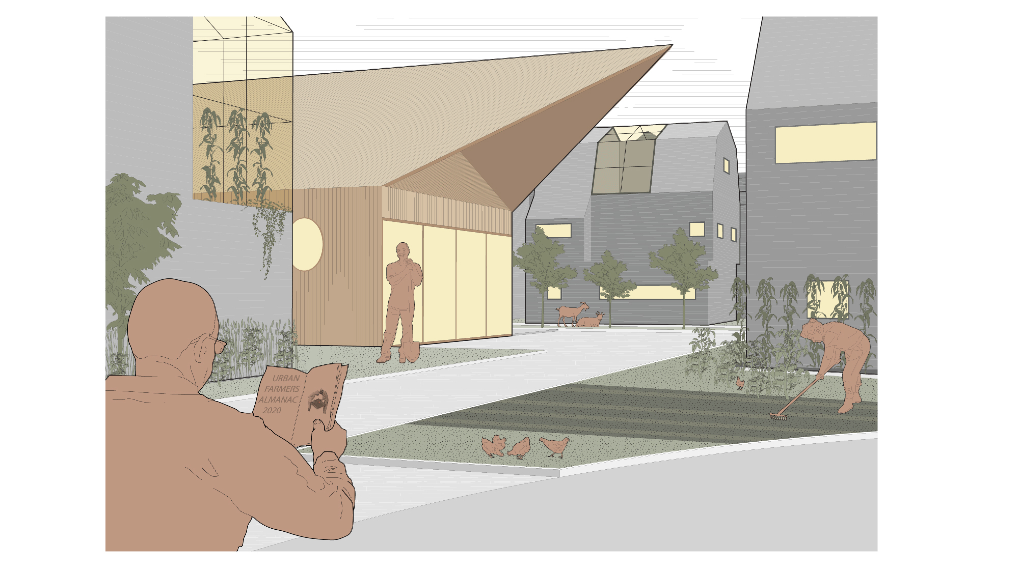
Ophelia, Tanner, and Houda write: "Growth Oriented Local Food (GOLF) addresses food security in Toronto's inner suburbs by reimagining one of the city's underutilized golf courses as a commons for food production. The project proposes developing a network of infrastructure in order to spatialize existing food policy in Toronto and serve as a catalyst for neighbourhood renewal.
Our proposals address densification of the suburban fabric through the integration of agriculture with housing at various scales, from postwar detached single-family homes to cooperative townhouses and aging towers-in-the-park. Borrowing from rural typologies and spatial concepts, we aim to bring a degree of self-sufficiency to the suburbs by building on the existing practices of backyard food production."
(Instructor: Mason White)
Ross Beardsley Wood, Alexia Dumas-Malouf, Jacqueline Hampshire, and Kate Vanbakel
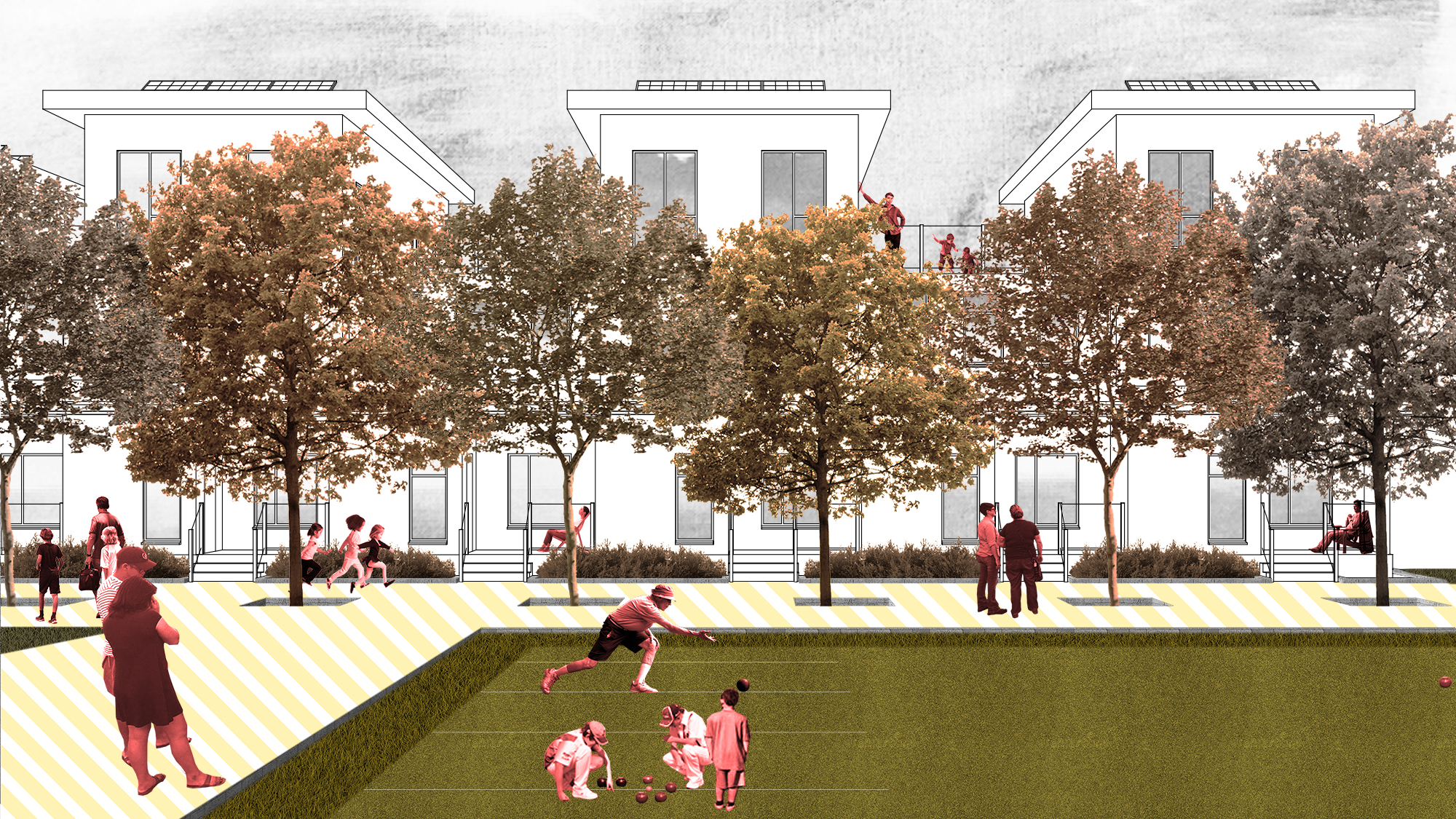
Ross, Alexia, Jacqueline, and Kate write: "Flemo is a proposal for the neighbourhood of Flemingdon Park that builds on the strengths of the community to develop a service-driven urban intervention. Flemingdon Park is a socio-geographic urban peninsula with physical boundaries defined by the Don Valley ravine network and large infrastructure projects. Car-centric development organized by super-blocks has resulted in a ground condition dominated by privatized open spaces and parking lots that are underutilized and do not serve the transit and pedestrian focused population. Our proposal is to use these urban leftovers to stitch together existing community assets, to generate new productive adjacencies and to establish an internal hierarchy of mobility. Processes of easement, de-privatization and the introduction of new green spaces will be of particular benefit to the youth population who participate in urban space through occupation rather than ownership. This strategy looks inward, reinforcing the existing community to ensure that it is not compromised by imminent future development."
(Instructor: Monica Hutton)
Lucy Yang, Priyanka Shah, Ashlin Lithgow, and Jeff Jang
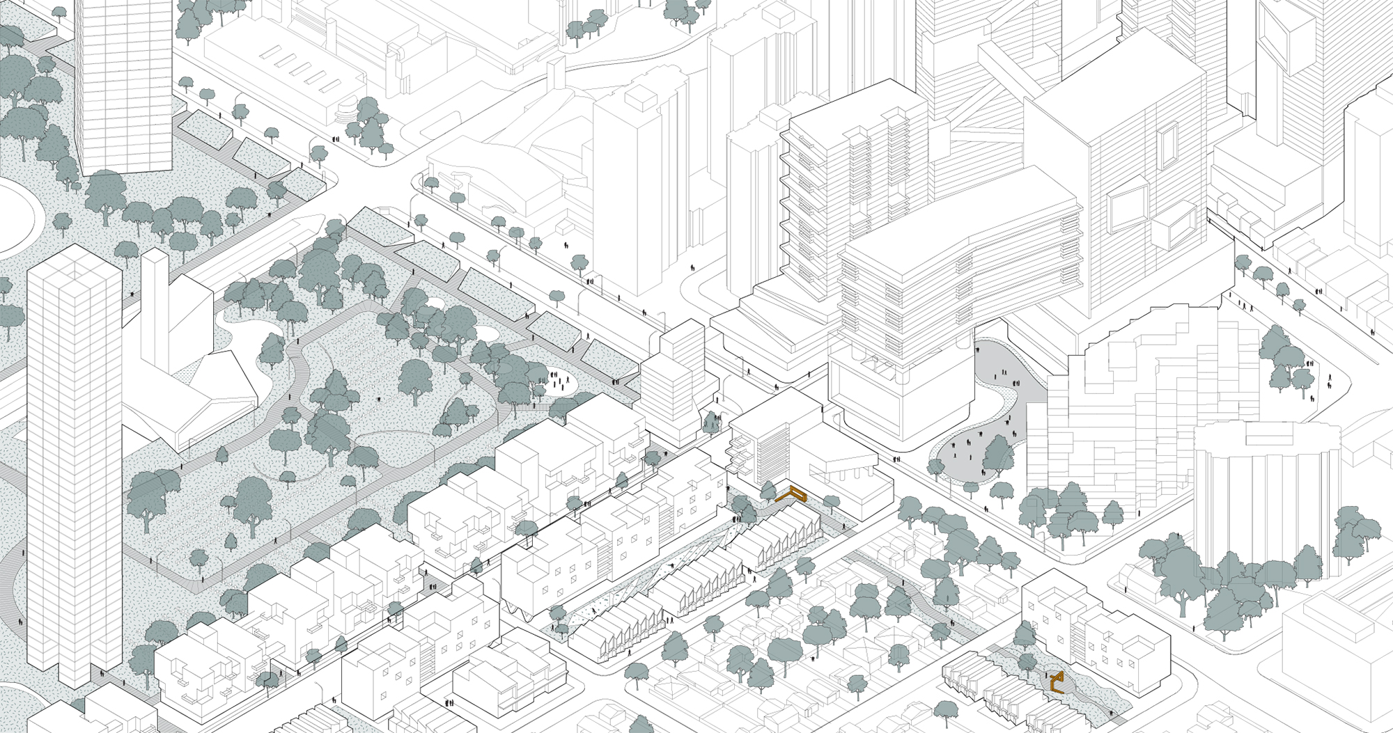
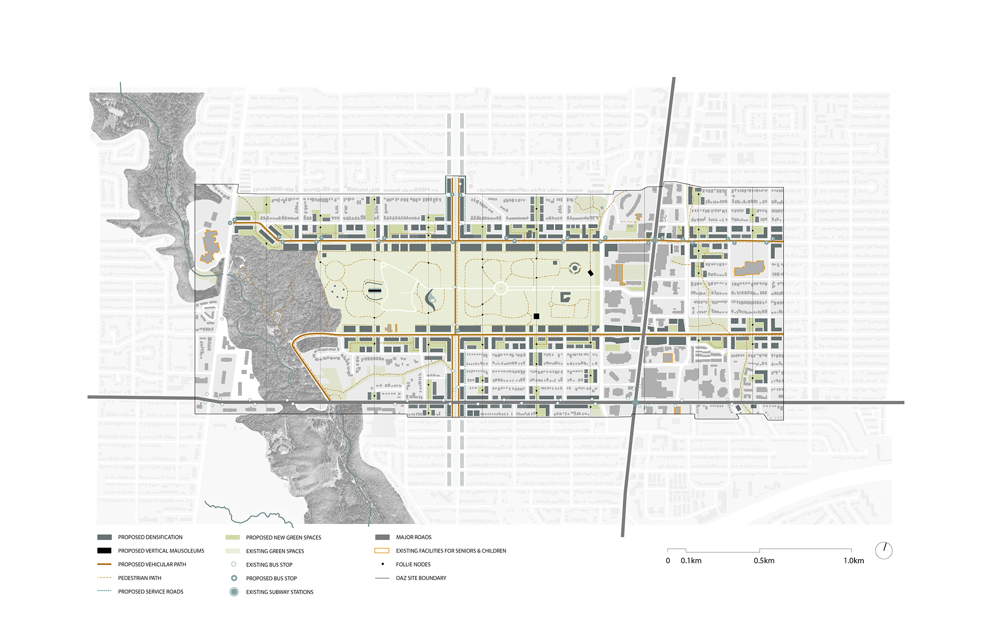
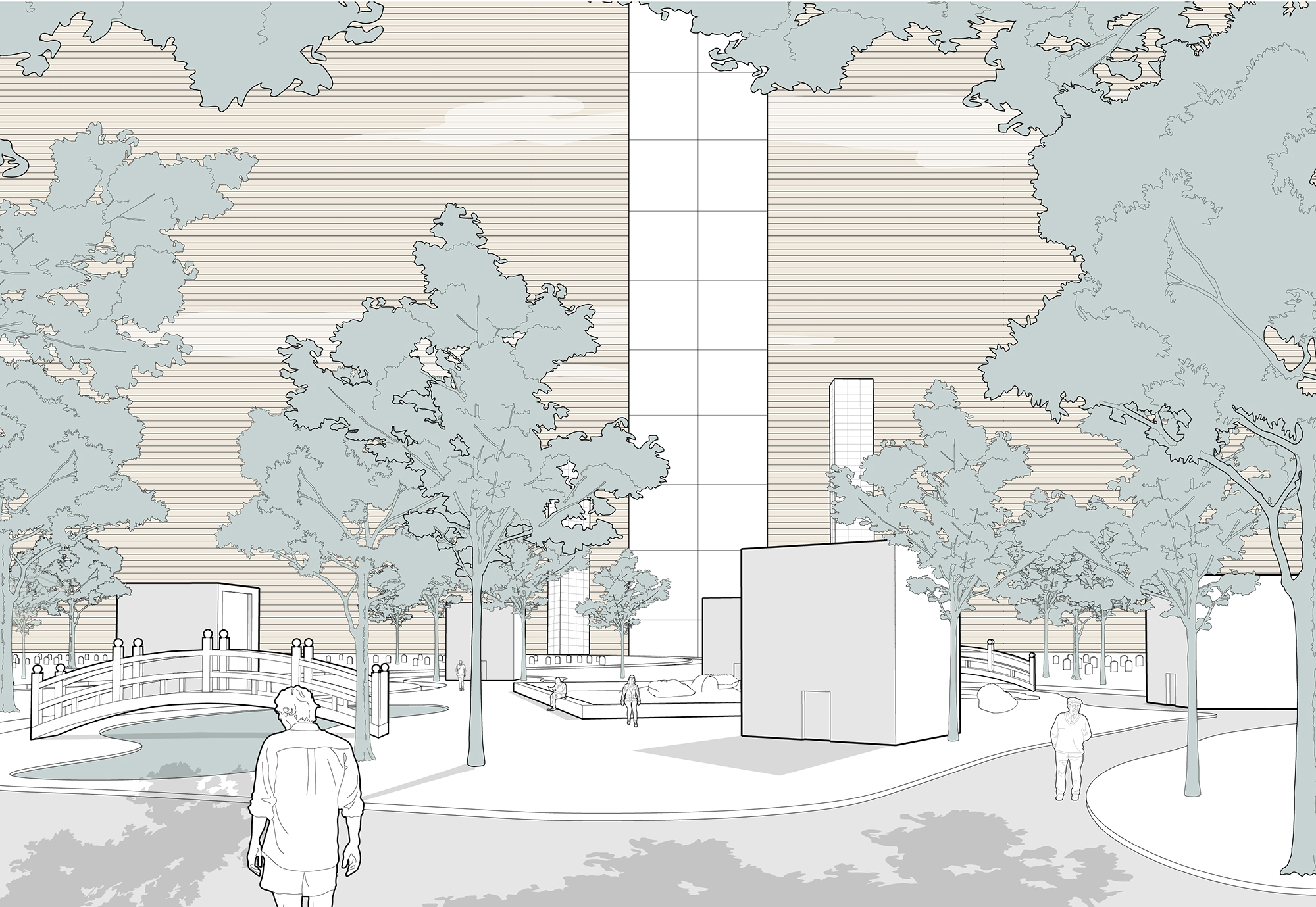
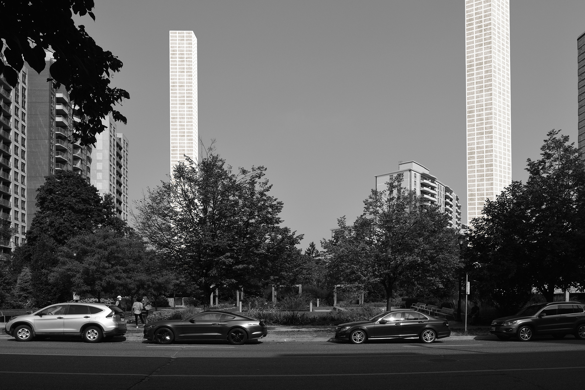
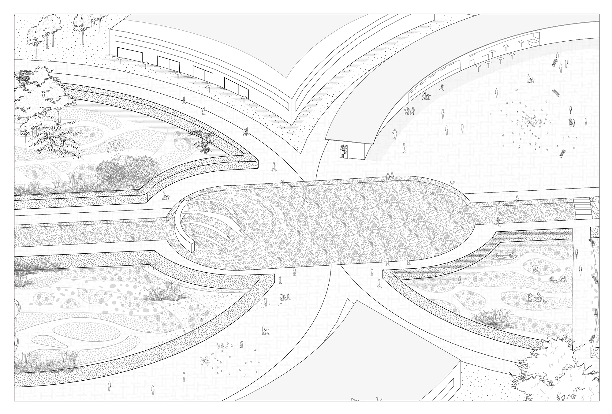
Lucy, Priyanka, Ashlin, and Jeff write: "Toronto’s cemeteries are valuable pockets of open space in our urban fabric. This project addresses the increasing pressures of densification on urban open space, where the value of airspace cannot be ignored. What is the 21st century cemetery? We envision the modern cemetery as a place for celebrating the cyclical nature of life and death, and encouraging health and wellness in life as well as dignity in death. We propose densifying for the dead by implementing new vertical cemeteries that densify alongside our growing cities. These vertical mausoleums become visual markers of death throughout the city and allow for the normalizing of the concept of death, ultimately becoming monuments to honour the deceased."
(Instructor: Dina Sarhane)
Sahar Pashazanousi, Elmer Lyu, Allan Shi, and Meichun Zhu
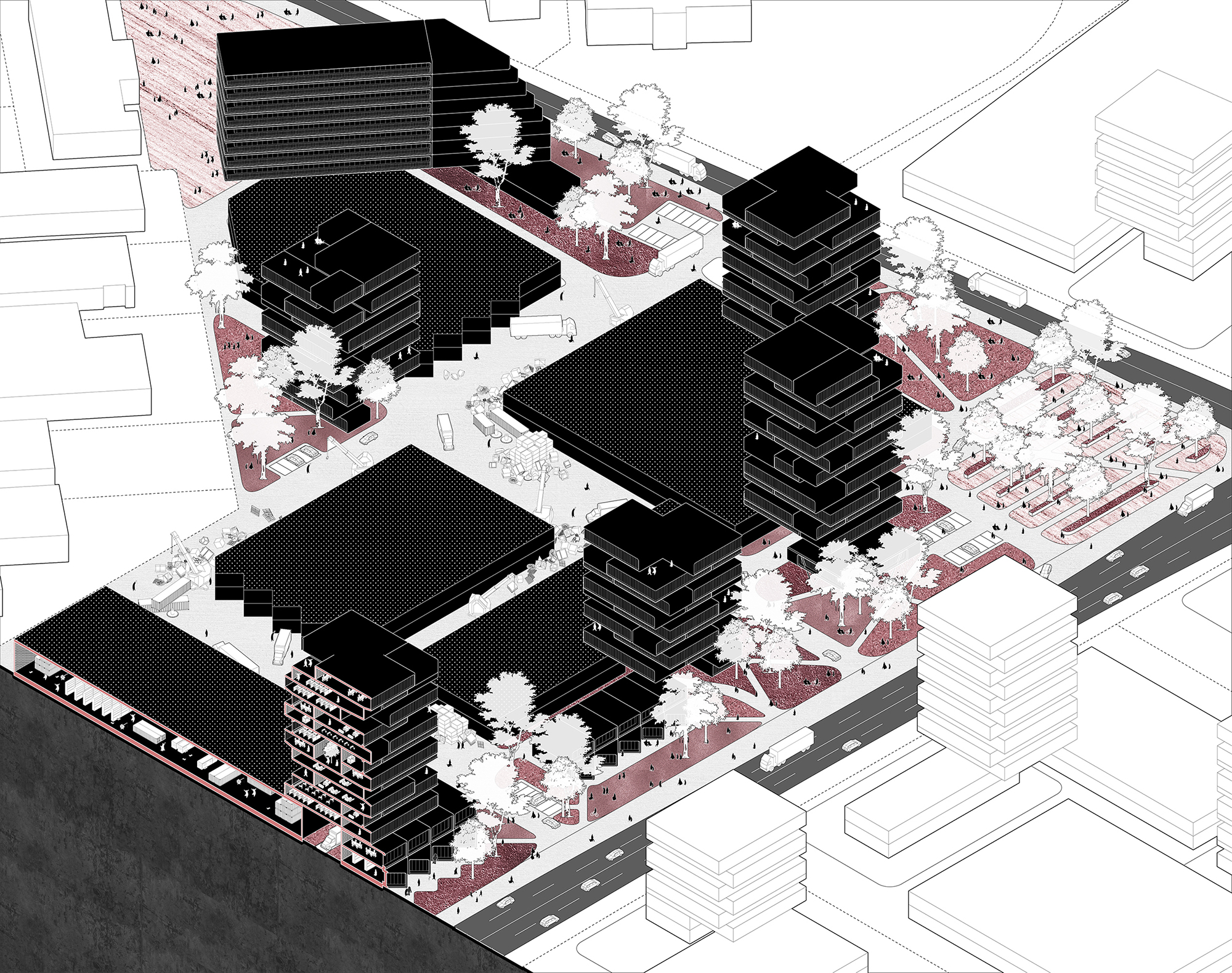
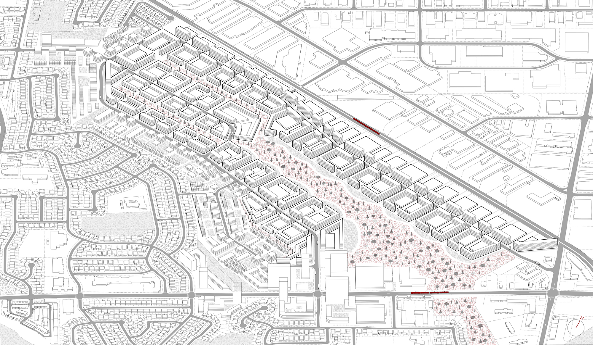
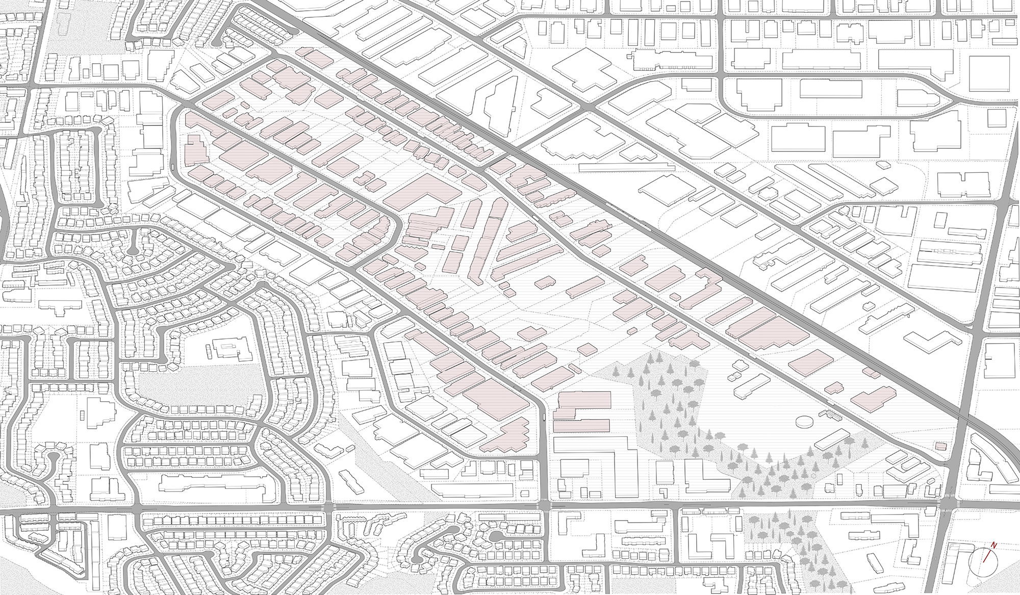
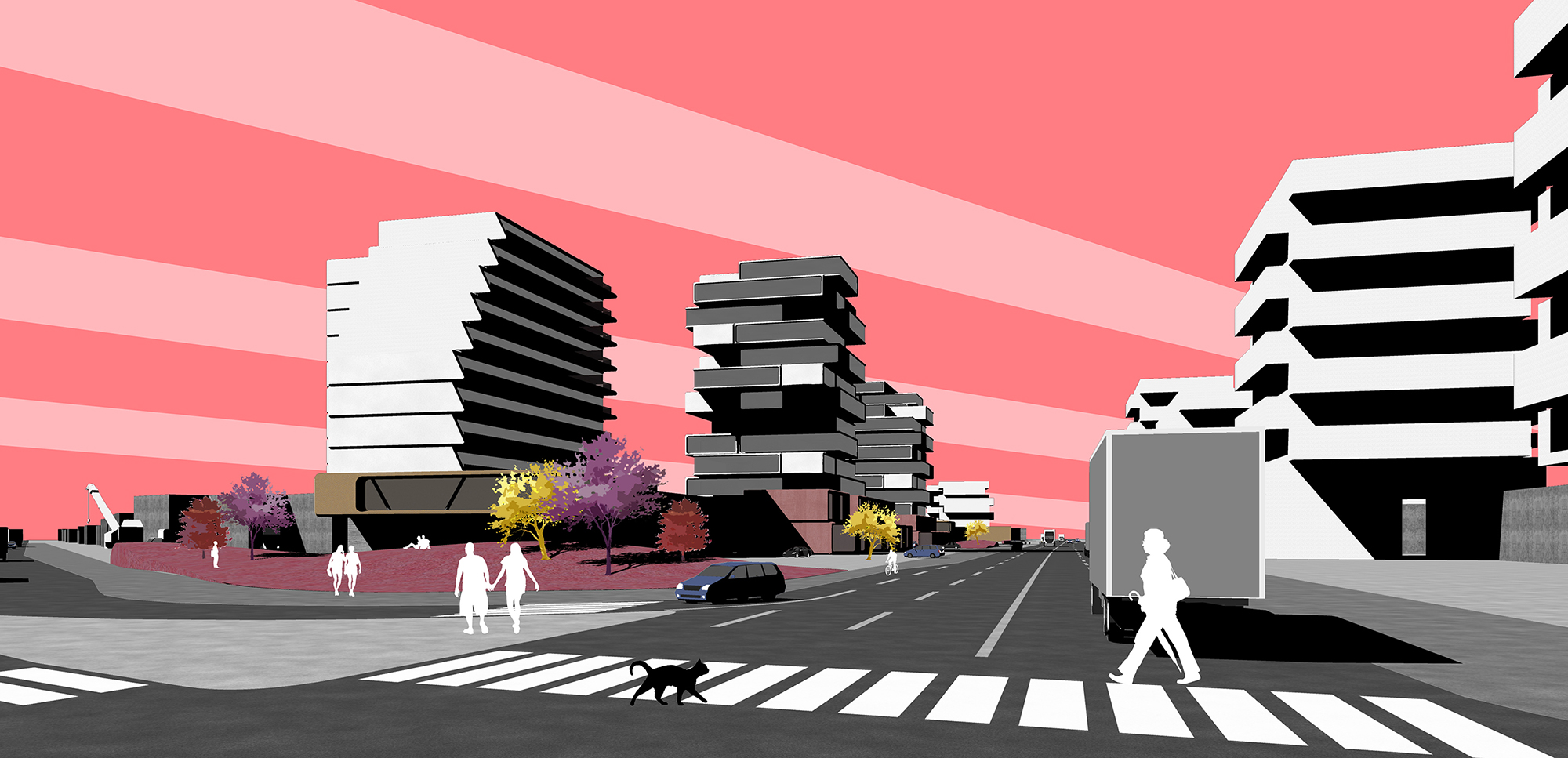
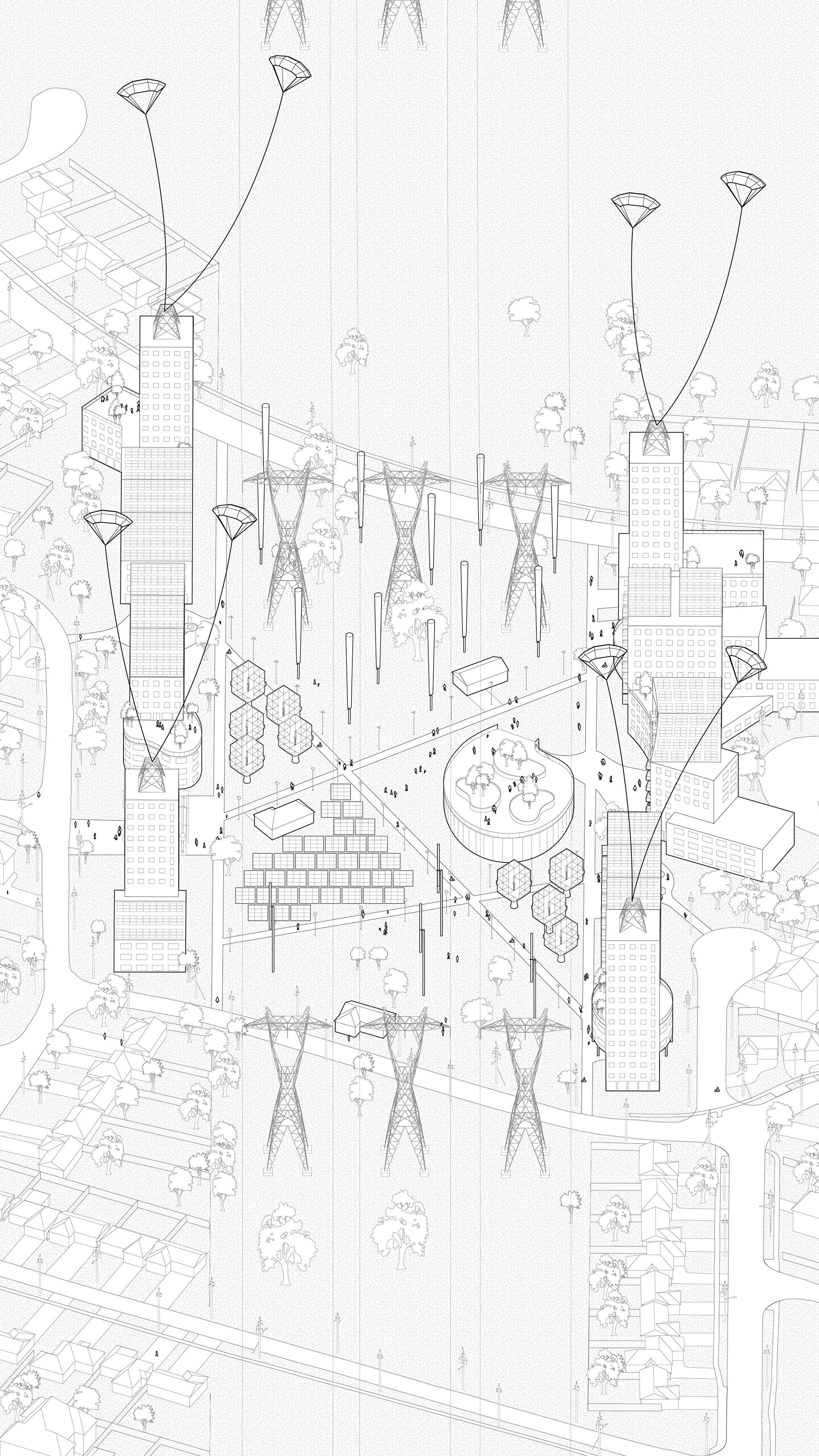
Sahar, Elmer, Allan, and Meichun write: "Prompted by transit investment projects, employment lands are often ideal sites for the new development of housing and retail. However, the city also struggles to retain space for all kinds of industrial needs. This paradox prompted us to use this project as a way to explore the relationship between new residential development and existing employment lands. As a group, the research we did together on Emery Village revealed one of the most distinctive features of its land condition: having an extremely clear gap that divides employment land from residential neighbourhoods. It is because of those unique land conditions that we made Emery Village our design action zone. Our intervention includes proposing a last-mile shuttle system, extending the existing ravine system to cover more industrial area, and a new waterway to deal with flooding."
(Instructor: Michael Piper)
Lizeth Natalia Enriquez Goyes, Jenna Gauder, Clara Zaida
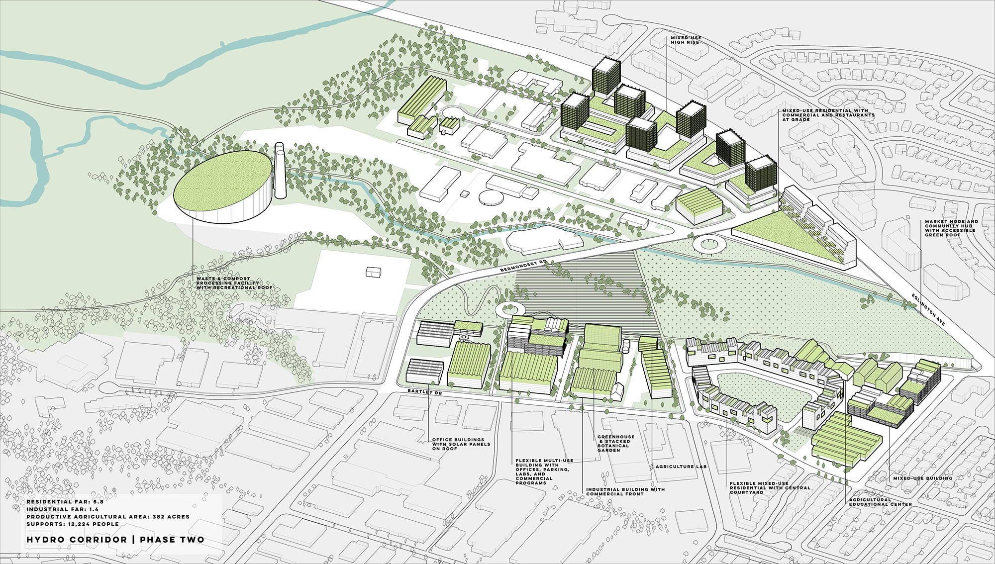
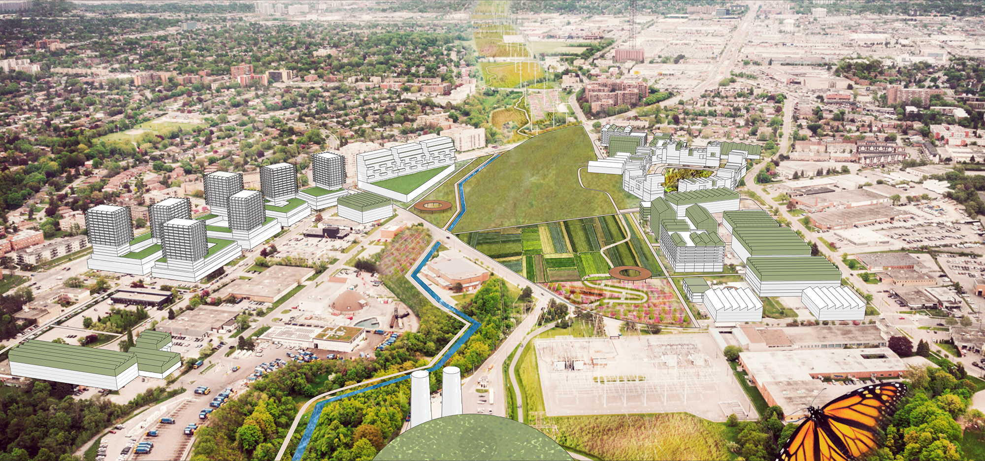
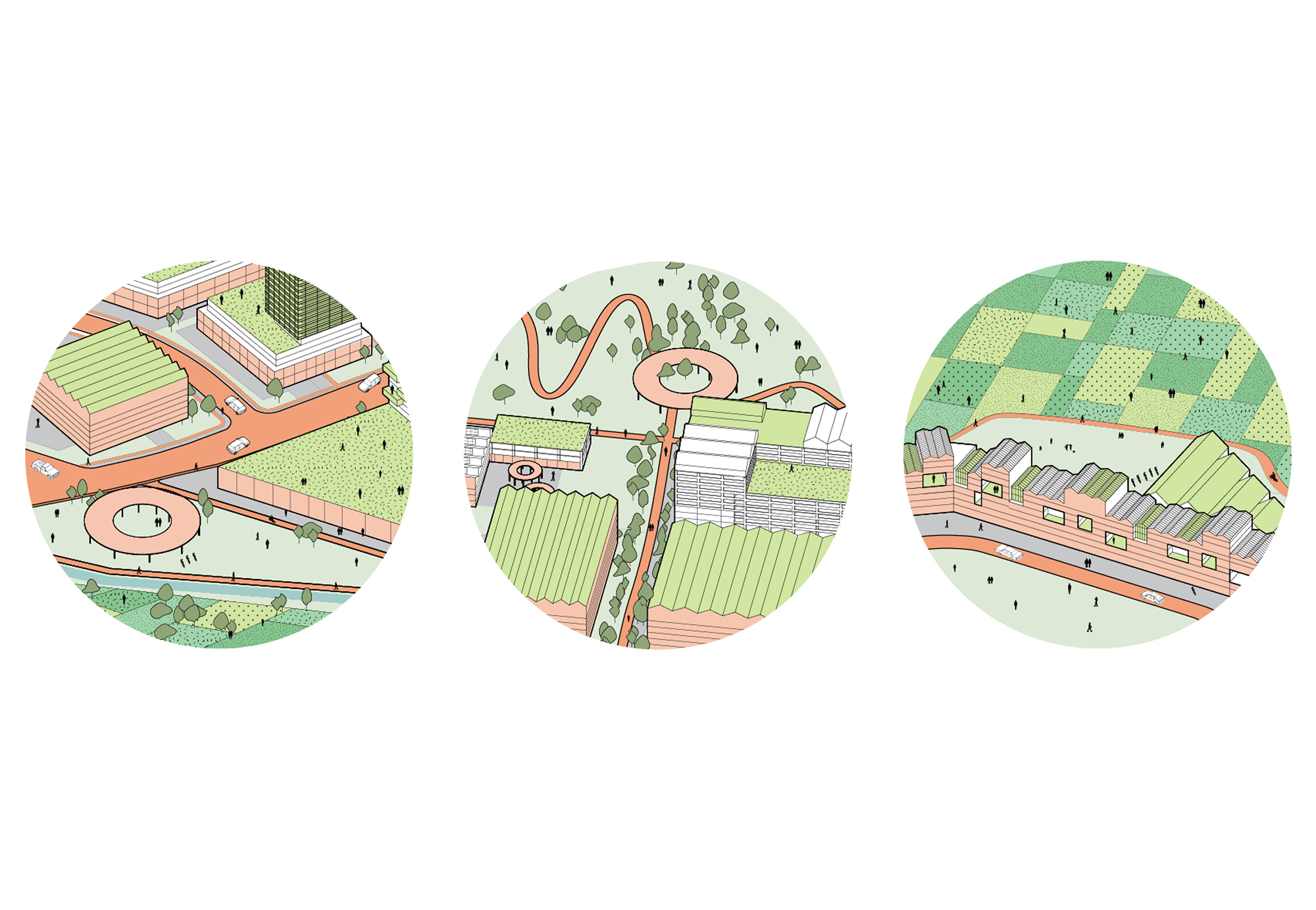
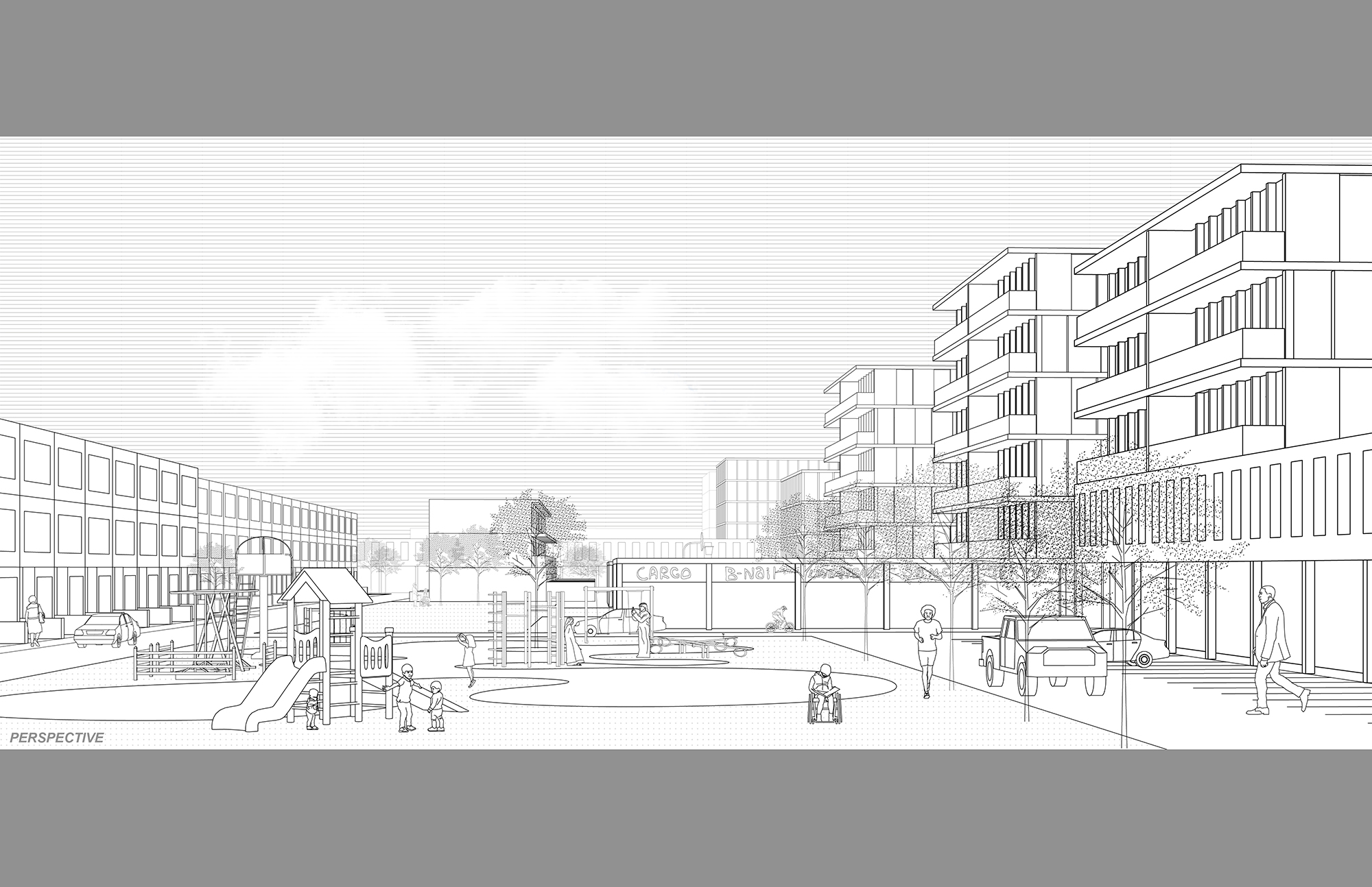
Lizeth, Jenna, and Clara write: "From the Greek words sitos, meaning food, and utopia, meaning good place or no place, 'Sitopia' translates to food-place. Bermondsey Sitopia recognizes the dynamic relationship between food and place through urban agriculture — how we produce it, access it, and consume it. Bermondsey is a diminishing core employment area wedged between the Don Valley and a nearby hydro corridor, experiencing poor access to fresh food. Sitopia aims to connect food producers with food consumers by taking advantage of the vastly unproductive open space networks found within urban employment lands. With the involvement of industries, retailers, and educational and community centres, industrial areas like Bermondsey can serve as a framework for turning no place into a food-place."
(Instructor: Roberto Damiani)
Erik Roberson, Yoyo Tang, and Zakary Jacobi
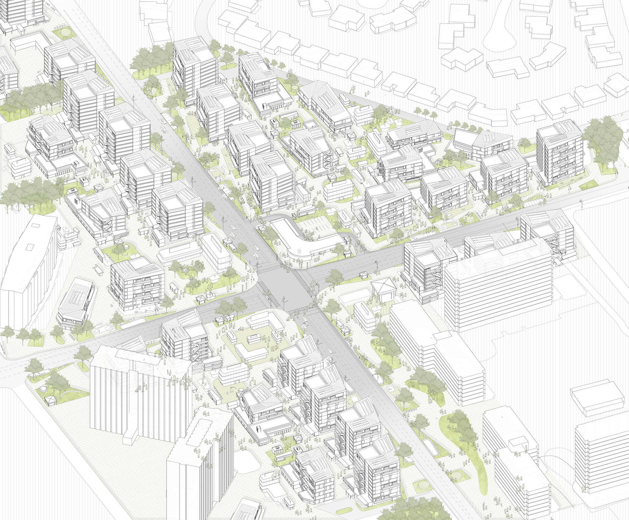
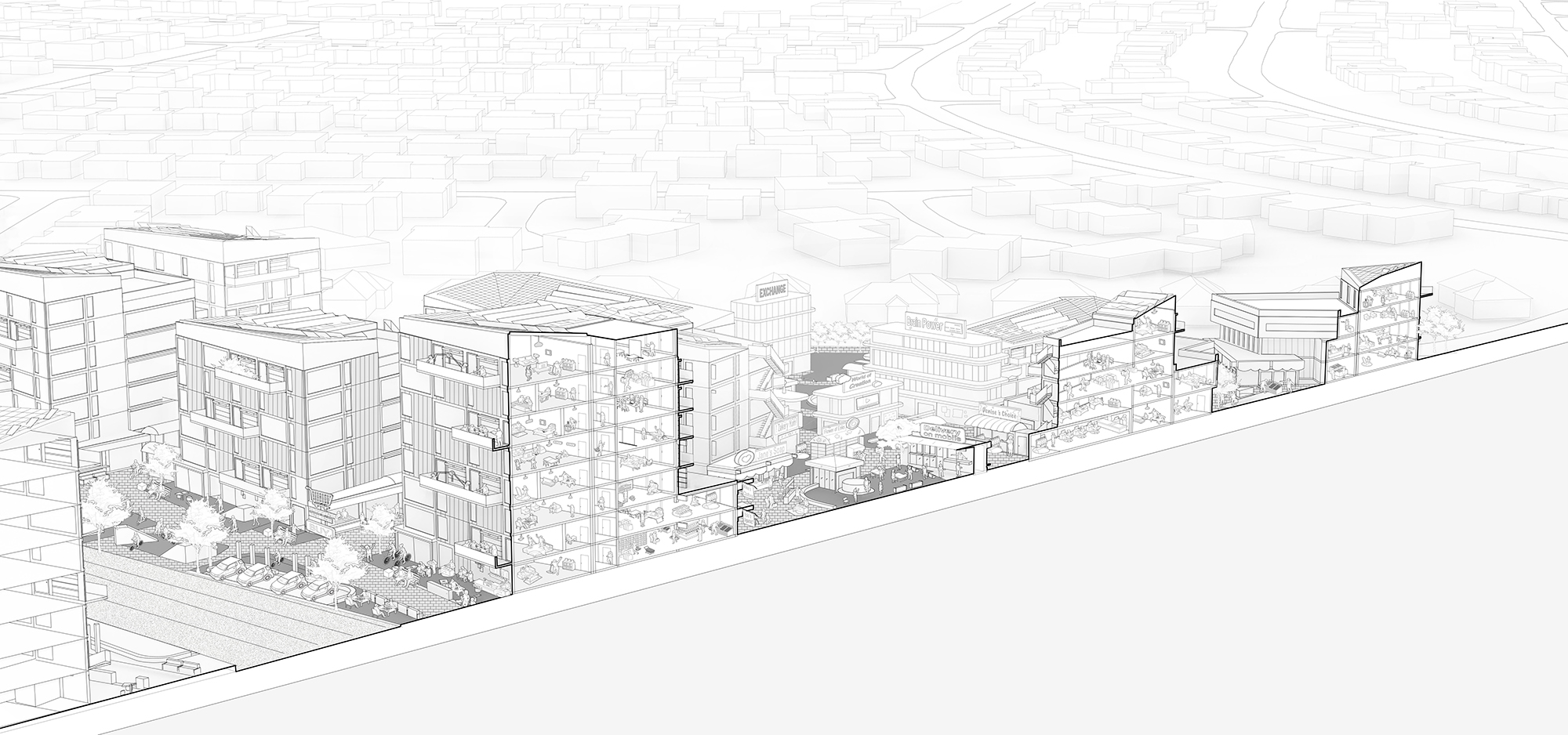
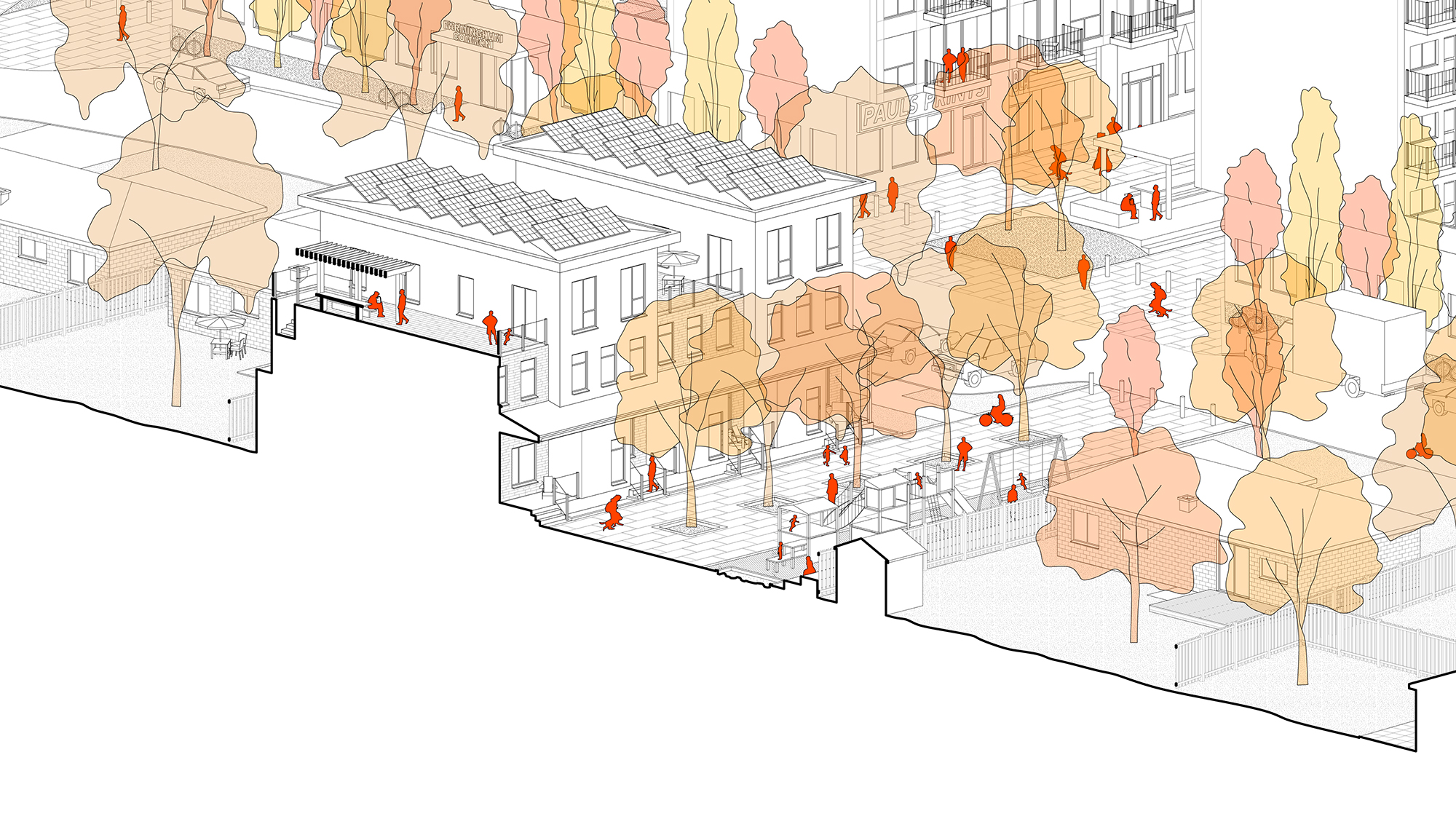
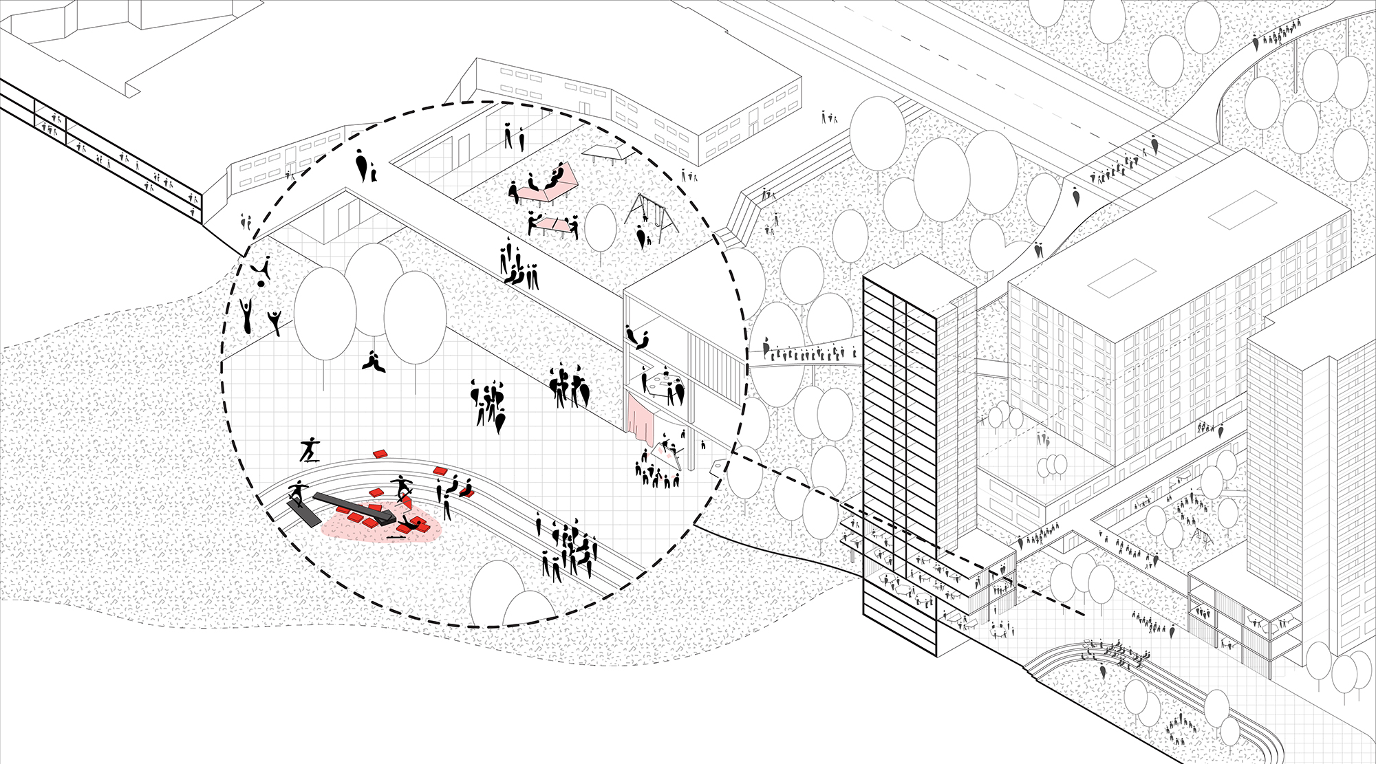
Erik, Yoyo, and Zakary write: "Power and Place is a critical analysis of policy-based decisions that have been made over the last half century that have resulted in a dramatic increase in levels of inequality within Toronto's Yellowbelt regions. The project looks to challenge typical approaches to tackling inequality, which look primarily at concentrations of poverty as sites of intervention. Power and Place proposes that inequality is a multifaceted issue: enclaves of wealth are equally as problematic as concentrations of poverty in terms of inequality and should be thought of as spaces of intervention towards tackling these issues as well. The proposal works to create spaces that redistribute power and lower inequality by leveraging the social capital that communities of wealth possess. This is done through the refronting of communities onto a new public realm that is programmed to draw in community members, looking to both support new mixed income communities and provide shared assets for existing residents."
(Instructor: Mason White)
Haiqa Nisar, Dipra Shetty, and Evan Webber
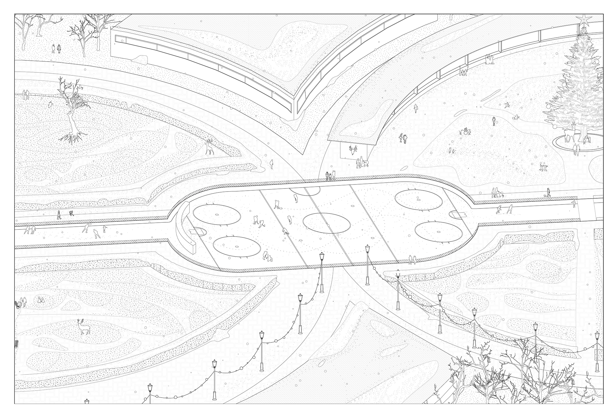
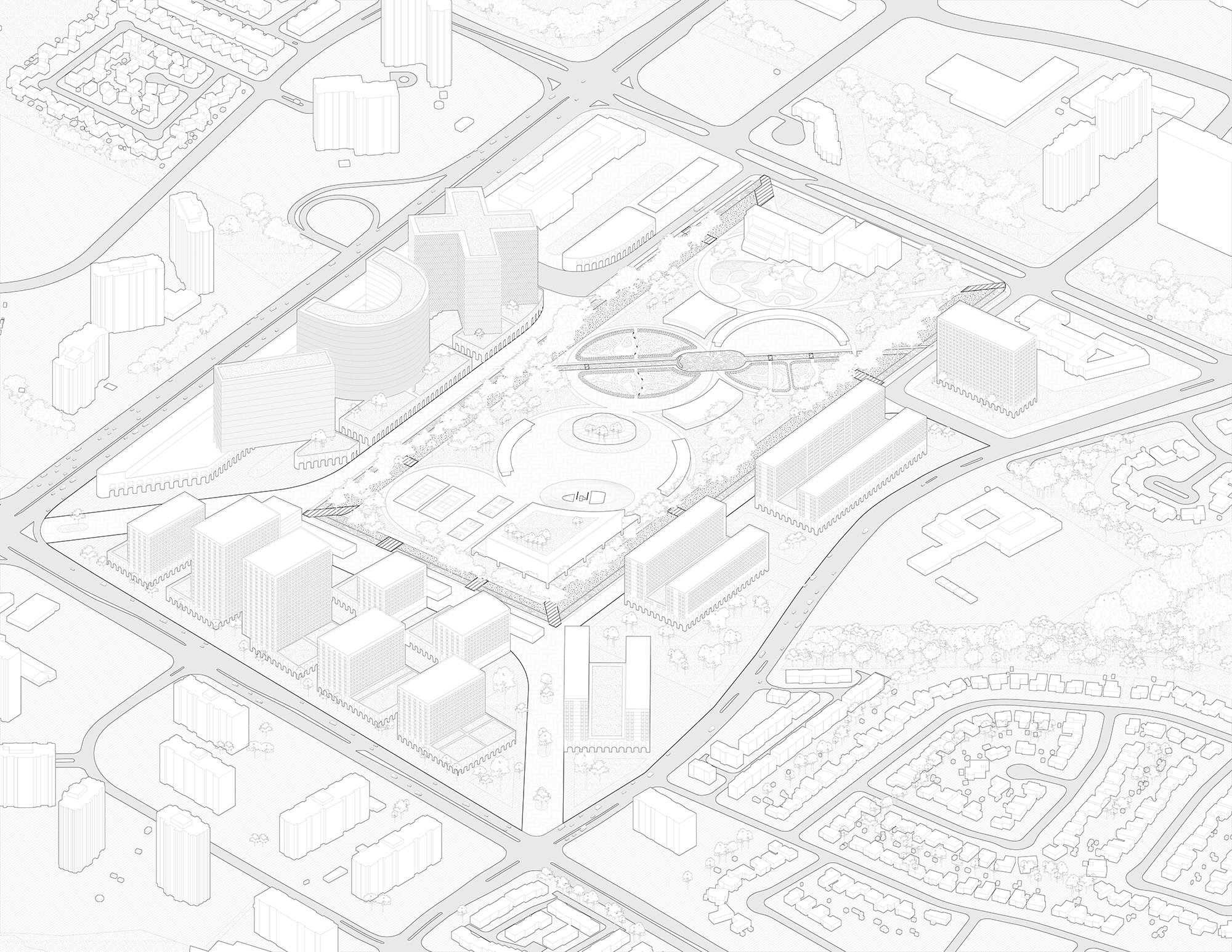
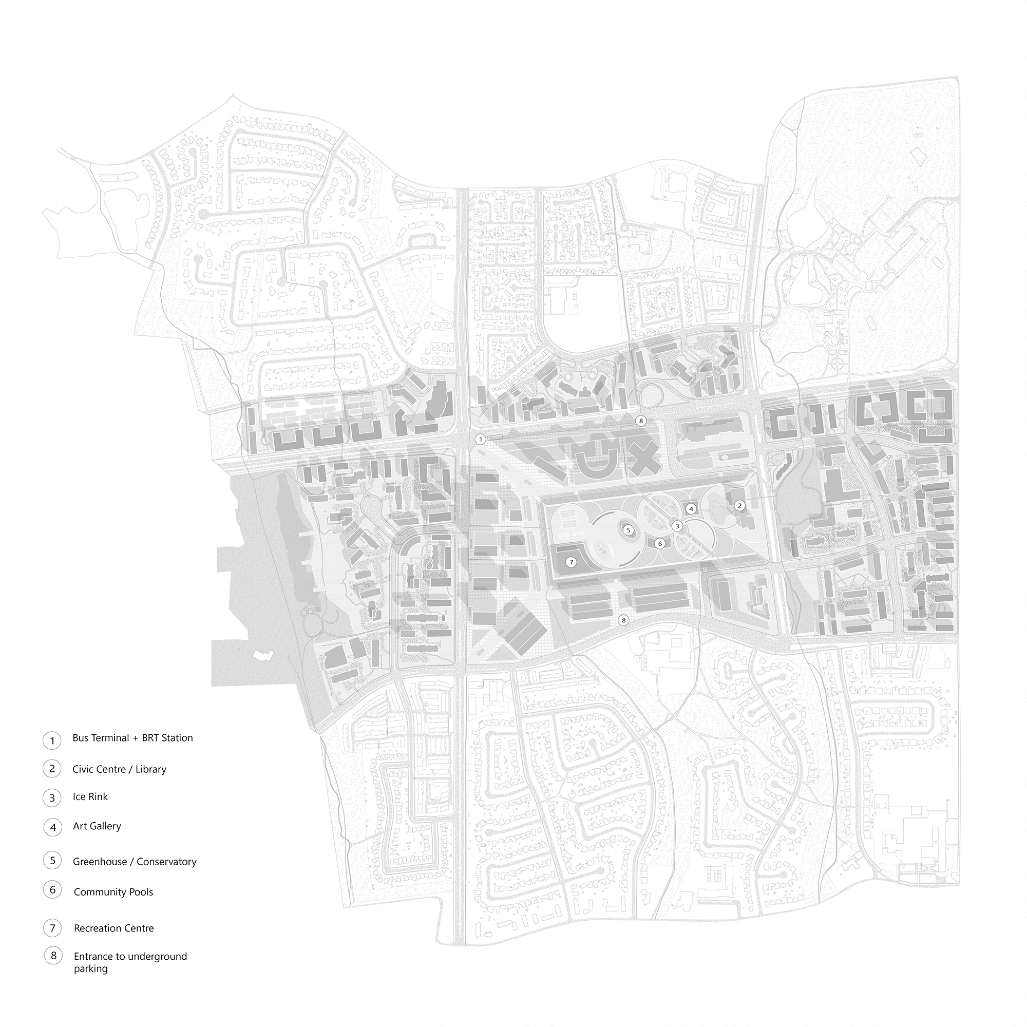
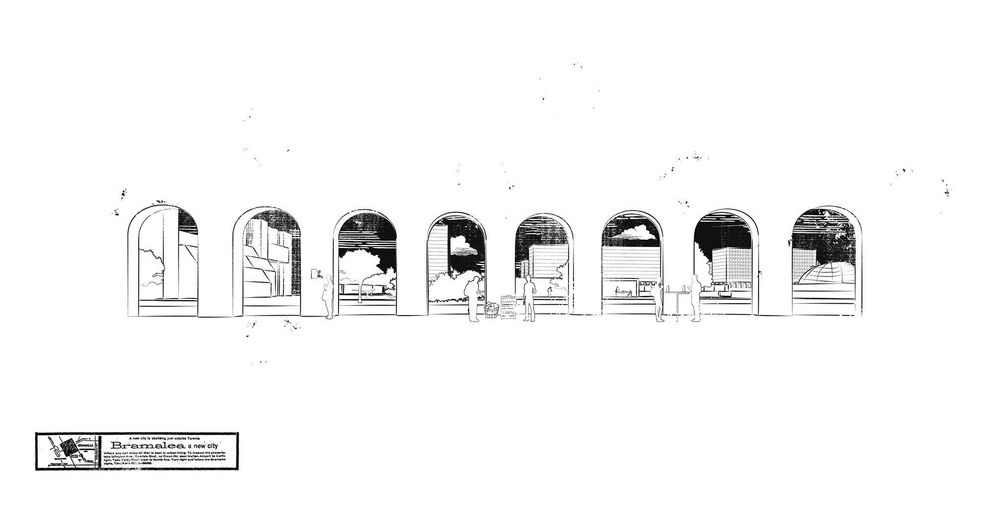
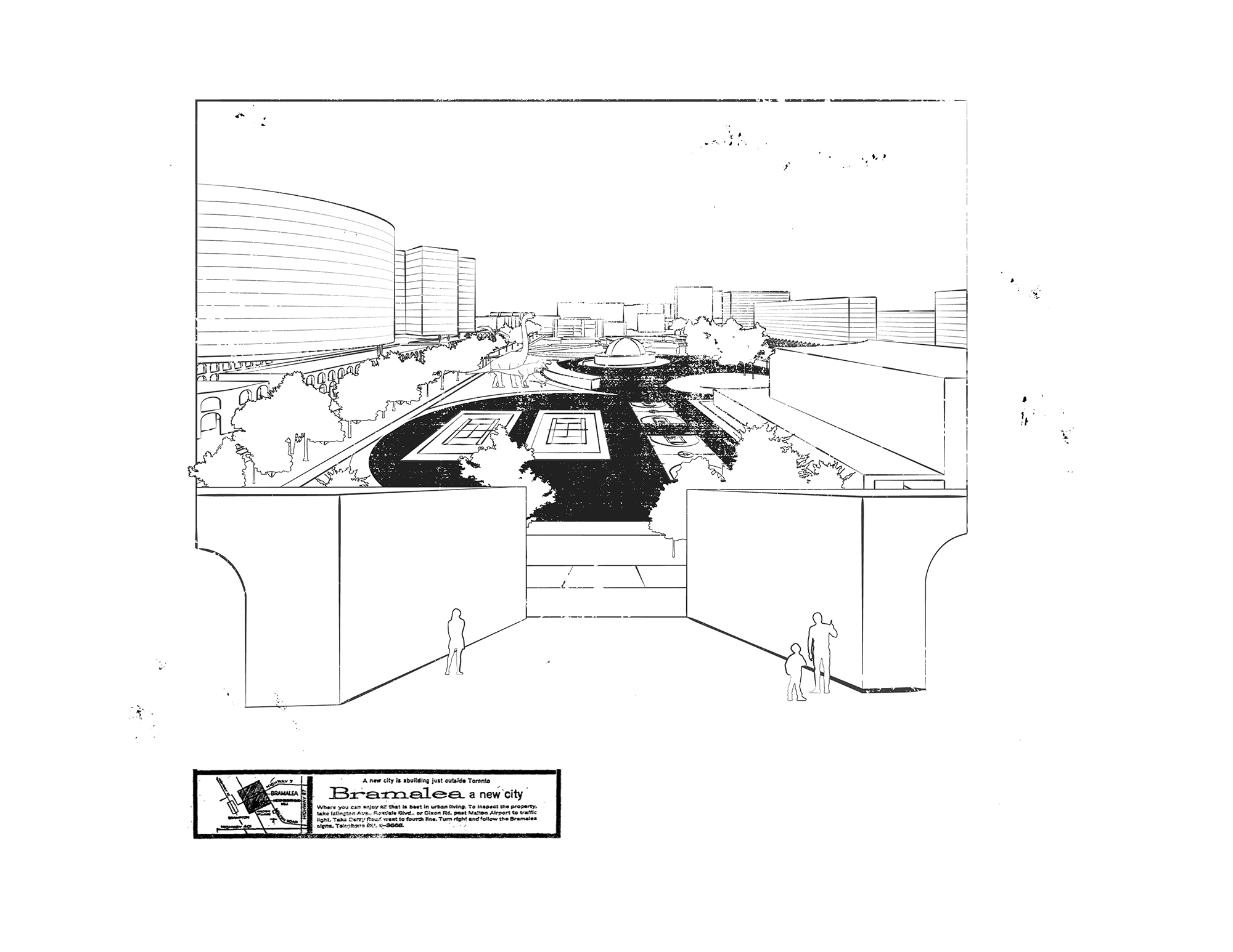
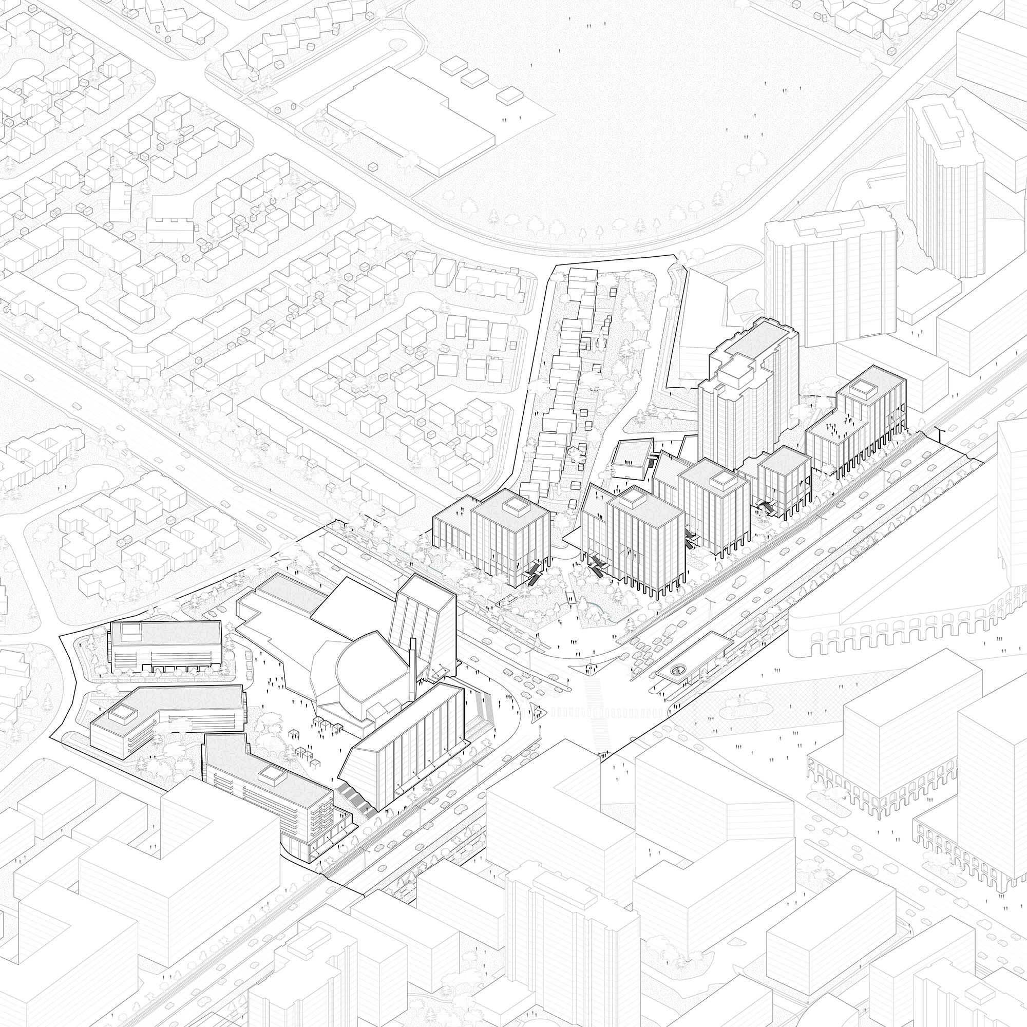
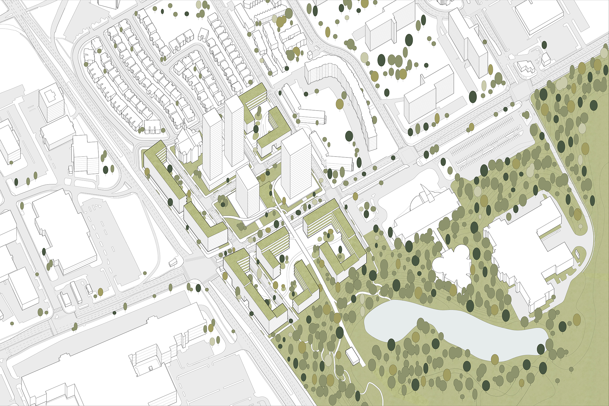
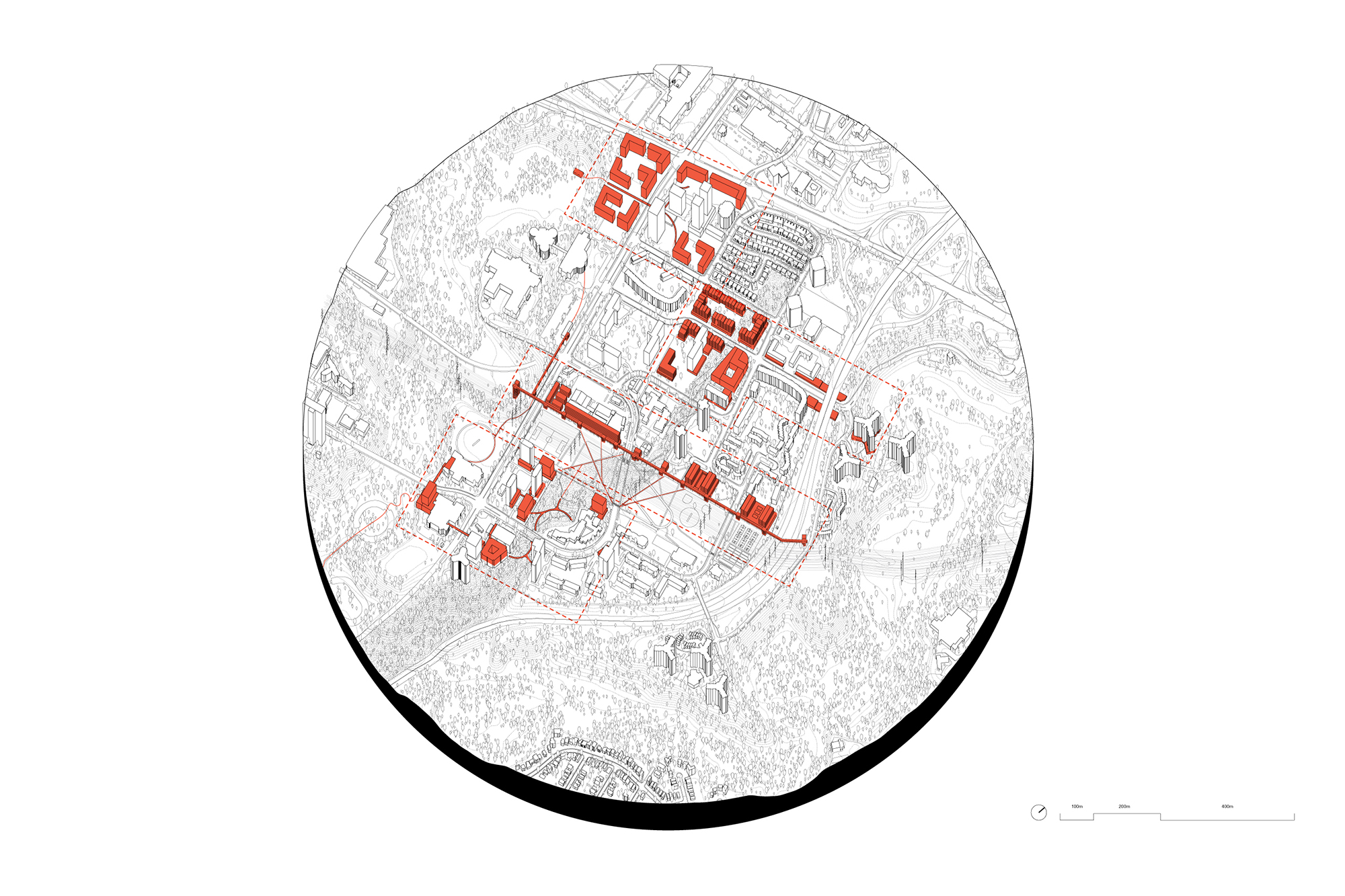
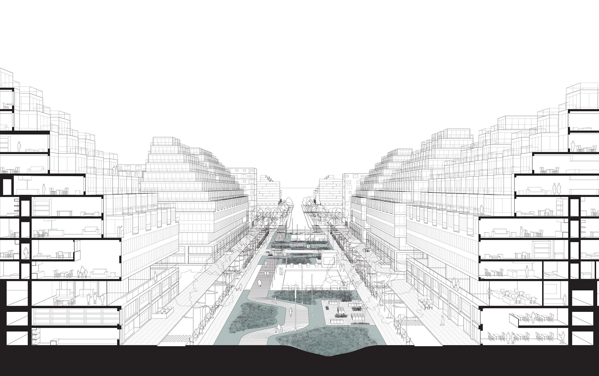
Haiqa, Dipra, and Evan write: "Bramalea: Canada’s first satellite city, designed in the 1950s as a completely self-sustaining community where employment, housing, recreation, and leisure would all be combined in perfect harmony. It was said to be the solution to urban sprawl, and yet it fell victim to sprawl all the same. The city’s centre, envisioned to inspire civic life, has separated the community into those who come from outside and those who live within. The centre’s periphery, lined with towers in the park, have fallen to the same woes as many of Toronto’s other aging high-rise rental projects. In response, a new master plan for Bramalea seeks the design of a new civic centre that generates vitality and provides many of the cultural and civic amenities needed by the community. It works to integrate living, working, social, and civic spaces, and it develops new systems that permit easy movement between existing and renewed neighbourhoods."
(Instructor: Jonathan Cummings)