

Molly Lalonde, "Paying it Forward"
In Landscape Studio 1, students researched Toronto's Riverdale Park and then developed proposals for its transformation over a 30-year period. Molly's proposal was a bold one: her design calls for the complete removal of the Don Valley Parkway, a major north-south highway that runs through the park, dividing it in two. "The concept I was working off of was ecosystem resilience," she says. "I studied environmental science in undergrad, and I came at this design from that perspective. Making change and acting in an environmentally responsible way requires a radical way of thinking, as well as intersectional and ecocentric solutions."
Molly argues that dismantling the DVP would solve a few different problems. It would dramatically reduce car emissions in the area, and would also eliminate the need for city maintenance crews to dump tonnes of road salt in the Don Valley every winter. The absence of these pollutants would reduce the amount of harmful runoff entering the waters of the Don River. A healthier river would lead to a healthier Lake Ontario.
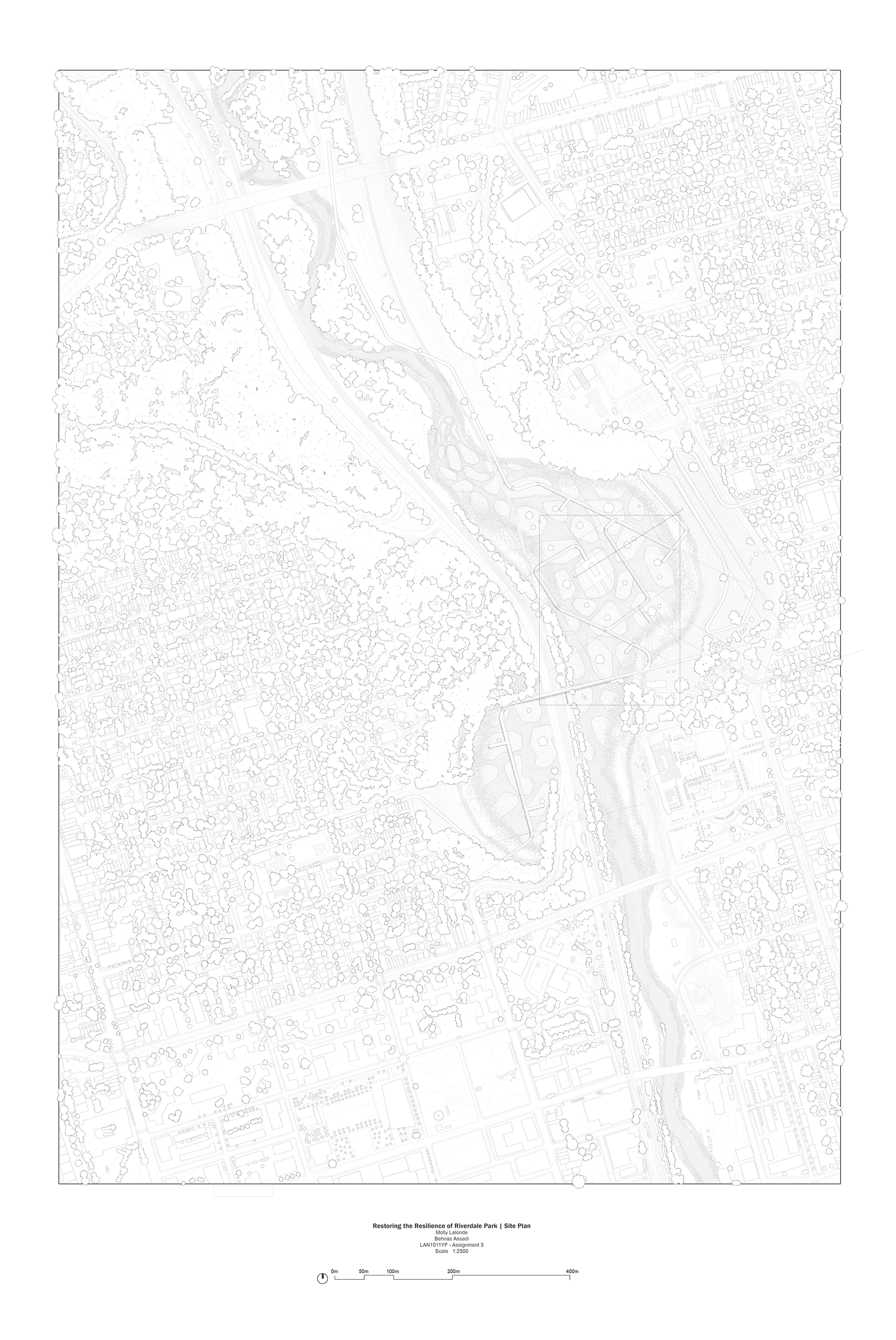
Molly's site plan. (Click here to view a larger version.)
But Molly wouldn't entirely eliminate the Don Valley as a transportation corridor. In place of the DVP, she would install a high-speed rail line linking downtown Toronto to the city's northern suburbs. And beside that new rail line, she would create a landscape unlike anything else within the city's borders.
The transformation would begin with a massive excavation project. Riverdale Park would be scooped out and sculpted into a series of small islands and then flooded with water from the Don, essentially renaturalizing the park by turning it back into a wetland. "I modelled the shapes of these islands off research I found from MIT, where they were looking at constructed wetlands and the best shapes to build islands in order to slow the flow of water coming from the river," Molly says. "Slower moving water means it can be cleaned by the wetlands that would be planted there. And it also means it's easier for things to take root."
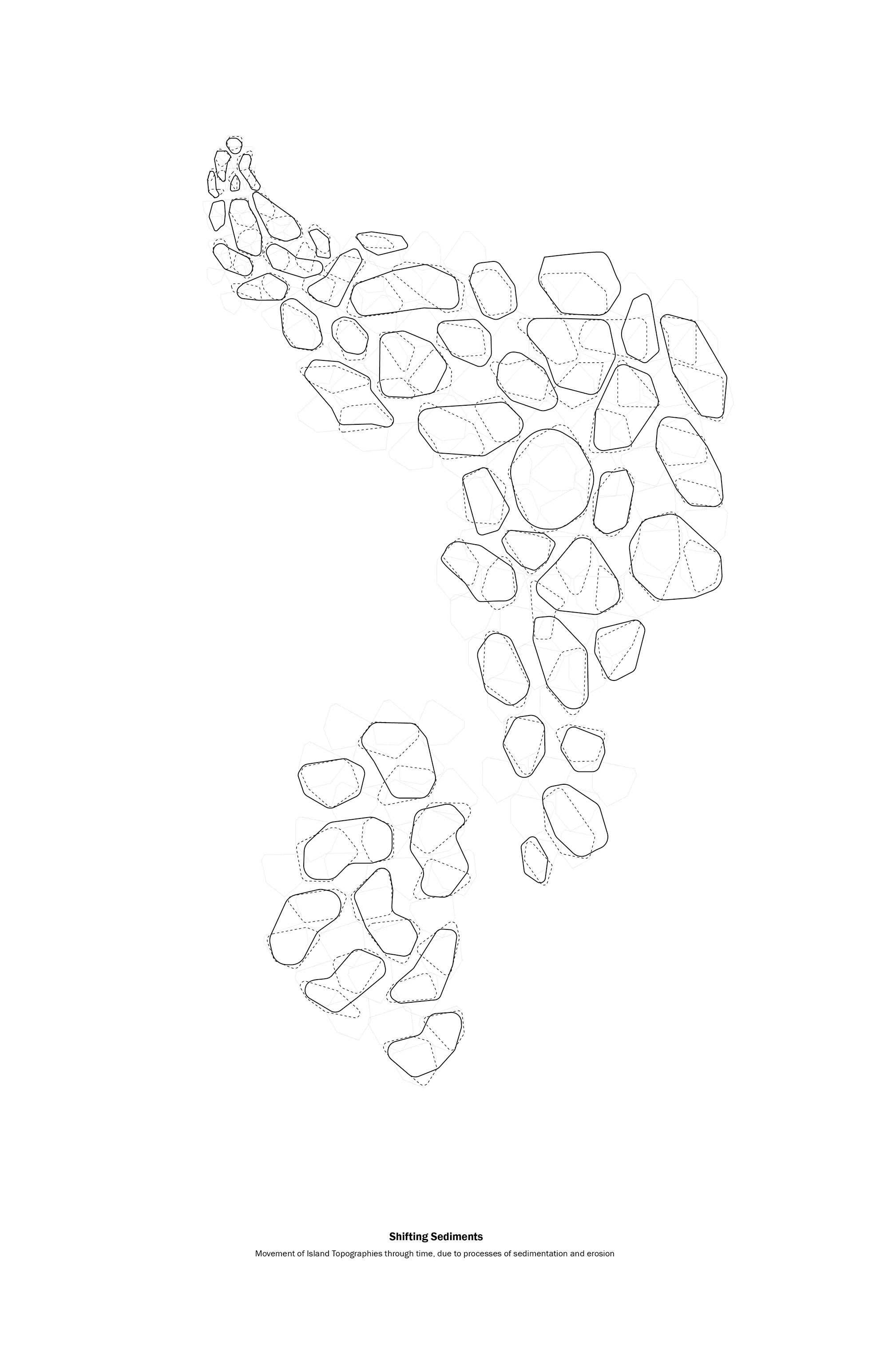
A drawing showing predicted sediment flow. (Click here to view a larger version.)
Molly predicted the way the islands' sediments would flow and change over decades. Over time, each island would become a miniature habitat for plants and animals. The islands and their vegetation would slowly absorb pollutants, which would improve the Don's water quality.
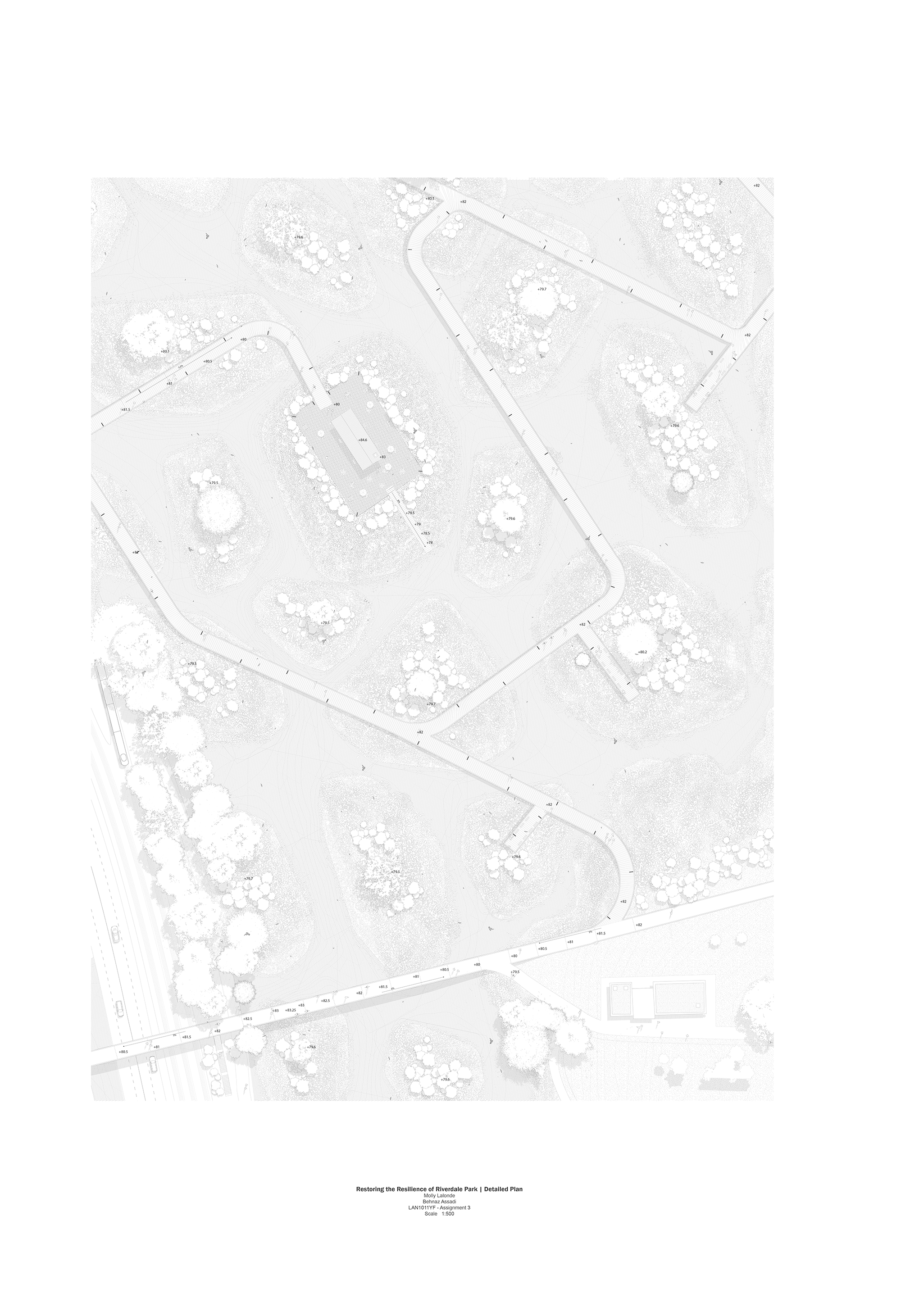
A plan showing Molly's proposed network of raised pathways. (Click here to view a larger version.)
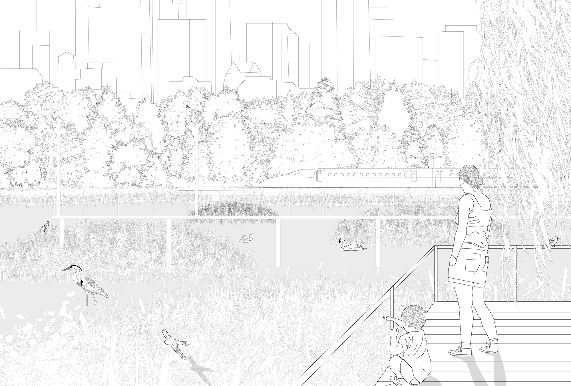
For human visitors, Molly's site plan includes a network of raised pathways that link the islands into a multi-use walking and cycling trail. A café and warming station on a large, central island would provide comfort for park-goers during the colder months.
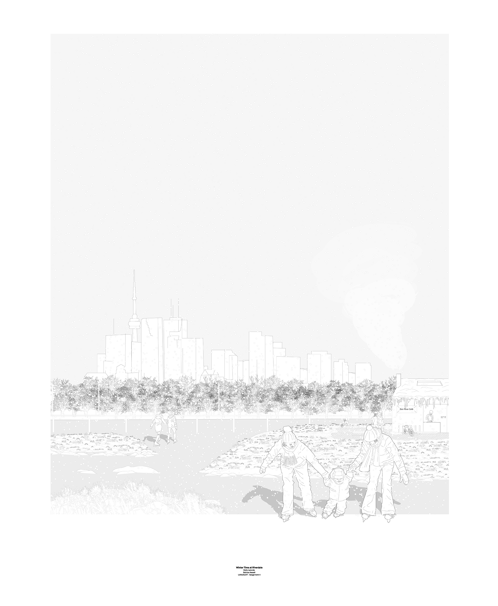
Perspective rendering showing skating on the Don River. (Click here to view a larger version.)
And Molly also envisioned another type of winter use. "The hope is that the water would be decontaminated enough that it loses salinity," she says. "Right now the Don River is really salty for a freshwater river, and it actually doesn't freeze in the winter for that reason. Skating in the Don is a historical activity that has taken place for a long time and can't happen anymore. Hopefully the wetlands decontaminating and taking out the salts from the water would mean skating would be possible again."