

Xiang Ye, Yijie Dai, Chaya Bhardwaj, Rida Khan, "Heaven's Kitchen"
Superstudio is a multidisciplinary design studio. Students from the Daniels Faculty's Master of Architecture, Master of Landscape Architecture, and Master of Urban design programs collaborate on detailed master plans for urban neighbourhoods.
Xiang, Yijie, and Chaya — all architecture students — and Rida, an urban design student, were assigned the Golden Mile, a neighbourhood near the intersection of Eglinton and Warden Avenues in central Scarborough. The area is currently dominated by big-box retailers, but that may change soon. The Eglinton Crosstown, a new rapid-transit light rail line slated for completion in 2022, will soon transform the neighbourhood into a public transit hub, opening up new possibilities for residential and commercial redevelopment.
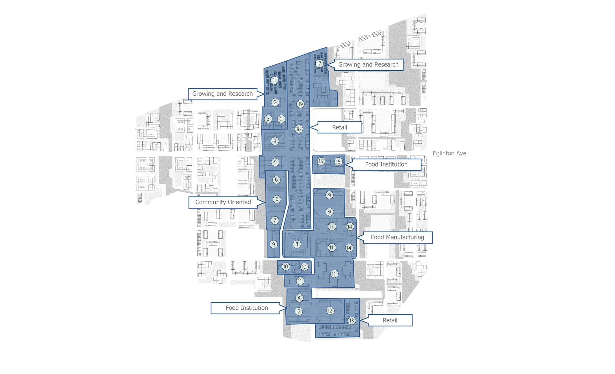
Each student group was required to organize their master plan around the needs of three different types of community actors. Xiang, Yijie, Chaya, and Rida chose the following: food distributors; housing developers; and the city of Toronto's Parks, Forestry, and Recreation division, which oversees the development and maintenance of Toronto green spaces.
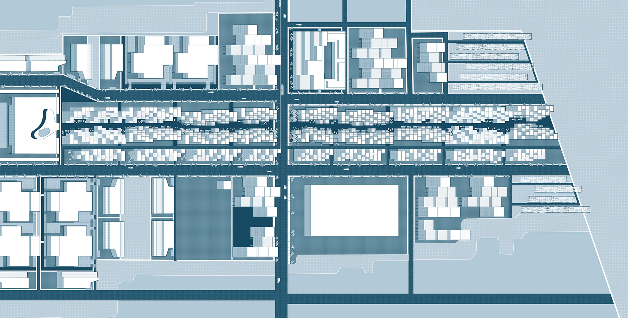
With these different interest groups in mind, an overarching concept began to take shape: the group would create a proposal for remaking the Golden Mile into a mixed-use, high-density residential neighbourhood with food and nature at its core.
The group's master plan.
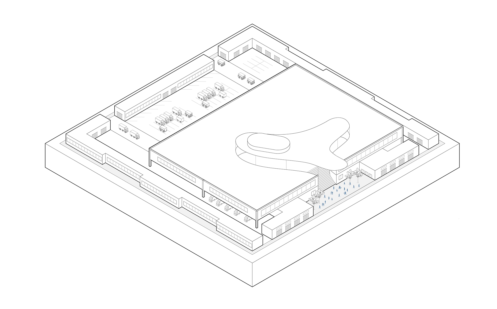
At the centre of the group's plan was the Ontario Food Terminal, a giant produce distribution hub that's located in south Etobicoke, on Toronto's west side. "We learned that the Ontario Food Terminal is Toronto's main food source," Chaya says. "We also learned that because the terminal is so close to Lake Ontario, it's located on two flood planes, which puts into question our ability to get food during weather events."
"From that point, our group thought that it would be interesting to centre our project on a complementary Food Terminal located in the east end. We're not replacing the existing Food Terminal. We're adding a second one."
The existing food terminal is for industry buyers, and is not open to the public. The group envisioned their second food terminal as being a community hub. There would still be an area reserved for industry, but there would also be a large open market for ordinary, individual shoppers. The loading docks and offices necessary for the industrial side of the operation would be hidden away in an internal courtyard:
The food terminal would anchor a pedestrianized "food street" that would run through the centre of the neighbourhood. At the north end of the street would be facilities for food cultivation and research. Toward the middle of the street, near busy Eglinton Avenue, there would be food retail representative of Toronto's many ethnic cuisines. South of Eglinton would be where the new food terminal was located, along with some facilities for food manufacturing.
Atop the businesses in the retail portion of the food street would be three levels of housing. Farther away from the central area would be clusters of mid-rise and high-rise residential buildings. The group envisioned each of these residential buildings as having a wide central plaza where residents could congregate or host informal markets.
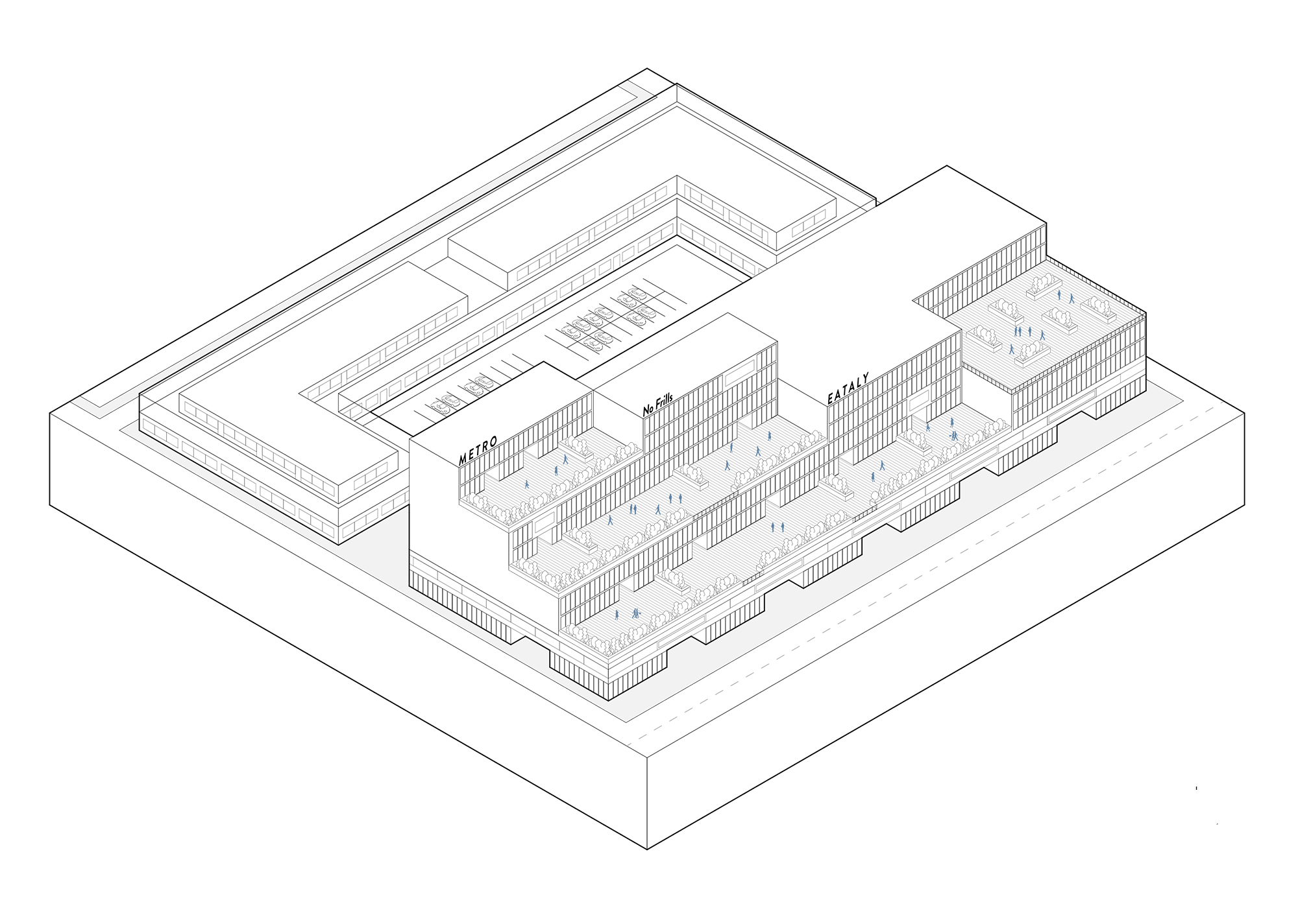
A mixed-use building with restaurants and residences.
The master plan also calls for a series of recreation centres. The group's proposed design is a ramp-shaped building that residents could play on top of, as well as inside. "The ramps were our way of finding a way to make the building match the terraced look of the project while also having it be a space where people could walk and run," Chaya says.
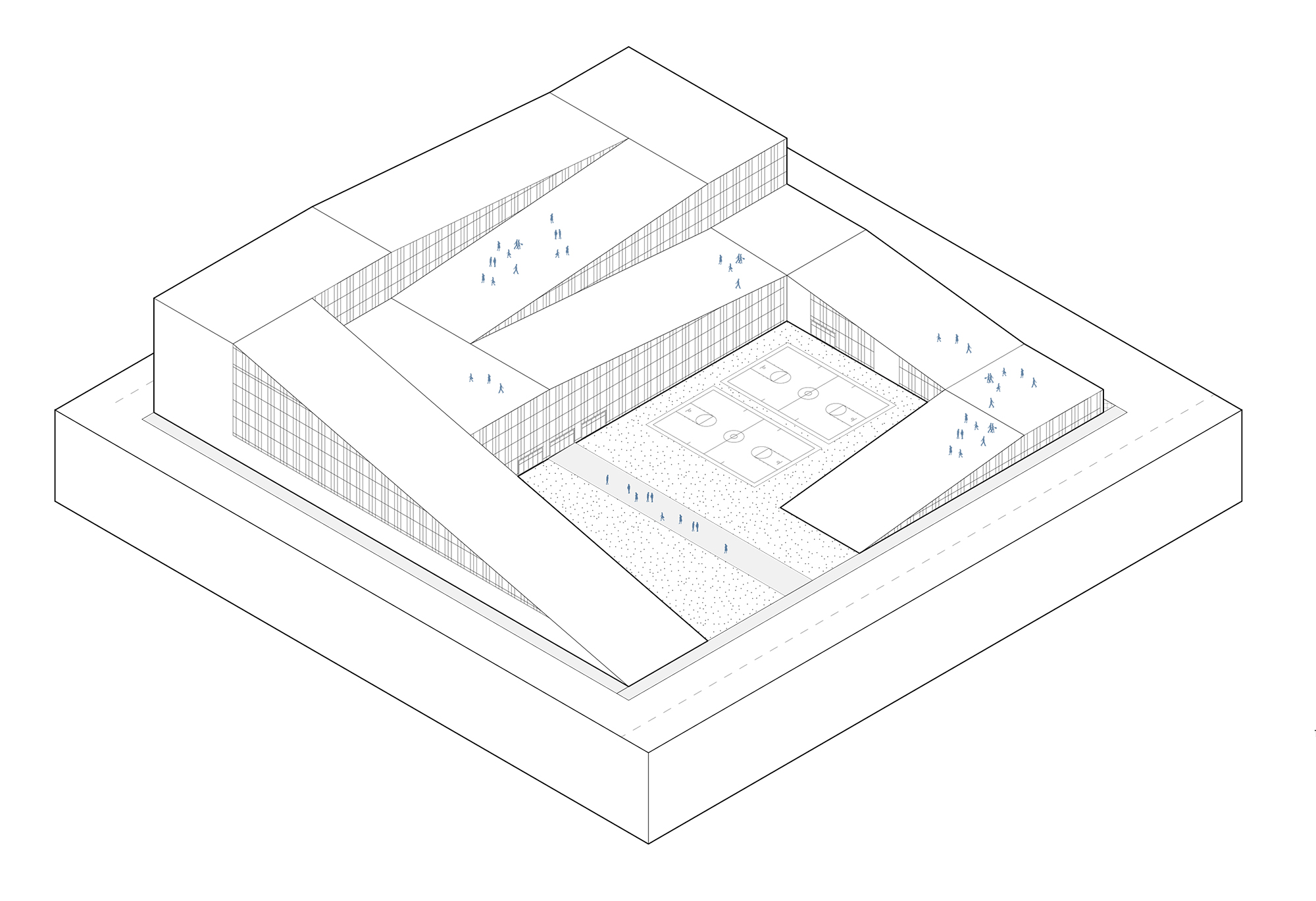
The group's recreation centre design.
And finally, to address the needs of the city's parks department, the group planned a series of linear parks throughout the neigbourhood. These parks would connect with the grassy utility corridor located at the Golden Mile's north end, opening up the possibility of future integration with the Meadoway — a proposed multi-use utility-corridor trail network that the city of Toronto is in the process of designing and implementing. The new parks would improve the area's water permeability, reducing runoff during major storms, and they would also act as convenient pedestrian travel arteries for locals.
Instructors: Victor Perez Amado and Dina Sarhane