old_tid
34

11.12.17 - CityLab tells the story of North America's "Third Coast" in 8 maps

A recent article by CityLab highlights the expansive, detailed, and beautifully illustrated research in the book Third Coast Atlas: A Prelude to a Plan by Clare Lyster, Charles Waldheim, Daniel Ibañez, and  Daniels Faculty Associate Professor Mason White.

Filled with maps, plans, diagrams, timelines, photographs, and essays, the large, hardcover book offers a multi-layered description of the process of urbanization throughout the Great Lakes region: North America’s “Third Coast.”

CityLab provides "The Story of the Great Lakes in 8 Maps," referencing illustrations from the book.

Writes Zach Mortice:

The Great Lakes were where the skyscraper and the shopping mall were invented. The urban street grid was perfected here, and the field of urban planning took some of its earliest steps here toward becoming a formalized profession. Its ports and shipping distribution districts were trendsetters. And all manner of Modernist campus and quasi-megastructure experiments took root in the humble middle of North America. Think of Mies van der Rohe’s campus at Chicago’s Illinois Institute of Technology and his Lafayette Park neighborhood in Detroit; Bertrand Goldberg’s city-within-two-towers Marina City, also in Chicago; and Moshe Safdie’s influential Habitat 67 in Montreal.

It is a vast legacy, matched by the physical dimensions of the Great Lakes themselves.

Visit CityLab to read the full article.

05.12.17 - Superstudio reviews: students present ideas for Rail Deck Park

On December 5, as Toronto City Council voted in favour of moving forward with planning for Rail Deck Park, Master of Architecture, Master of Landscape Architecture, and Master of Urban Design students presented design ideas for this new public space, which would be built over the rail corridor that cuts through the southern edge of the downtown core.

"Toronto city council voted 36-4 in favour of pushing ahead with planning work for the park, which is now estimated to cost some $1.665 billion although only five per cent of the design is complete," reported CBC News. "If built, the park would span the rail corridor from Blue Jays Way to Bathurst Street, creating more than eight hectares (21 acres) of green space in the middle of the city."

Above are photos of some of the projects that were presented on December 5.

Congratulations to all Superstudio students on completing your final review!

23.11.17 - Daniels alumni and faculty recognized for West Don Lands tranformation in Toronto

The transformation of the West Don Lands in Toronto into a sustainable, mixed-use community has been recognized with a 2017-2018 Global Award for Excellence from the Urban Land Institute (ULI). The award-winning pedestrian-friendly community — a 79-acre site nestled between the Don Valley and Gardiner Expressway, near the Distillery District — was designed with the help of a number of faculty and alumni from the Daniels — including the Director of the Faculty’s Master of Urban Design program Mark Sterling.

Sterling was the Urban Design Lead for the Public Realm Master Plan led by David Leinster (BLA 1985) of The Planning Partnership.

Writes Batel Yona for the ULI’s website:

Innovative and high-quality parks and public realm are among the area’s hallmarks, each incorporating robust biodiversity and natural landscapes. Corktown Common is positioned atop a flood-protection land form that protects 519 acres (210 ha) of downtown Toronto and unlocks the area’s development potential. Underpass Park transformed an unused area into a family-friendly recreational community space. The Front Street Promenade, a linear park that constitutes the spine of the new neighborhood, is programmed with curated public art installations and linked to the district’s secondary network of mews, courtyards, and pathways to create a healthy, walkable, integrated new community. Toronto’s first woonerf streets are also found here.

The team for the West Don Lands project includes:

Master developer: Waterfront Toronto; precinct plan: Urban Design Associates
Developers: Urban Capital (River City), DREAM Unlimited, Kilmer Group (Canary District), Toronto Community Housing
Public realm and urban designers: the Planning Partnership with PFS Studio plus &Co., Michael Van Valkenburgh Associates Inc.
Landscape designers: Claude Cormier & Associates, NAK Design Strategies Architectural design: (River City) Saucier & Perrotte, ZAS Architects; (Canary District) architects Alliance, KPMB Architects, Page + Steele/IBI Group Architects, Daoust Lestage, MacLennan Jaunkalns Miller Architects, (Shade Pavillion) Maryann Thompson Architects
Design/builder: (Canary District) EllisDon Inc., Ledcor Group
Retail designer: Live Work Learn Play

For more information, visit the ULI website.

09.11.17 - What kind of city do you want Toronto to be?

What kind of city do we want Toronto to be? As part of Edit: Expo for Design, Innovation & Technology, PARTISANS partnered with New York’s Storefront for Art and Architecture to bring its Letters to the Mayor series to Toronto. The installation, which was on display September 28 to October 8, displayed letters written by Toronto architects to Mayor John Tory, who visited the expo to view them on opening night.

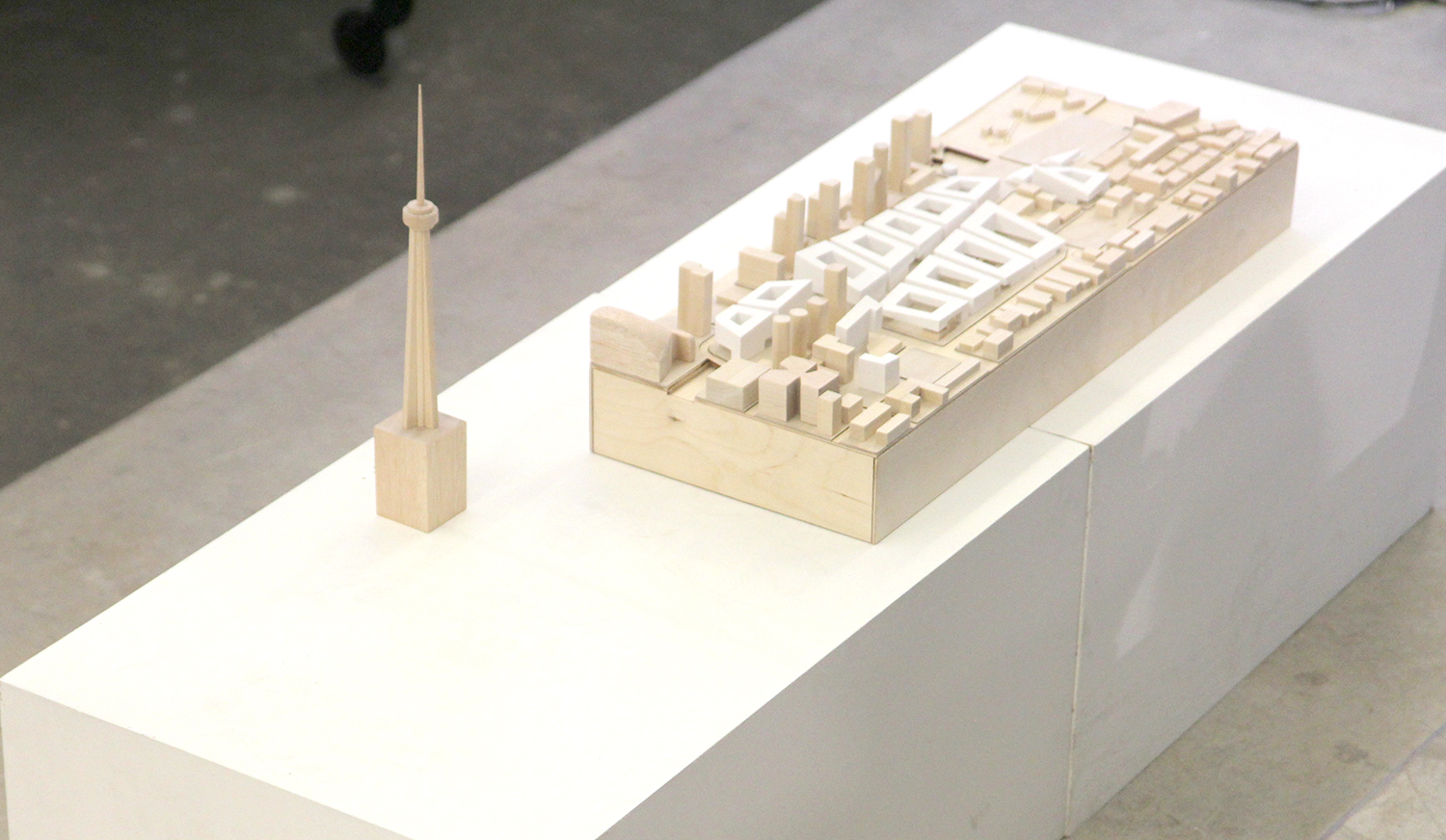
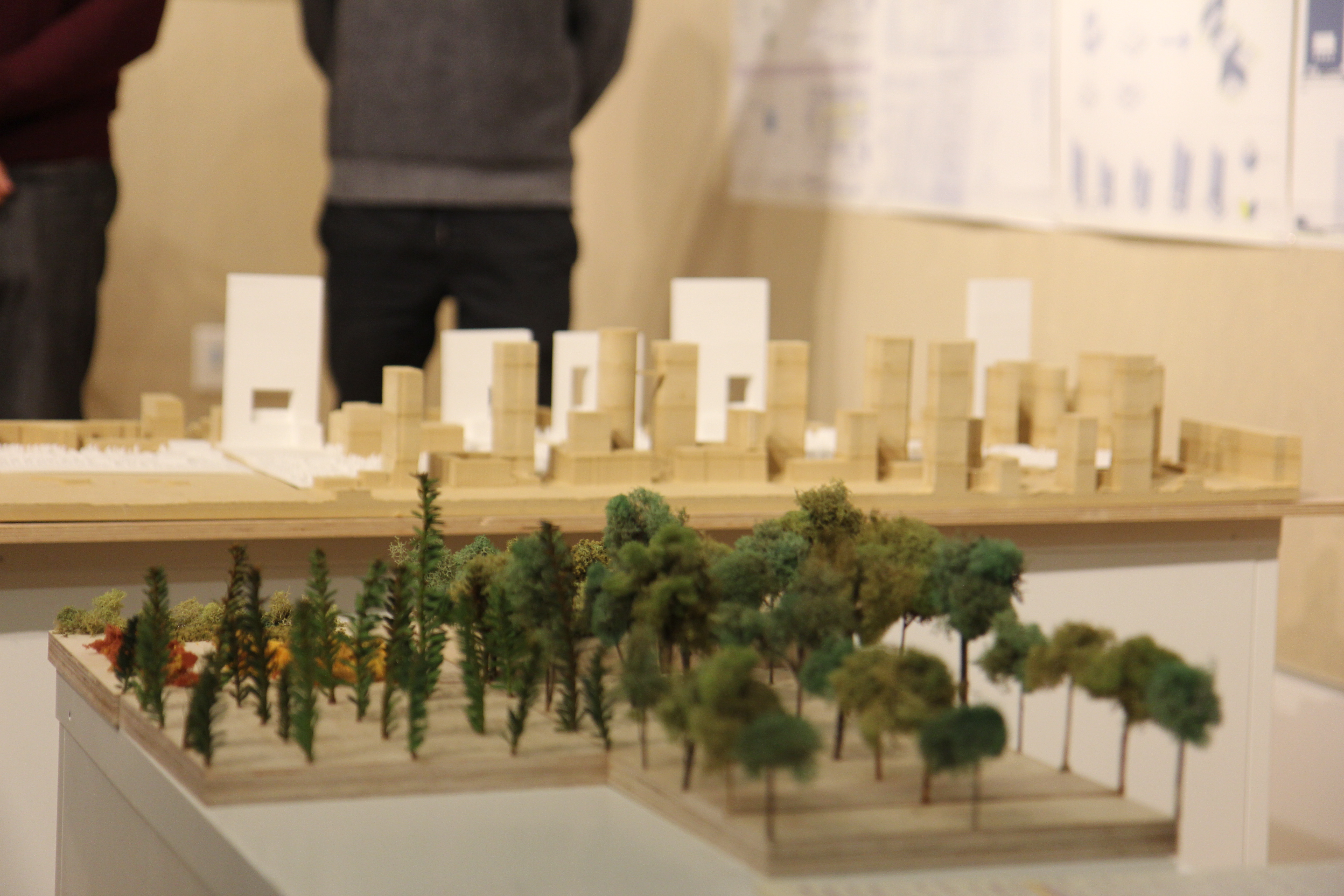
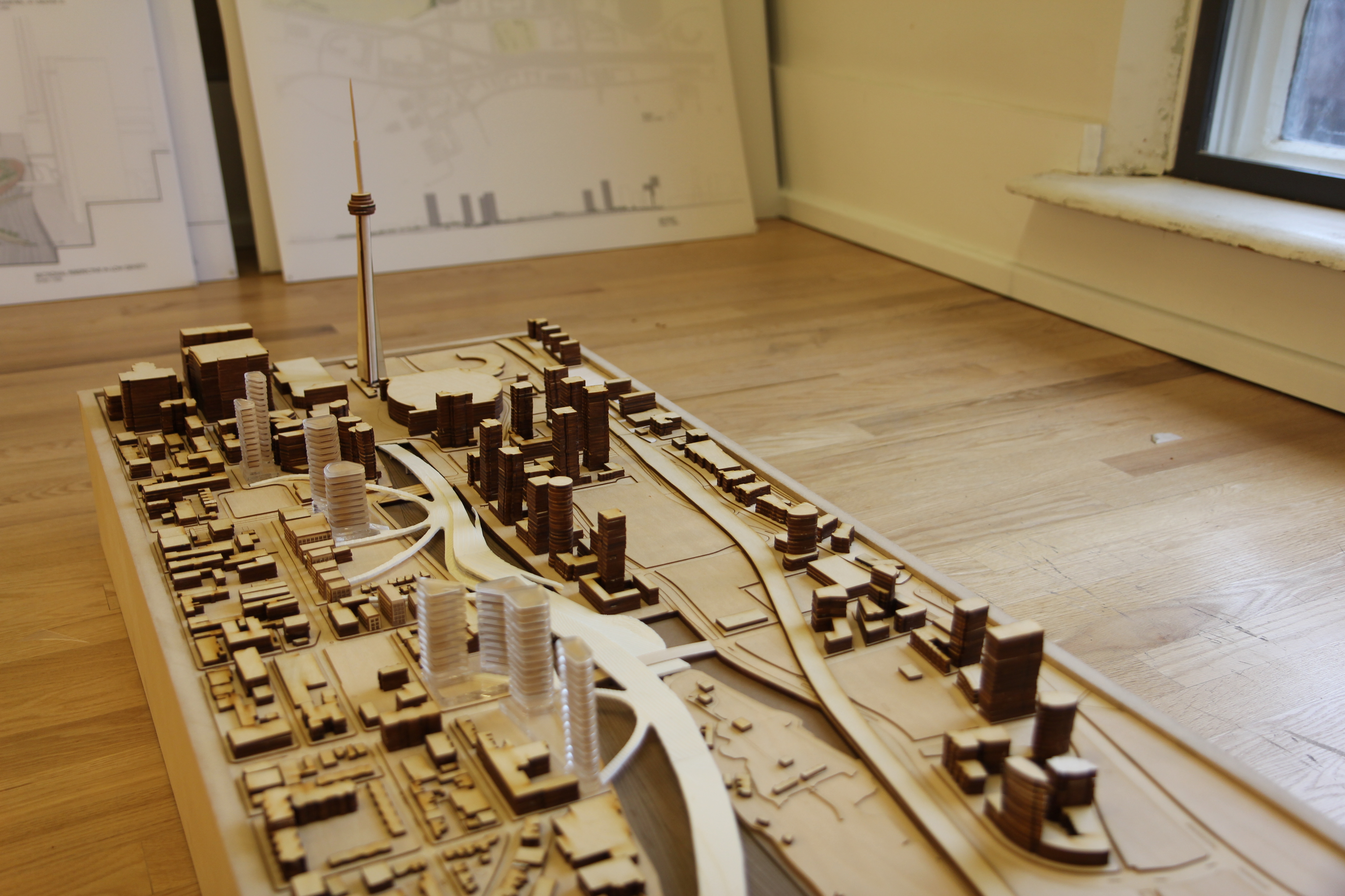
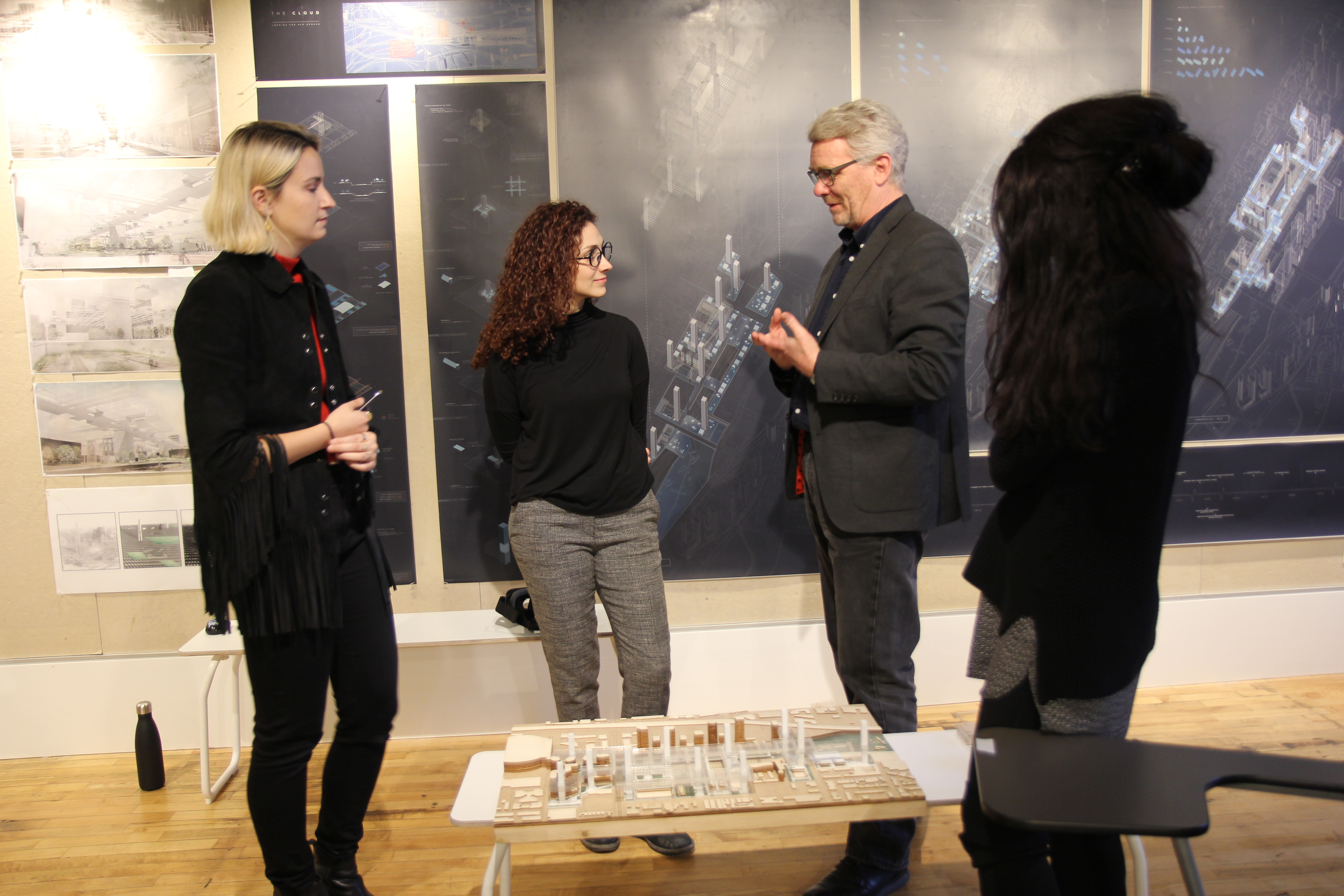
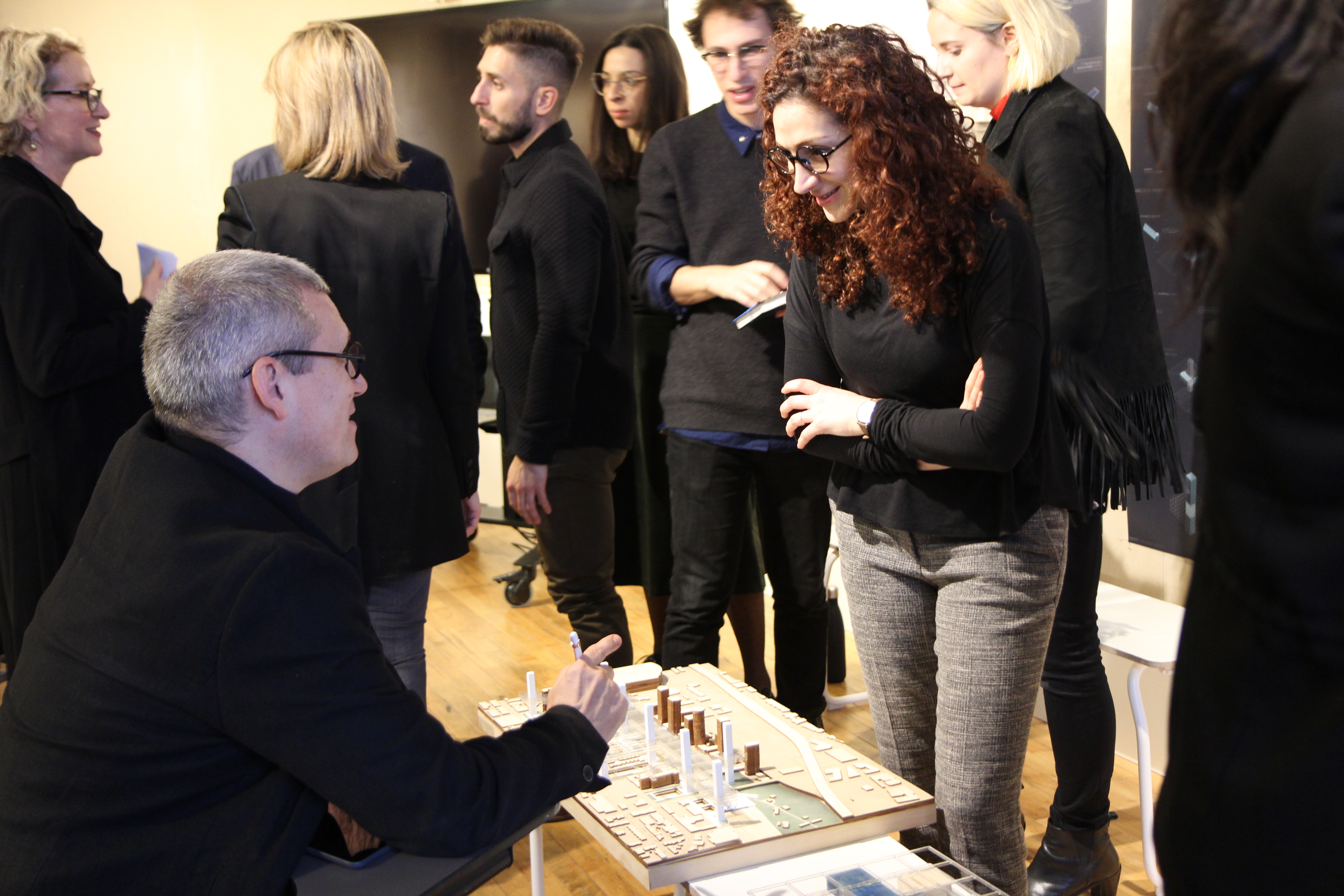
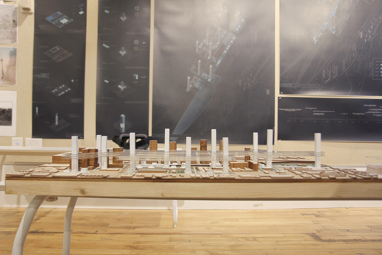
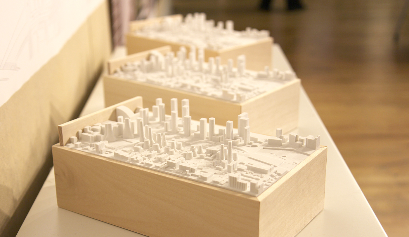
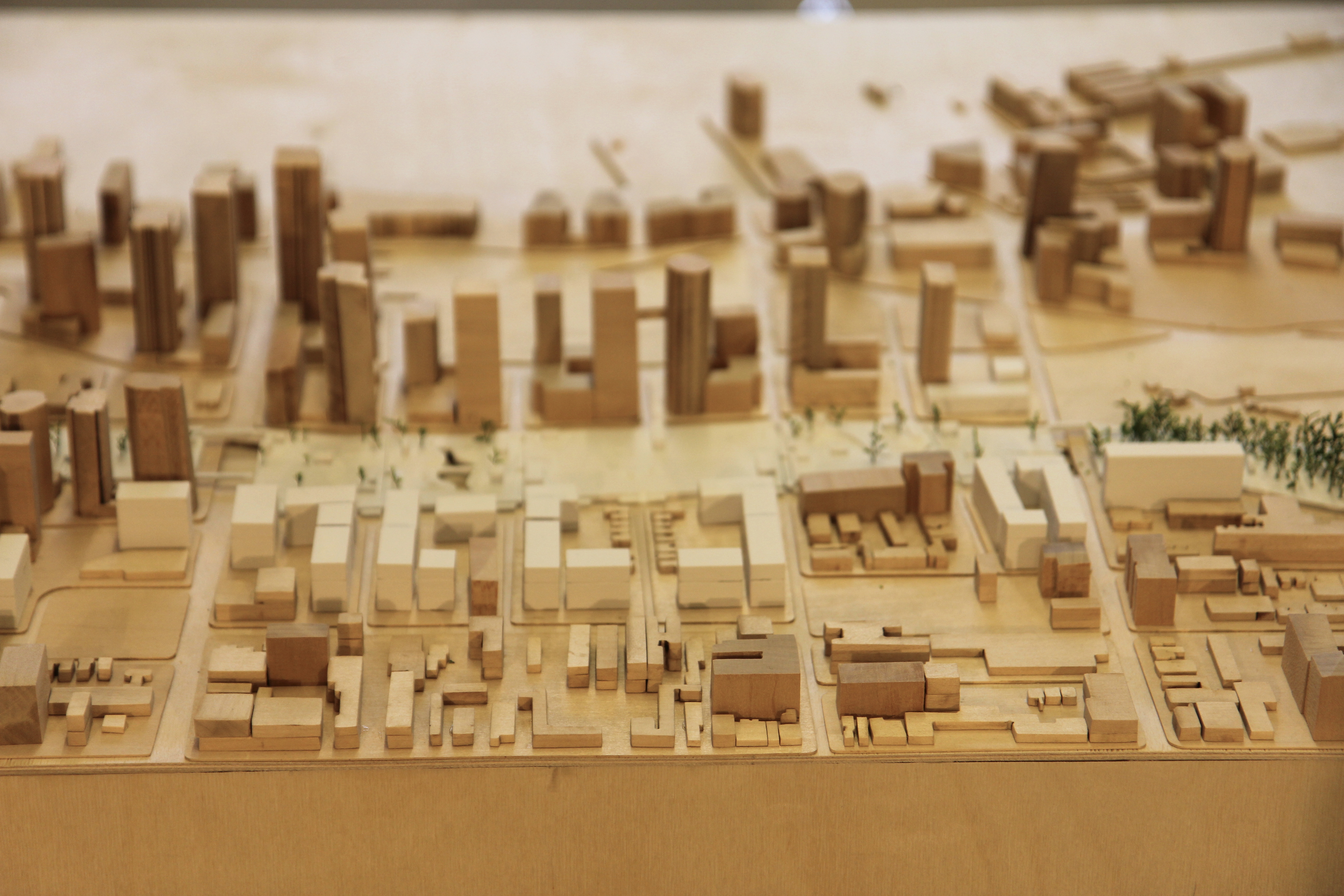
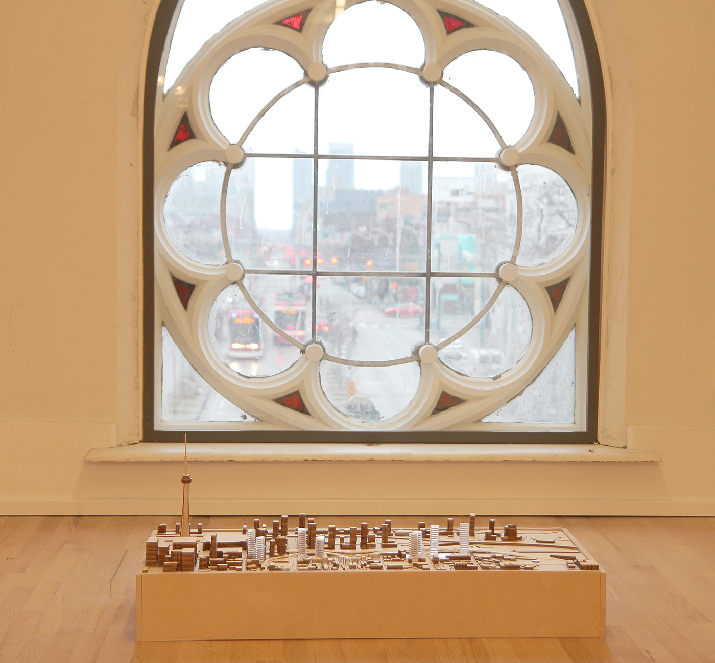
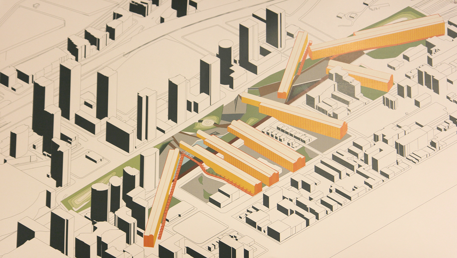
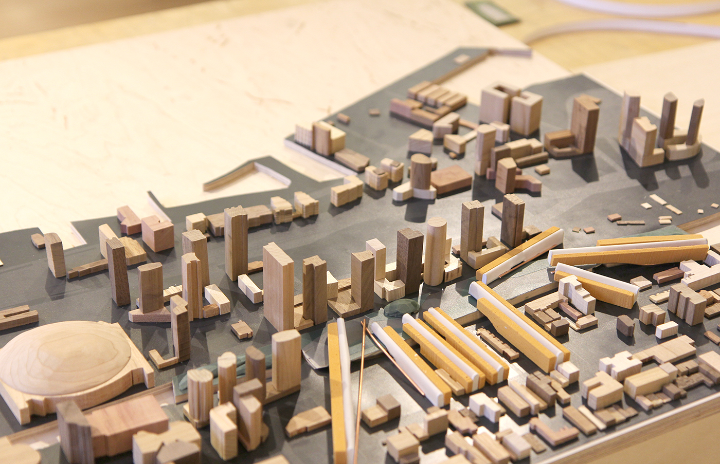
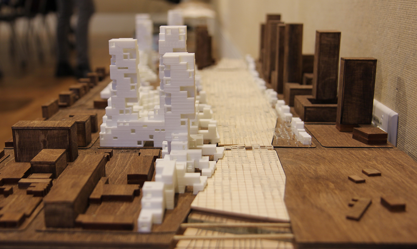
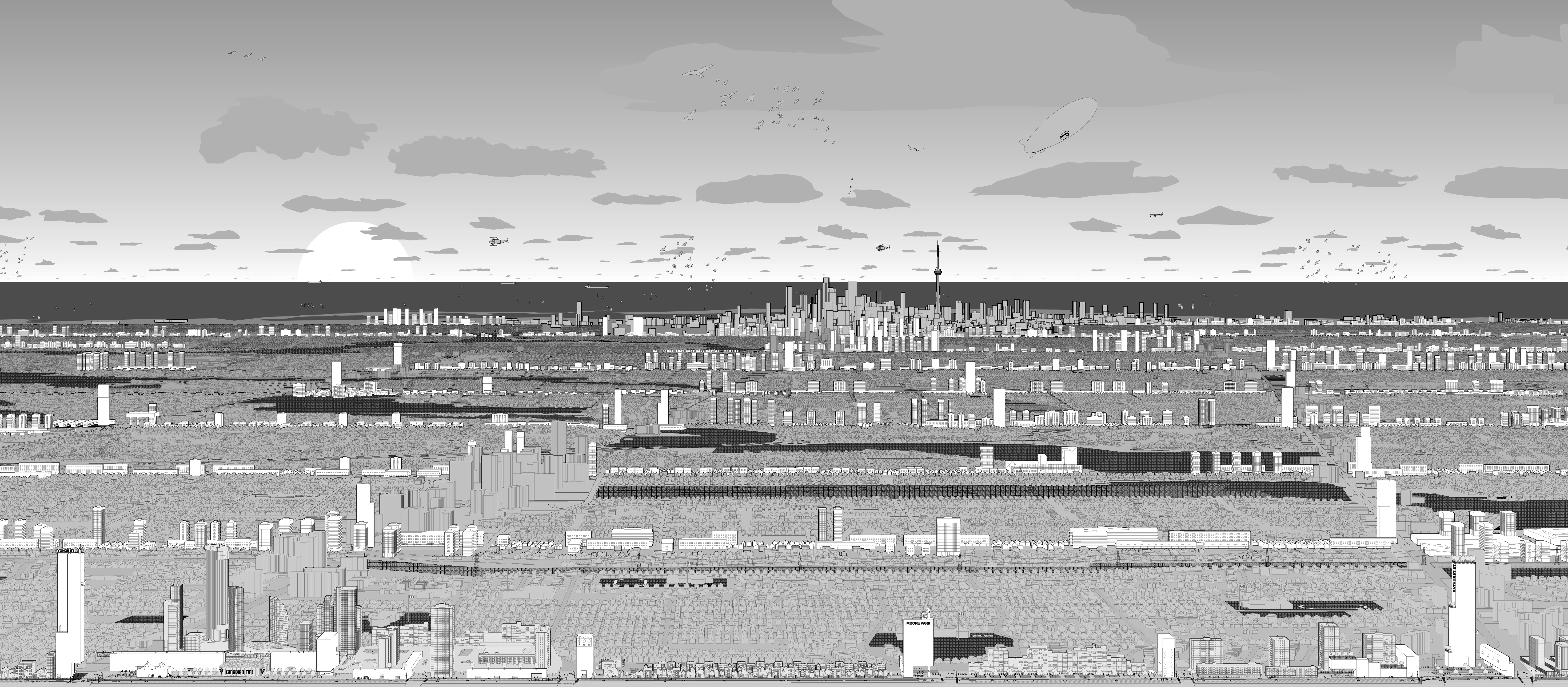
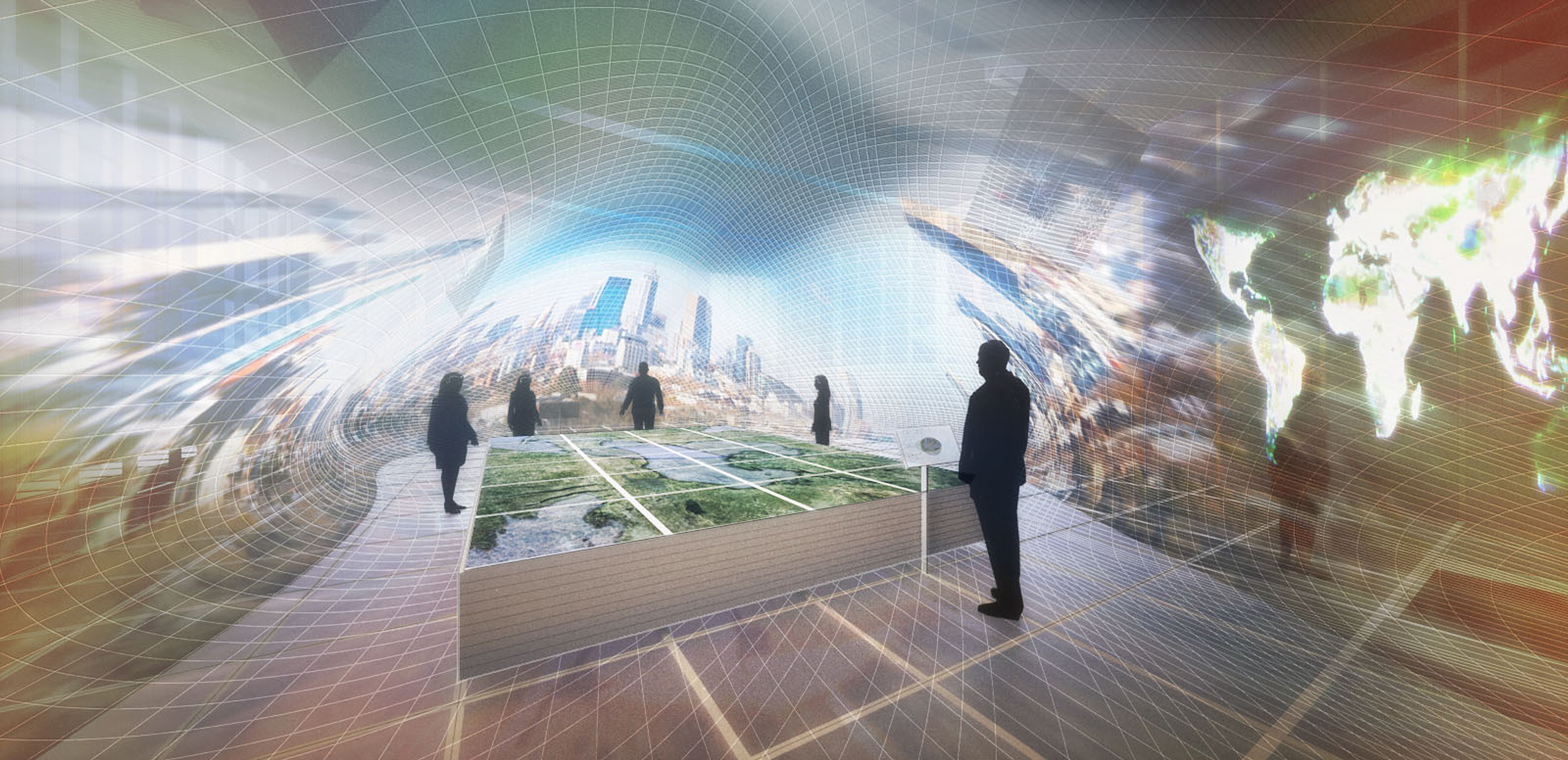
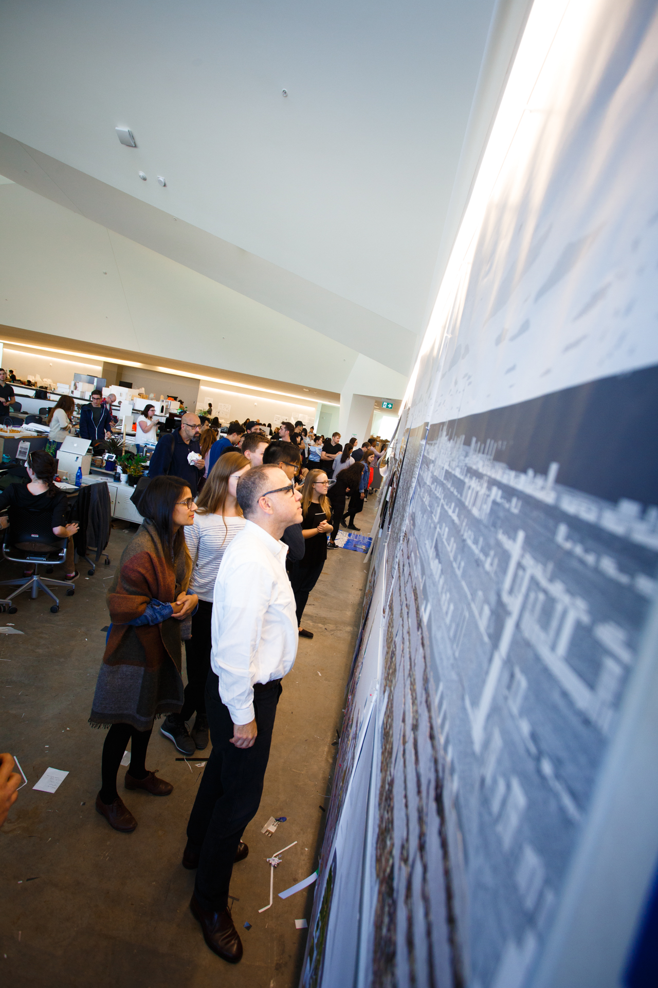
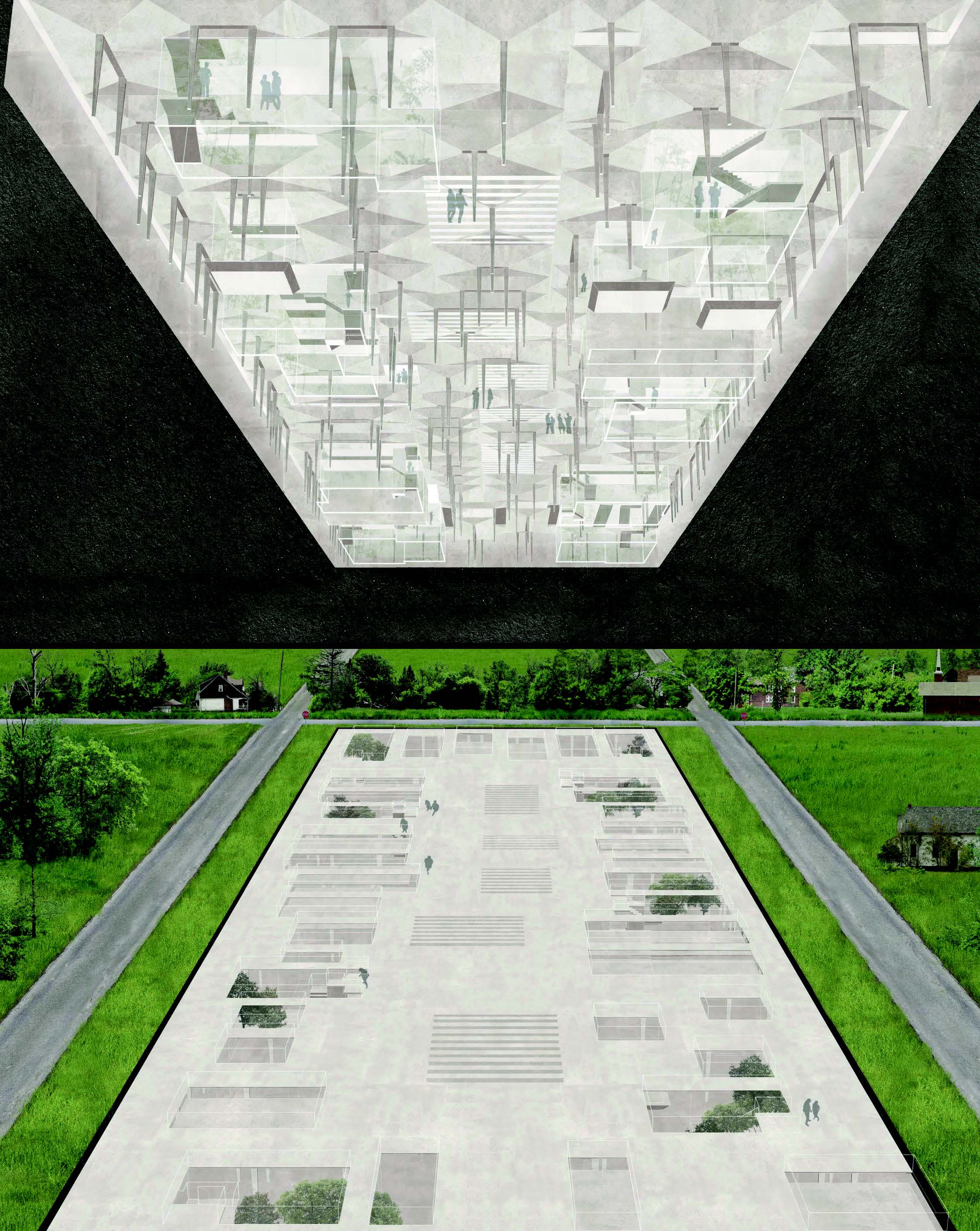
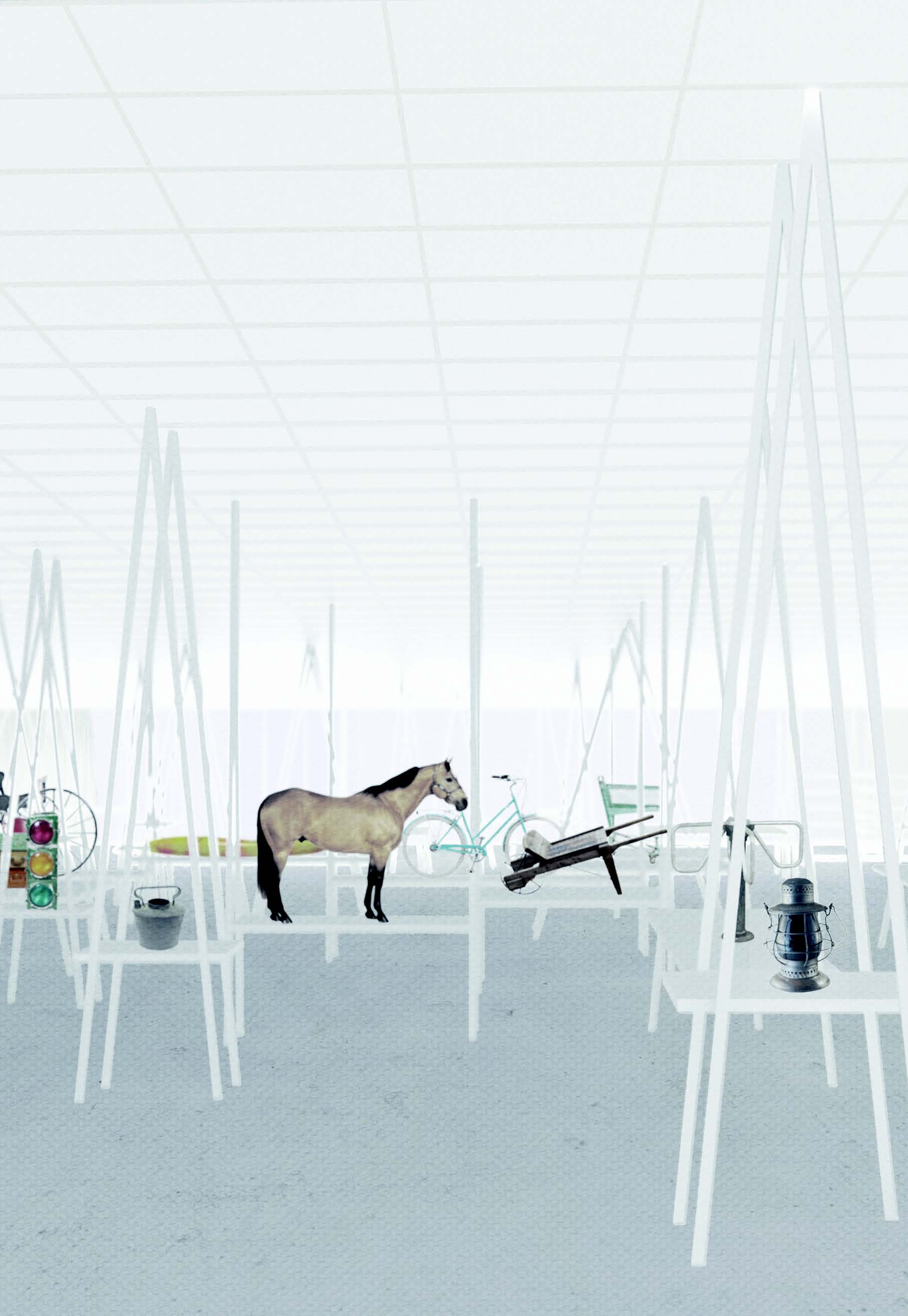
Dean Richard Sommer drew inspiration from the Daniels Faculty’s own installation at the Edit expo: a large, detailed 25-foot-long “fun-house mirror” of a future Toronto looking south to the lake from Steeles Avenue (a portion of which is displayed above). For those who missed it, we’ve pasted his letter below.


Dear Mayor Tory:

For those who envision the future of Toronto, what is the picture that they hold in their minds eye? 

For the city’s official planners, the picture might be akin to a paint-by-number kit — one colour for the established residential areas, another for the main corridors where intensification is allowed, another for former industrial lands now subject to unfettered development, and hatching for heritage and other zoning overlays. The development industry has a different picture: a mashed-up monopoly board of dots and spots of investment opportunities metastasized across the city, with a successful ruling from the Ontario Municipal Board as the ‘get-out-of-jail-free’ card. Yet, how are the consequences of these ways of guiding the city’s future seen and understood? And what might better capture the experience and vision of Toronto’s heterogeneous citizenry? Is it a graphic novel of a day in the life of a short order cook who travels several hours daily across the city by TTC? Or is it a still from the TV drama “Suits,” filmed in a camouflaged version of downtown Toronto glossed up as a glamorous stage for aspiring professionals?

A great city, like a great book, painting, or piece of music must first be imagined — and one must start by creating some engaging big pictures of what we hope to build. In a society aspiring to democracy, there should be competing pictures of our urban future to inspire and focus debate. Which pictures might help people understand something beyond the specific lens of their experience, or self-interest?

Powerful, civically-minded people often tell me “Toronto is a city of neighborhoods,” and “Toronto is built incrementally, deal by deal,” and how in this system there is “no way to think more holistically, or conceive and pursue ways of building the city beyond single projects,” as if these are incontrovertible truths or political circumstances somehow unique to Toronto. They are neither. Incrementalism in the absence of vision replicates the status quo and breeds mediocrity. A great and growing metropolis like Toronto must see itself as more than just an amalgamation of neighborhoods and districts. Even for those fortunate enough to rent or own a home in a well-established neighborhood, where they work or play inevitably takes them to other places, and this everyday reality makes them citizens of something much greater.

Here, at Canada’s oldest and largest school of Architecture, Landscape and Design, the John H. Daniels Faculty, now perched at the head of Spadina Avenue, we consider — and draw — the city from many angles. I would like to invite you to join us in this messy art of building a real vision for our city. Together, we need to ask whether more of the same will do and, if not, what is missing.

Respectfully,

Richard Sommer, Dean

John H. Daniels Faculty of Architecture, Landscape, and Design

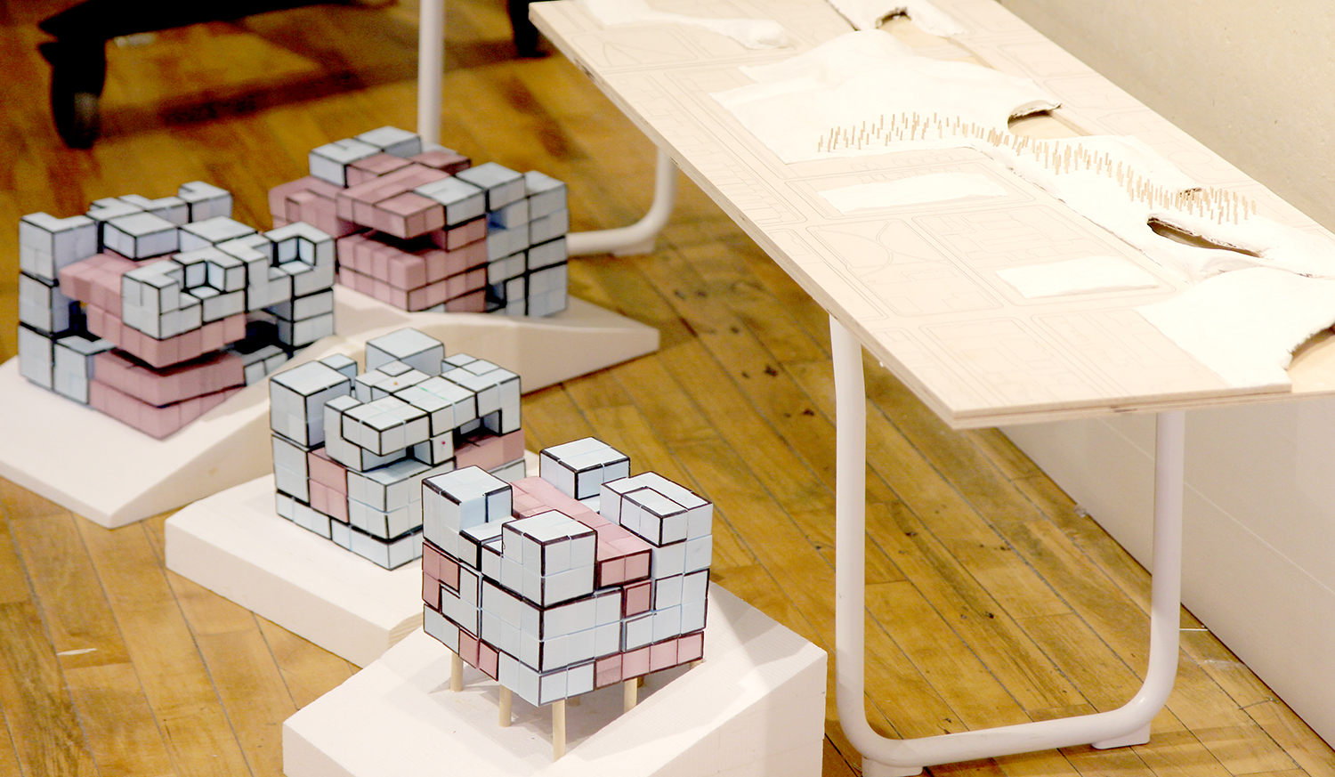
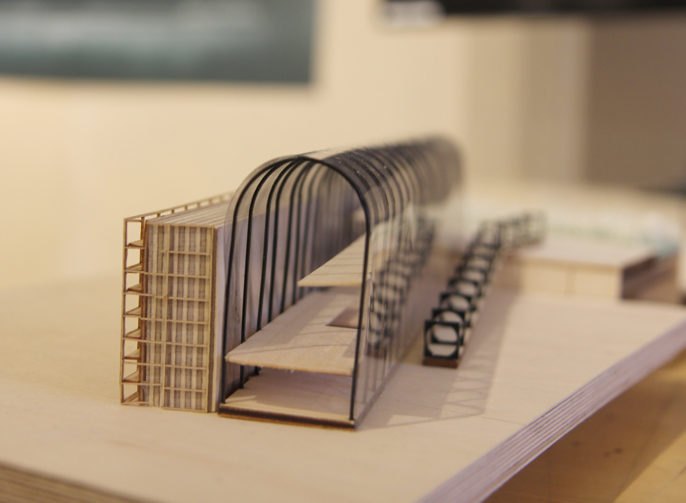
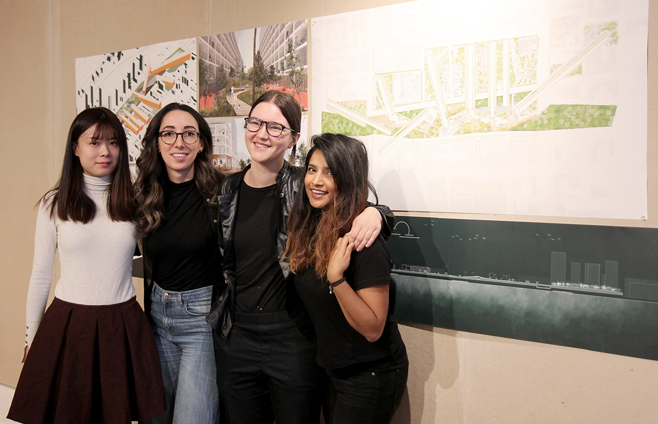
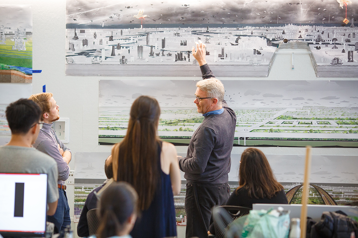
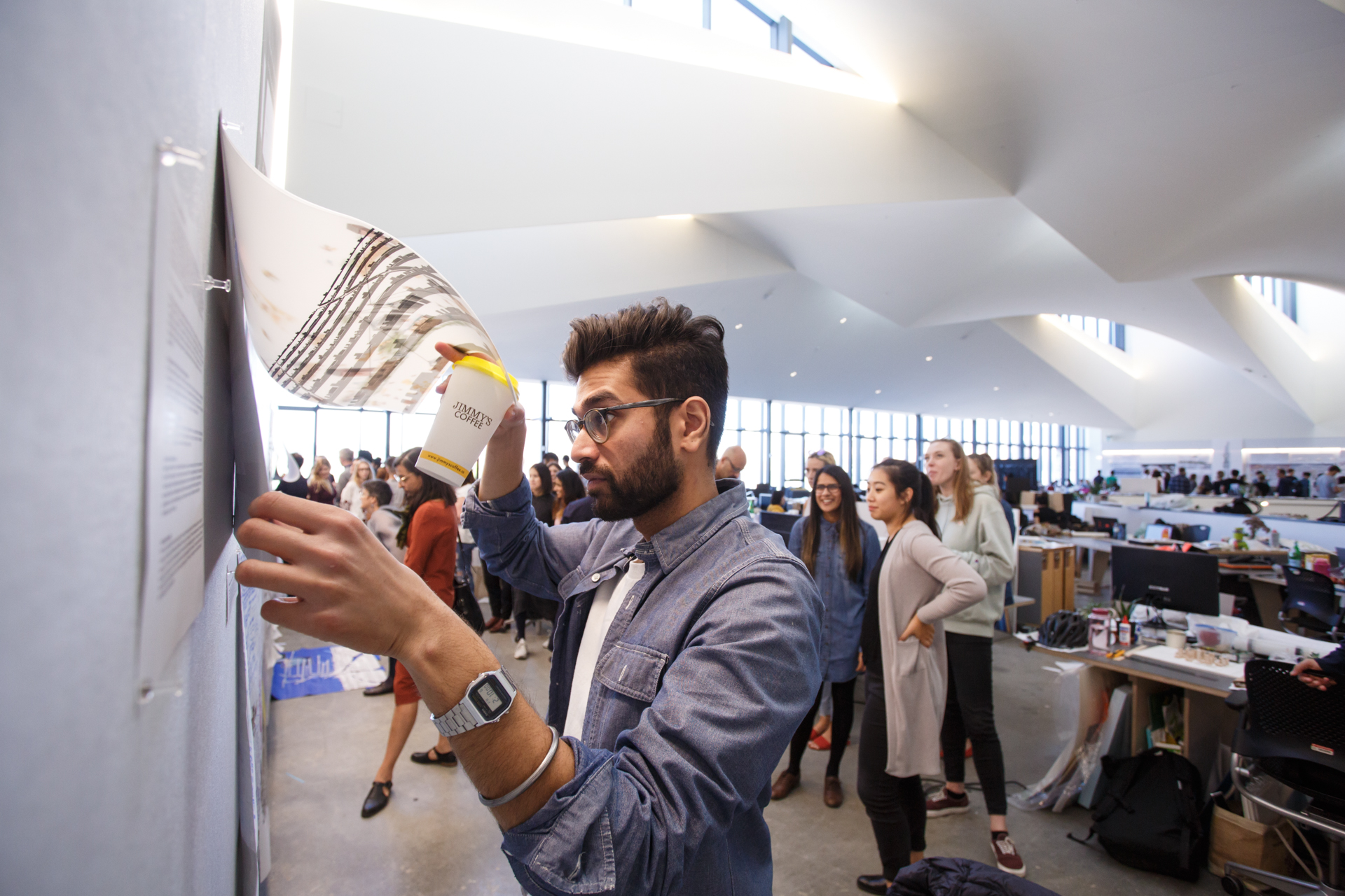
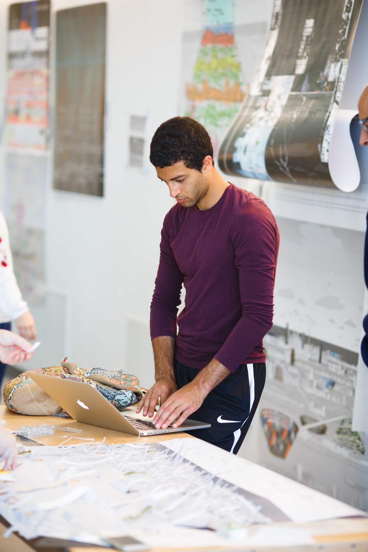
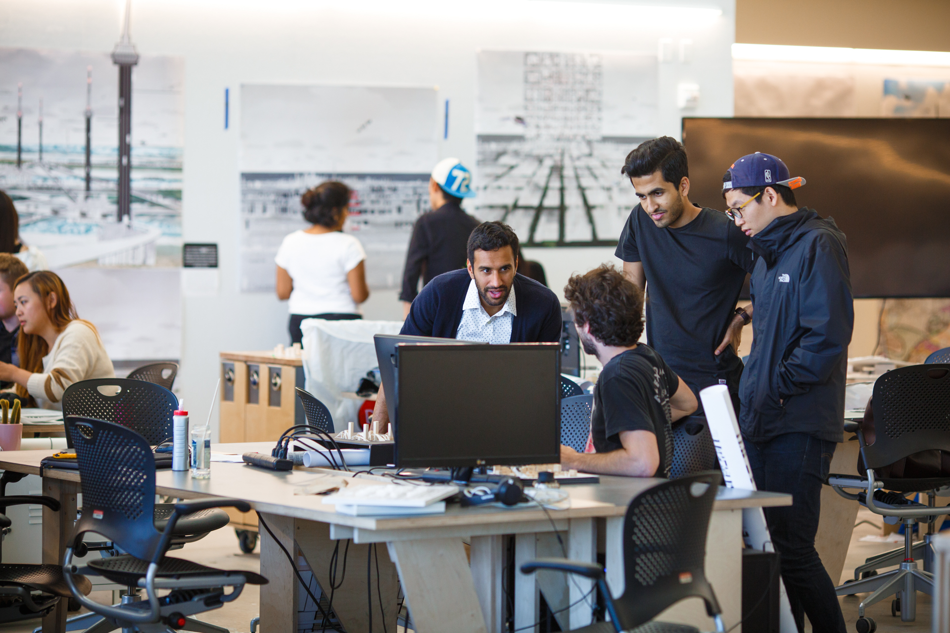
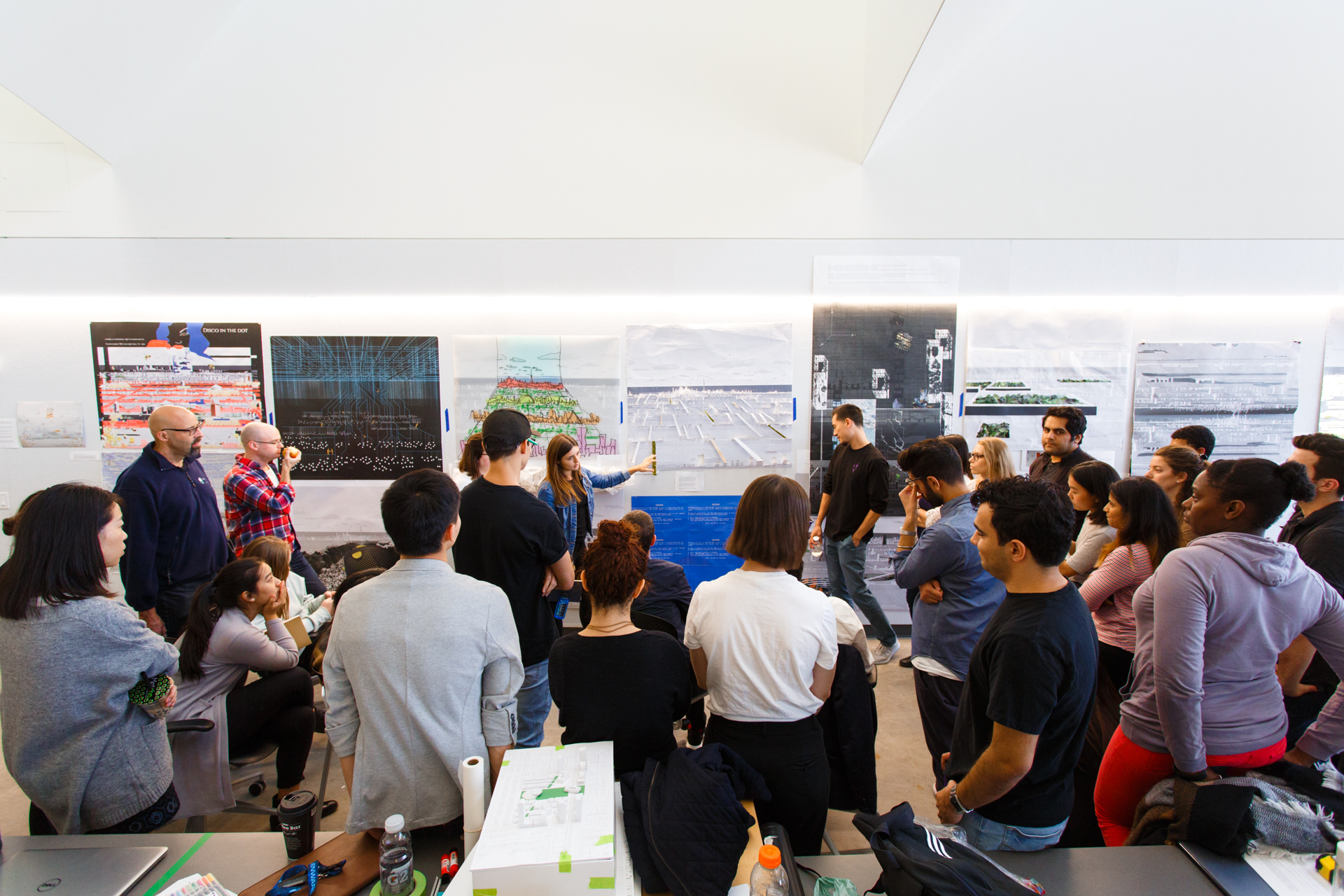
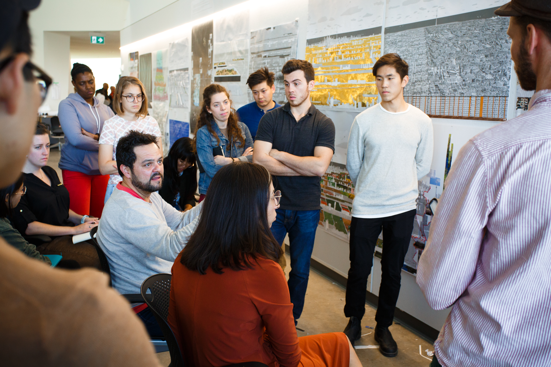
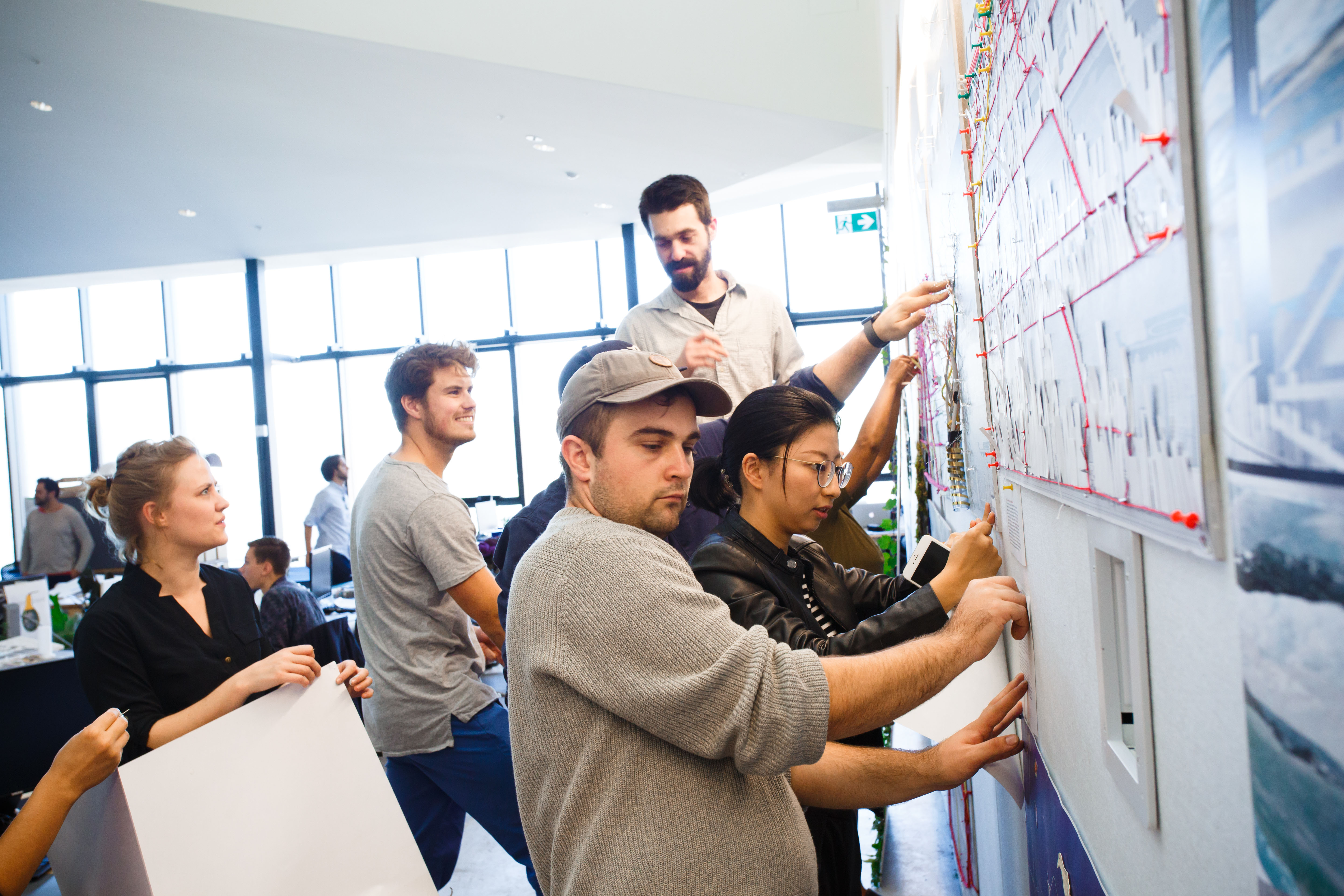
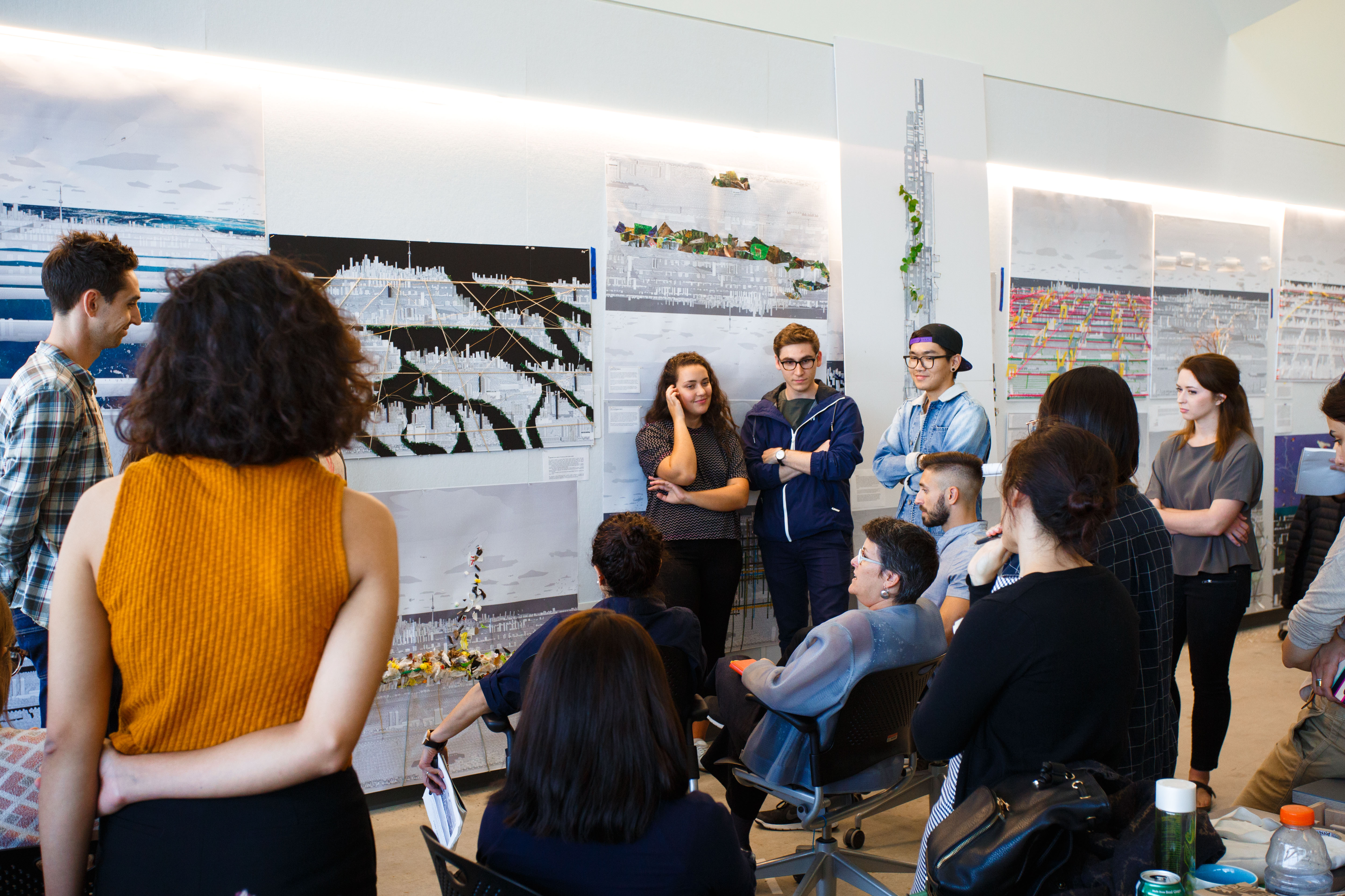
Photo, top: Graduate students in Superstudio create "big pictures" of Toronto based on the Faculty's Edit installation. Photo by: Harry Choi
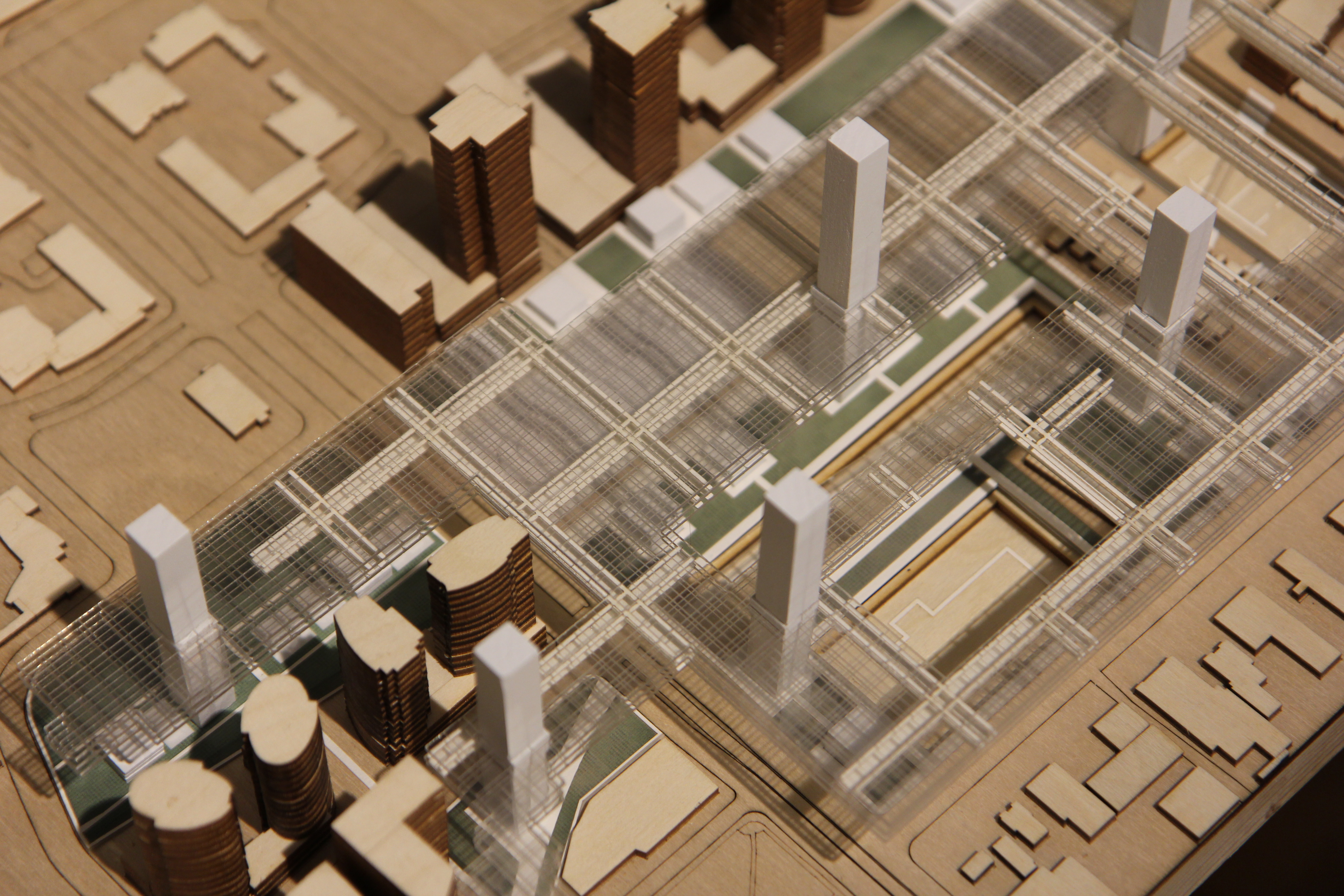
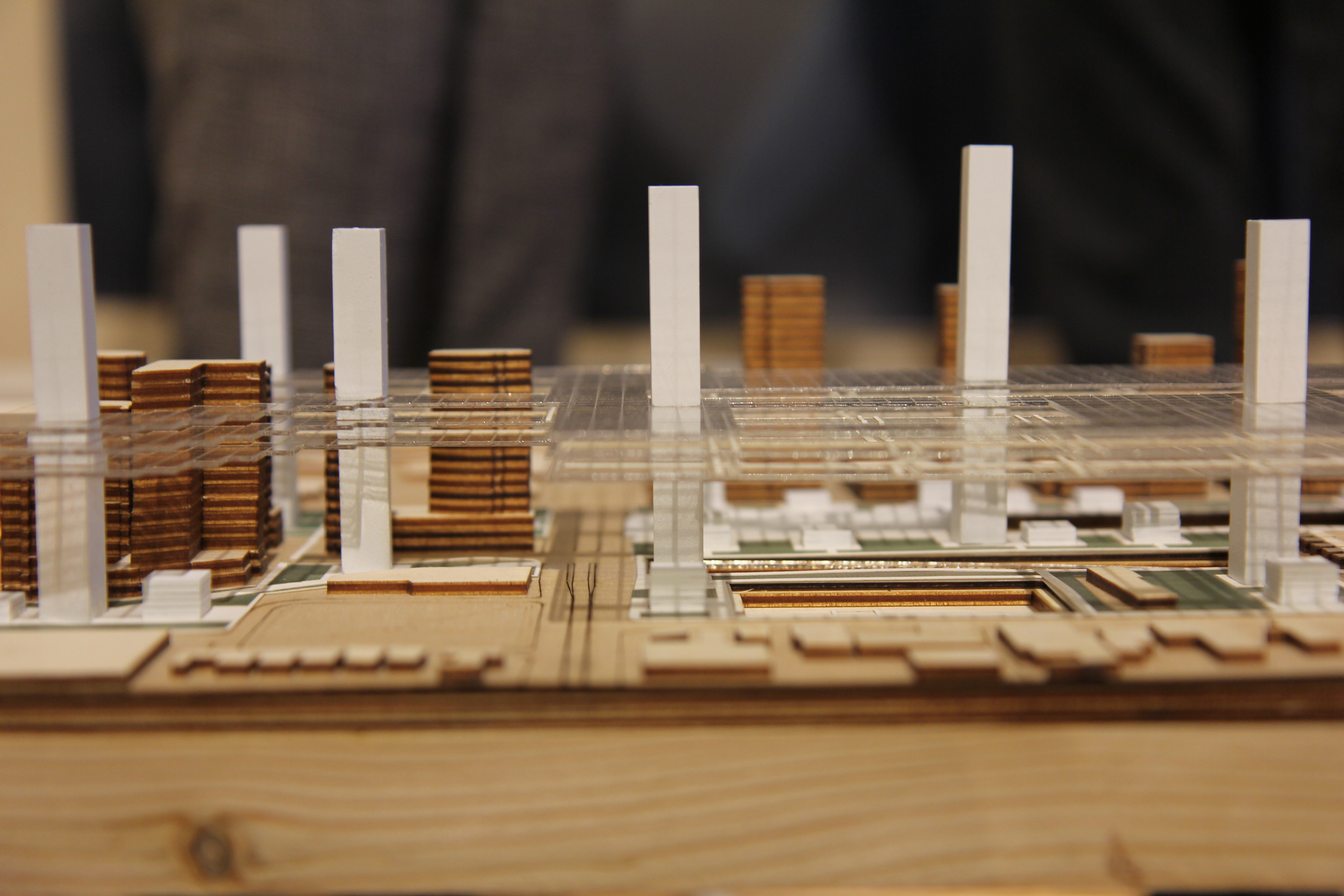
Image, middle: a section of the Faculty's Edit installation: "Where is the big picture, Toronto?"

Modal Cities Theatre and Lab at One Spadina. Rendering by NADAAA.

05.11.17 - Robert Wright & other U of T experts discuss smart cities at Innis Town Hall

Last week, Associate Professor and Director of the Centre for Landscape Research Robert Wright was part of a panel discussion that highlighted U of T’s expertise and different perspectives on smart cities. The panelists brought research from a workshop in India, and also weighed in on Sidewalk Lab’s recent announcement to create a new, technologically connected neighbourhood for Toronto’s waterfront. Moderated by Janice Stein, Wright was joined by U of T experts Judy Farvolden, V. Kumar Murty, Patricia O’Campo, Enid Slack, and David Wolfe.

“Panelists agreed that smart cities cannot take a one-size-fits-all approach – all cities and towns are built differently with different wants and needs,” wrote Romi Levine for U of T News.

The event comes after a workshop in India led by U of T earlier this year at the Indian Institute of Technology-Bombay Centre Centre for Urban Science and Engineering (IIT-B) on the future of smart cities. Presenters from U of T and IIT-B approached the definition of smart cities from a broad perspective, considering physical and social infrastructural needs as well as the role of management and services required for the sustainable operation, inclusive development, and growth of metropolitan areas. Presentations connected leading-edge research and knowledge together with strategies and recommendations for approaching India’s next decade of smart cities development.

To view the presentations from the workshop, visit the Cities@UofT Cities Blog.

Photo, top: Modal Cities Theatre and Lab at One Spadina. Rendering by NADAAA. The Model Cities Theatre and Lab will draw on comparative data and insights from the Global Cities Indicators Facility for use in conjunction with emerging 3D and other visualization techniques in order to test and project new ideas in urban design. The theatre and lab will facilitate research on designing cities holistically, and offer a public forum for creating new decision frameworks, design options, policy alternatives, and industry solutions.

01.11.17 - Fadi Masoud explores what Olmsted can teach us about resilience and adaptation

Last week, Assistant Professor Fadi Masoud presented a paper titled “Landscape’s Comprehensive Standards” at the 17th annual National Conference on Planning History under a session titled "Projects by the Olmsted Firm: Sourcing the Past to Improve Resilience” hosted by the Society for American City & Regional Planning History in Cleveland, Ohio.

The paper explored a selection of Olmsted's landscape-driven comprehensive planning projects from the turn of the last century, and compared them to corollary principles exemplified in contemporary resilience and adaptation design strategies today.

Masoud conducted the research on Olmsted’s projects as part of the 2016 Beveridge Fellowship at the Fairsted National Olmsted Archives. A set of strategies were extracted by analyzing coastal projects completed by the Olmsted office such as:

  • Plan for the Rockaways (1879),  
  • New York City's Regional Plan (1920) (pictured above),
  • The Toronto Island’s Waterfront Plan (1912),
  • Riverside Park Park and Extension in Manhattan’s Upper West Side (1913),
  • Florida’s Lakelands and Winterhaven Subdivisions (1921), and
  • Boston’s Back Bay Fens (1877)

Concepts such “Landscape as Filter”,  “Space for Dynamic Flexibility”, the “Integration of Green and Grey Infrastructure”, and “Landforms as Buffer”, are critical planning and design strategies present in both Olmsted’s coastal planning work, and the winning entries of contemporary design competitions such as Rebuild by Design (2014), MoMA’s Rising Currents (2010), and WaterfronToronto (ongoing).

The Society for American City and Regional Planning History (SACRPH) is an interdisciplinary organization dedicated to promoting scholarship on the planning of cities and metropolitan regions over time, and to bridging the gap between the scholarly study of cities and the practice of urban planning. The organization’s members come from a range of professions and areas of interest, and include historians, architects, planners, environmentalists, landscape designers, public policy makers, preservationists, community organizers, and students and scholars from across the country and around the world.

24.10.17 - WHAT IS A SCHOOL (of architecture, landscape architecture, art, or urban design)?

This fall, as students and faculty at the University of Toronto’s John H. Daniels Faculty of Architecture, Landscape, and Design start school in their new home at One Spadina Crescent, questions around the changing nature of the disciplines of architecture, landscape architecture, art, and urbanism and their evolving pedagogical approaches have become especially urgent.

To celebrate the school’s new home and speculate about how to make best use of it in the coming years, the Faculty is mounting a series of discussions, lectures, and workshops, as well as a symposium. These events will explore the relationship between our workspaces and the pedagogies, research projects, and forms of public outreach in which we engage.

What kind of a pedagogical instrument is a school? What is its scope and reach? How do we conceptualize its relationship to the public? How can a school be a both a place where ideas are cultivated and where they are subject to continuous experimentation? And what implications does this productive tension have for the politics at play in our approach to art, architecture, landscape architecture, and urban design? The series will host a rich array of educators, theorists, historians, and practitioners and will culminate in a symposium in the spring that will bring together thinkers who are at the forefront of conceptualizing and designing our schools.

“My mantra has been that architecture and its allied disciplines are as much a way of finding the world, as they are of forming it, and how it follows that a great design school models practice by acting as a hinge between study and action,” says Professor Richard Sommer, Dean of the Daniels Faculty. “With our new platform at One Spadina, we have an unprecedented opportunity to explore and demonstrate this.”

Upcoming lectures include:

For more information about this series, visit www.daniels.utoronto.ca/events/what-is-a-school

09.10.17 - Graduate students imagine alternative futures for Toronto

In one of their first "Superstudio" assignments this year, graduate students were asked to overlay ideas onto a supergraphic of the city of Toronto initially created for the Design Exchange’s inaugural EDIT Festival. The students looked at the city through a specific lens in an exercise to imagine alternative futures.

Questions addressed in the exercise include:

  • How can the process of looking at and drawing the city at a very large scale inform the way we design the city at other, smaller scales?
  • What infrastructural, landscape, and building features should be highlighted in drawings of the kind?
  • How might designers participate in imaging processes of city-wide and regional urbanization in a serious yet inventive way that can offer compelling, future-oriented alternatives?
  • What kind of big pictures might inspire the public imagination in ways that might compel citizens to participate in making meaningful change?

The Daniels Faculty's  Superstudio course is an opportunity for architecture, landscape, and urban design students to discover shared concerns, approaches, and design solutions, and to model the kinds of collaborative, creative, and technical processes required to successfully address the complex demands (political, social, cultural, environmental, formal, infrastructural, etc.) of urban projects today and into the future. Graduate students in architecture, landscape, and  urban design work on the same set of assignments throughout the semester, allowing each discipline to bring its range of approaches to urban-scale exercises so they can be identified and speculated upon across the whole “super” studio.

For the full album, visit the Daniels Faculty Flickr page.

02.10.17 - Friday, October 6: Join GALDSU for the launch of The Annual

The Graduate Architecture, Landscape, and Design Student Union (GALDSU) will launch this year’s issue on Friday, October 6. This issue will explore “the multiplicity of ways in which the graduate students of Daniels confront the realities of our world – and their worlds – as a way to imagine and create space for multiple futures.” How, Co-Editors and Alumni Jasper Flores, Elise Hunchuck, and Dayne Roy-Caldwell ask, do the “practices of architecture, landscape architecture, urban design, and visual studies suggest ways for us to design with and for each other?”

The launch party will take place at OFFSITE Concept Space at 867 Dundas Street West. There will be music, food, and a cash bar. Copies of the new publication will be available to purchase. For more information, visit the Eventbrite page.

A note from the editors on the cover image (pictured above): “The moon was installed at the Art Museum at the University of Toronto in April 2016, alongside Gillian Dykeman (MVS 2016)'s video 'Dispatches from the Feminist Utopian Future,' watercolour schematic drawings of the earthworks, and a keystone covered in tachyon particles. For more, please see 'Dispatches from the Feminist Utopian Future (page 13-18) and Psychic Strata: Land, Art, Subjectivity (page 19-26). Both works are by Gillian Dykeman. The cover photograph was taken by Jesse Boles (MVS 2015), courtesy of Gillian Dykeman (2015).

Other photos (in order of appearance): 2-On Spheres by Ekaterina Dovjenko, 3-Wasting Futures by Elaine Chau, 4-To Melt Into Air, Slowly by Vanessa Abram, 5-∆ Museum by Melissa Gerskup and Ray Wu

Tinker's Orchard by Acre Architects, founded by Monica Adair and Stephen Kopp

01.10.17 - POP // CAN // CRIT symposium explores the marketing and promotion of architecture in Canada

On October 27, Lecturers Adrian Phiffer, Alex Josephson, and Monica Adair will join discussions on marketing and promotion of architecture at this year’s POP // CAN // CRIT symposium. In its second year, POP // CAN // CRIT 2017 will bring together Canadian architects, marketing professionals, photographers, advocacy groups, and media to discuss and debate the vital roles that architects, media, marketing personnel, and the public play in shaping the general discourse surrounding architecture.

Featured Panel Discussions

Panel 2: advocacy + activism
Moderator: Matt Blackett (Spacing)
Speakers: Toon Dreessen, Susan Algie, Monica Adair, Johanna Hurme

Panel 3: image + architecture
Moderator: Adrian Phiffer
Speakers: Ben Rhan, Younes Bounhar, Amanda Large, Norm Li, Naomi Kriss

Panel 4: architecture as icon/ branding + Toronto condo revolution
Moderator: Nicola Spunt (PARTISANS)
Speakers: Alex Josephson, Alex Bozikovic, Adrian Phiffer

In these discussions, participants will be answering questions such as, “In what ways do we market architecture?" "How can we best advocate for the profession?" "And what impact does a photograph have on our understanding of the built environment?” The event will take place at the Design Exchange in Toronto with $45 general admission and $35 student admission. Tickets can be purchased on Eventbrite.

For more information, visit http://spacing.ca/popcancrit/

Listen to audio from last year’s discussions:

Photo, top: Tinker's Orchard by Acre Architects, founded by Monica Adair and Stephen Kopp.